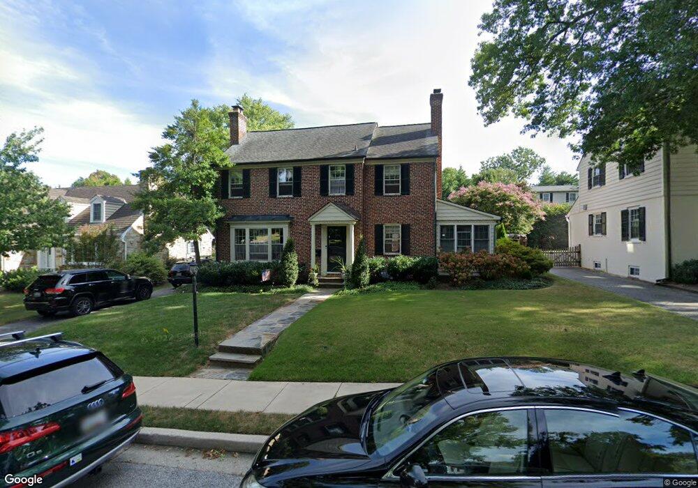
509 Worcester Rd Towson, MD 21286
Estimated Value: $672,000 - $786,000
--
Bed
4
Baths
2,098
Sq Ft
$347/Sq Ft
Est. Value
About This Home
This home is located at 509 Worcester Rd, Towson, MD 21286 and is currently estimated at $727,667, approximately $346 per square foot. 509 Worcester Rd is a home located in Baltimore County with nearby schools including Stoneleigh Elementary School, Dumbarton Middle School, and Towson High Law & Public Policy.
Ownership History
Date
Name
Owned For
Owner Type
Purchase Details
Closed on
Mar 1, 1995
Sold by
Kalkstein Jeffrey W
Bought by
Coan Michael J
Current Estimated Value
Home Financials for this Owner
Home Financials are based on the most recent Mortgage that was taken out on this home.
Original Mortgage
$200,000
Interest Rate
8.96%
Purchase Details
Closed on
Aug 8, 1989
Sold by
Cox Ralph J
Bought by
Kalkstein Jeffrey W
Create a Home Valuation Report for This Property
The Home Valuation Report is an in-depth analysis detailing your home's value as well as a comparison with similar homes in the area
Home Values in the Area
Average Home Value in this Area
Purchase History
| Date | Buyer | Sale Price | Title Company |
|---|---|---|---|
| Coan Michael J | $268,000 | -- | |
| Kalkstein Jeffrey W | $225,500 | -- |
Source: Public Records
Mortgage History
| Date | Status | Borrower | Loan Amount |
|---|---|---|---|
| Closed | Coan Michael J | $200,000 |
Source: Public Records
Tax History Compared to Growth
Tax History
| Year | Tax Paid | Tax Assessment Tax Assessment Total Assessment is a certain percentage of the fair market value that is determined by local assessors to be the total taxable value of land and additions on the property. | Land | Improvement |
|---|---|---|---|---|
| 2025 | $7,262 | $591,800 | $138,000 | $453,800 |
| 2024 | $7,262 | $561,867 | $0 | $0 |
| 2023 | $3,515 | $535,800 | $0 | $0 |
| 2022 | $6,940 | $505,600 | $129,600 | $376,000 |
| 2021 | $6,381 | $493,367 | $0 | $0 |
| 2020 | $6,381 | $481,133 | $0 | $0 |
| 2019 | $6,436 | $468,900 | $129,600 | $339,300 |
| 2018 | $6,181 | $455,633 | $0 | $0 |
| 2017 | $6,105 | $442,367 | $0 | $0 |
| 2016 | $5,703 | $429,100 | $0 | $0 |
| 2015 | $5,703 | $429,100 | $0 | $0 |
| 2014 | $5,703 | $429,100 | $0 | $0 |
Source: Public Records
Map
Nearby Homes
- 612 Coventry Rd
- 625 Yarmouth Rd
- 425 Rodgers Ct
- 418 Chumleigh Rd
- 63 Burkshire Rd
- 324 Stanmore Rd
- 28 Stone Ridge Ct
- 7512 Far Hills Dr
- 500 Fairway Ct
- 908 Stevenson Ln
- 12 Stone Ridge Ct
- 112 E Burke Ave
- 421 Regester Ave
- 212 E Burke Ave
- 664 Regester Ave
- 6931 Summit Cir
- 240 E Burke Ave
- 6923 Summit Cir
- 104 Willow Ave
- 117 Glen Argyle Rd
- 511 Worcester Rd
- 513 Worcester Rd
- 507 Worcester Rd
- 512 Yarmouth Rd
- 510 Yarmouth Rd
- 508 Yarmouth Rd
- 515 Worcester Rd
- 1 Aintree Rd
- 505 Worcester Rd
- 516 Yarmouth Rd
- 506 Yarmouth Rd
- 504 Worcester Rd
- 3 Aintree Rd
- 503 Worcester Rd
- 4 Aintree Rd
- 518 Yarmouth Rd
- 504 Yarmouth Rd
- 600 Worcester Rd
- 513 Yarmouth Rd
- 517 Yarmouth Rd