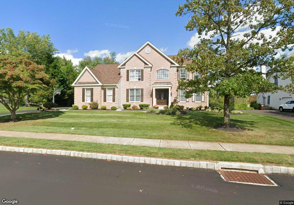
5092 Grundy Way Doylestown, PA 18902
Estimated Value: $924,953 - $1,093,000
4
Beds
3
Baths
3,525
Sq Ft
$283/Sq Ft
Est. Value
About This Home
This home is located at 5092 Grundy Way, Doylestown, PA 18902 and is currently estimated at $997,738, approximately $283 per square foot. 5092 Grundy Way is a home located in Bucks County with nearby schools including Cold Spring Elementary School, Holicong Middle School, and Central Bucks High School - East.
Ownership History
Date
Name
Owned For
Owner Type
Purchase Details
Closed on
Jul 16, 1999
Sold by
Cold Spring Hunt Lp
Bought by
Sawyer Robert and Sawyer Rosemary
Current Estimated Value
Home Financials for this Owner
Home Financials are based on the most recent Mortgage that was taken out on this home.
Original Mortgage
$334,842
Outstanding Balance
$93,274
Interest Rate
7.49%
Estimated Equity
$904,464
Create a Home Valuation Report for This Property
The Home Valuation Report is an in-depth analysis detailing your home's value as well as a comparison with similar homes in the area
Home Values in the Area
Average Home Value in this Area
Purchase History
| Date | Buyer | Sale Price | Title Company |
|---|---|---|---|
| Sawyer Robert | $372,047 | -- |
Source: Public Records
Mortgage History
| Date | Status | Borrower | Loan Amount |
|---|---|---|---|
| Open | Sawyer Robert | $334,842 |
Source: Public Records
Tax History Compared to Growth
Tax History
| Year | Tax Paid | Tax Assessment Tax Assessment Total Assessment is a certain percentage of the fair market value that is determined by local assessors to be the total taxable value of land and additions on the property. | Land | Improvement |
|---|---|---|---|---|
| 2025 | $9,285 | $54,790 | $10,520 | $44,270 |
| 2024 | $9,285 | $57,030 | $10,520 | $46,510 |
| 2023 | $8,970 | $57,030 | $10,520 | $46,510 |
| 2022 | $8,863 | $57,030 | $10,520 | $46,510 |
| 2021 | $8,757 | $57,030 | $10,520 | $46,510 |
| 2020 | $8,757 | $57,030 | $10,520 | $46,510 |
| 2019 | $8,700 | $57,030 | $10,520 | $46,510 |
| 2018 | $8,700 | $57,030 | $10,520 | $46,510 |
| 2017 | $8,629 | $57,030 | $10,520 | $46,510 |
| 2016 | $8,714 | $57,030 | $10,520 | $46,510 |
| 2015 | -- | $57,030 | $10,520 | $46,510 |
| 2014 | -- | $57,030 | $10,520 | $46,510 |
Source: Public Records
Map
Nearby Homes
- 4250 Aly Dr
- 4925 Redfield Rd
- 4936 Davis Dr
- 3975 Amberton Ct
- 5063 Sagewood Ct
- 5115 Sugar Hill Ct
- 5281 Harrington Ct
- 5491 Long Ln
- 5182 Point Pleasant Pike
- 4201 Sir Andrew Cir
- 6680 Point Pleasant Pike
- 4605 Twinbrook Cir
- 4964 Point Pleasant Pike
- 4542 Deep Creek Way
- 4190 Milords Ln
- 3689 Hancock Ln
- 3468 Holicong Rd
- 3865 Burnt House Hill Rd
- 3479 Durham Rd
- 3455 Durham Rd
- 5100 Grundy Way
- 47 Via Quattro Novembre
- Owls Nest Ln
- Owls Nest Ln
- Owls Nest Ln
- 5084 Grundy Way
- 5093 Grundy Way
- 5099 Grundy Way
- 5085 Grundy Way
- 5105 Redfield Rd
- 5103 Grundy Way
- 5068 Woodward Dr
- 5081 Grundy Way
- 4205 Leslie Dr
- 5076 Grundy Way
- 4215 Leslie Dr
- 4195 Leslie Dr
- 5090 Redfield Rd
- 4225 Leslie Dr
- 5075 Grundy Way