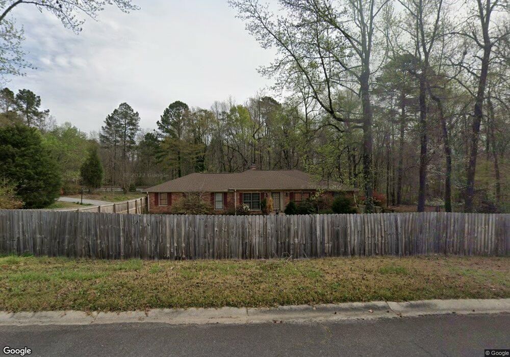
5093 Wingate Dr Macon, GA 31210
Estimated Value: $231,905 - $281,000
4
Beds
2
Baths
2,100
Sq Ft
$119/Sq Ft
Est. Value
About This Home
This home is located at 5093 Wingate Dr, Macon, GA 31210 and is currently estimated at $249,726, approximately $118 per square foot. 5093 Wingate Dr is a home located in Bibb County with nearby schools including Carter Elementary School, Howard Middle School, and Howard High School.
Ownership History
Date
Name
Owned For
Owner Type
Purchase Details
Closed on
Jun 22, 2018
Sold by
White Jackie M
Bought by
Smallwood Danny T
Current Estimated Value
Home Financials for this Owner
Home Financials are based on the most recent Mortgage that was taken out on this home.
Original Mortgage
$153,223
Outstanding Balance
$132,532
Interest Rate
4.6%
Mortgage Type
VA
Estimated Equity
$117,194
Purchase Details
Closed on
May 19, 1976
Sold by
Robert Robert C and Robert 417
Bought by
White Jackie M - Robert C
Create a Home Valuation Report for This Property
The Home Valuation Report is an in-depth analysis detailing your home's value as well as a comparison with similar homes in the area
Home Values in the Area
Average Home Value in this Area
Purchase History
| Date | Buyer | Sale Price | Title Company |
|---|---|---|---|
| Smallwood Danny T | $149,999 | None Available | |
| Smallwood Danny T | -- | None Available | |
| White Jackie M - Robert C | -- | -- |
Source: Public Records
Mortgage History
| Date | Status | Borrower | Loan Amount |
|---|---|---|---|
| Open | Smallwood Danny T | $153,223 |
Source: Public Records
Tax History Compared to Growth
Tax History
| Year | Tax Paid | Tax Assessment Tax Assessment Total Assessment is a certain percentage of the fair market value that is determined by local assessors to be the total taxable value of land and additions on the property. | Land | Improvement |
|---|---|---|---|---|
| 2025 | $1,802 | $73,347 | $11,055 | $62,292 |
| 2024 | $1,794 | $70,645 | $11,055 | $59,590 |
| 2023 | $1,592 | $62,690 | $8,504 | $54,186 |
| 2022 | $1,970 | $56,915 | $7,889 | $49,026 |
| 2021 | $2,163 | $56,915 | $7,889 | $49,026 |
| 2020 | $2,096 | $53,975 | $7,172 | $46,803 |
| 2019 | $2,020 | $53,975 | $7,172 | $46,803 |
| 2018 | $2,969 | $53,515 | $7,172 | $46,343 |
| 2017 | $1,479 | $46,478 | $7,184 | $39,294 |
| 2016 | $1,544 | $51,642 | $7,982 | $43,660 |
| 2015 | $2,187 | $51,642 | $7,982 | $43,660 |
| 2014 | $855 | $51,642 | $7,982 | $43,660 |
Source: Public Records
Map
Nearby Homes
- 5094 Wingate Dr
- 5105 Wingate Dr
- 5102 Wingate Dr
- 5087 Wood Dale Dr
- 5066 Wingate Dr
- 5121 Wingate Dr
- 5095 Idlewood Dr
- 5081 Idlewood Dr
- 0 Idlewood Dr Unit 7443288
- 5120 Wingate Dr
- 5054 Wingate Dr
- 0 Wingate Dr Unit 8785572
- 0 Wingate Dr Unit 8375617
- 0 Wingate Dr Unit 8250088
- 0 Wingate Dr Unit 7559096
- 0 Wingate Dr Unit 8229998
- 0 Wingate Dr Unit 7095823
- 5188 Wingate Dr Unit 302
- 5188 Wingate Dr
- 5109 Idlewood Dr