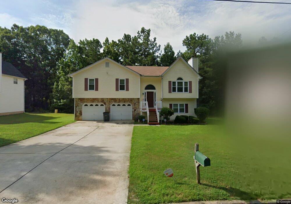
5095 Cochran Dr Union City, GA 30291
Estimated Value: $208,000 - $240,000
3
Beds
3
Baths
1,251
Sq Ft
$181/Sq Ft
Est. Value
About This Home
This home is located at 5095 Cochran Dr, Union City, GA 30291 and is currently estimated at $225,927, approximately $180 per square foot. 5095 Cochran Dr is a home located in Fulton County with nearby schools including Liberty Point Elementary School, Camp Creek Middle School, and Langston Hughes High School.
Ownership History
Date
Name
Owned For
Owner Type
Purchase Details
Closed on
Oct 4, 2024
Sold by
Carter Randy
Bought by
Carter Alia Moneta
Current Estimated Value
Purchase Details
Closed on
May 23, 2003
Sold by
Red Hill Assoc Llc
Bought by
Maddox Myra E
Home Financials for this Owner
Home Financials are based on the most recent Mortgage that was taken out on this home.
Original Mortgage
$100,000
Interest Rate
5.79%
Mortgage Type
New Conventional
Purchase Details
Closed on
May 31, 1996
Sold by
Oxford Inc
Bought by
Carter Randy
Create a Home Valuation Report for This Property
The Home Valuation Report is an in-depth analysis detailing your home's value as well as a comparison with similar homes in the area
Home Values in the Area
Average Home Value in this Area
Purchase History
| Date | Buyer | Sale Price | Title Company |
|---|---|---|---|
| Carter Alia Moneta | -- | -- | |
| Maddox Myra E | $42,100 | -- | |
| Carter Randy | $86,400 | -- |
Source: Public Records
Mortgage History
| Date | Status | Borrower | Loan Amount |
|---|---|---|---|
| Previous Owner | Maddox Myra E | $100,000 | |
| Closed | Carter Randy | $0 |
Source: Public Records
Tax History Compared to Growth
Tax History
| Year | Tax Paid | Tax Assessment Tax Assessment Total Assessment is a certain percentage of the fair market value that is determined by local assessors to be the total taxable value of land and additions on the property. | Land | Improvement |
|---|---|---|---|---|
| 2025 | -- | $90,120 | $20,480 | $69,640 |
| 2023 | $1,862 | $65,960 | $11,480 | $54,480 |
| 2022 | $604 | $65,960 | $11,480 | $54,480 |
| 2021 | $473 | $43,960 | $8,000 | $35,960 |
| 2020 | $473 | $43,440 | $7,920 | $35,520 |
| 2019 | $962 | $32,880 | $6,000 | $26,880 |
| 2018 | $441 | $26,440 | $3,280 | $23,160 |
| 2017 | $460 | $26,440 | $3,280 | $23,160 |
| 2016 | $536 | $30,360 | $5,240 | $25,120 |
| 2015 | $1,014 | $30,360 | $5,240 | $25,120 |
| 2014 | $312 | $18,480 | $2,120 | $16,360 |
Source: Public Records
Map
Nearby Homes
- 6320 Littleton Dr
- 0 Highpoint Rd Unit 10553938
- 5135 Hilltop Dr
- 6030 Stonewall Dr
- 000 Highpoint Rd
- 99 Highpoint Rd
- 0 Lakeside Dr Unit 22475152
- 0 Lakeside Dr Unit 7515650
- 4818 Sandstone Ln Unit 5
- 4812 Station Dr Unit 2
- 4811 Station Dr Unit 35
- 4817 Station Ln Unit 32
- 3227 Diamond Bluff
- 5947 Rock Rd
- Beaufort Plan at Stonewall Station
- Cecil Plan at The Enclave at Stonewall Station
- Nelson Plan at The Enclave at Stonewall Station
- Cooper Plan at Stonewall Station
- Cecil Plan at Stonewall Station
- Nelson Plan at Stonewall Station
- 5105 Cochran Dr Unit 2
- 5085 Cochran Dr Unit 2
- 5115 Cochran Dr
- 5075 Cochran Dr Unit 2
- 5080 Cochran Dr
- 5100 Cochran Dr Unit 2
- 5070 Cochran Dr Unit 2
- 5065 Cochran Dr Unit 2
- 5255 Cochran Ct
- 5125 Cochran Dr
- 6230 Tucker Ln
- 6230 Tucker Ln
- 5060 Cochran Dr
- 5055 Cochran Dr
- 6220 Tucker Ln
- 6248 Tucker Ln
- 6210 Tucker Ln
- 5120 Cochran Dr
- 6200 Tucker Ln
- 5515 Hillcrest Dr