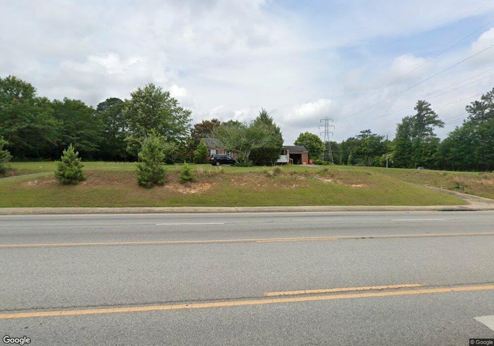
5097 Bloomfield Rd Macon, GA 31206
Estimated Value: $133,000 - $183,173
3
Beds
1
Bath
1,737
Sq Ft
$86/Sq Ft
Est. Value
About This Home
This home is located at 5097 Bloomfield Rd, Macon, GA 31206 and is currently estimated at $150,043, approximately $86 per square foot. 5097 Bloomfield Rd is a home located in Bibb County with nearby schools including Veterans Elementary School, Southwest High School, and Gilead Christian Academy.
Ownership History
Date
Name
Owned For
Owner Type
Purchase Details
Closed on
Jul 20, 2005
Sold by
Cain Ronald Andrew and Anderson Shirley J
Bought by
Alton Jones Of County Of Bibb
Current Estimated Value
Home Financials for this Owner
Home Financials are based on the most recent Mortgage that was taken out on this home.
Original Mortgage
$126,000
Interest Rate
5.51%
Mortgage Type
New Conventional
Create a Home Valuation Report for This Property
The Home Valuation Report is an in-depth analysis detailing your home's value as well as a comparison with similar homes in the area
Home Values in the Area
Average Home Value in this Area
Purchase History
| Date | Buyer | Sale Price | Title Company |
|---|---|---|---|
| Alton Jones Of County Of Bibb | $140,000 | None Available |
Source: Public Records
Mortgage History
| Date | Status | Borrower | Loan Amount |
|---|---|---|---|
| Previous Owner | Alton Jones Of County Of Bibb | $126,000 |
Source: Public Records
Tax History Compared to Growth
Tax History
| Year | Tax Paid | Tax Assessment Tax Assessment Total Assessment is a certain percentage of the fair market value that is determined by local assessors to be the total taxable value of land and additions on the property. | Land | Improvement |
|---|---|---|---|---|
| 2025 | $1,202 | $48,908 | $15,310 | $33,598 |
| 2024 | $1,242 | $48,908 | $15,310 | $33,598 |
| 2023 | $1,449 | $48,908 | $15,310 | $33,598 |
| 2022 | $1,329 | $38,387 | $13,470 | $24,917 |
| 2021 | $1,459 | $38,387 | $13,470 | $24,917 |
| 2020 | $1,490 | $38,387 | $13,470 | $24,917 |
| 2019 | $1,503 | $38,387 | $13,470 | $24,917 |
| 2018 | $2,481 | $38,387 | $13,470 | $24,917 |
| 2017 | $1,438 | $38,387 | $13,470 | $24,917 |
| 2016 | $1,328 | $38,387 | $13,470 | $24,917 |
| 2015 | $1,652 | $33,742 | $13,470 | $20,272 |
| 2014 | $1,900 | $33,742 | $13,470 | $20,272 |
Source: Public Records
Map
Nearby Homes
- 3842 Wynnwood Dr
- 4738 Bloomfield Rd
- 3913 Blair Ct
- 5060 Pinefield Dr
- 4940 Pinefield Dr
- 140 Spencer Hill Ct
- 4742 Bloomfield Rd
- 3607 Pineland Trail
- 4500 Chambers Rd
- 2868 Barrett Ave
- 2765 Alden St
- 197 Camden Trace
- 165 Camden Trace
- 189 Camden Trace
- 120 Camden Trace
- 124 Camden Trace
- 193 Camden Trace
- 177 Camden Trace
- 2995 Virginia Dr
- 3771 Walker Ave
- 5125 Bloomfield Rd
- 5104 Bloomfield Rd
- 5088 Bloomfield Rd
- 5114 Bloomfield Rd
- 5071 Bloomfield Rd
- 5137 Bloomfield Rd
- 5064 Bloomfield Rd
- 3896 Woodside Dr
- 3860 Wynnwood Dr
- 5145 Bloomfield Rd
- 3888 Woodside Dr
- 3867 Wynnwood Dr
- 3873 Woodside Dr
- 5051 Bloomfield Rd
- 5167 Bloomfield Rd
- 3880 Woodside Dr
- 3852 Wynnwood Dr
- 5058 Bloomfield Rd
- 5173 Bloomfield Rd
- 3859 Wynnwood Dr