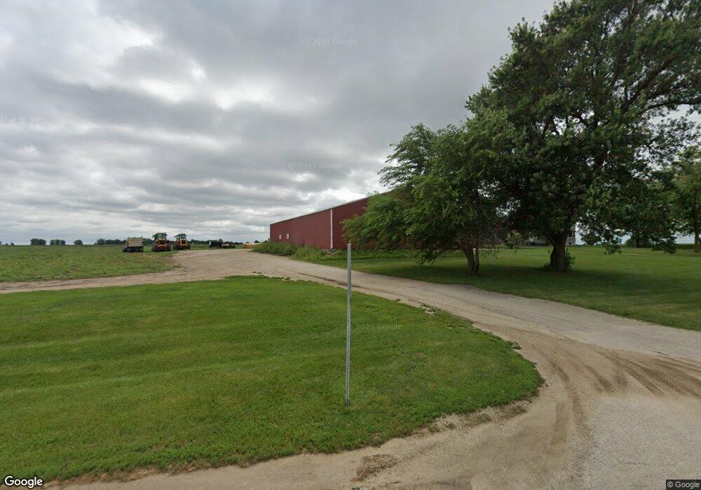
50W379 State Route 38 Maple Park, IL 60151
Estimated Value: $456,000 - $847,952
--
Bed
--
Bath
2,354
Sq Ft
$277/Sq Ft
Est. Value
About This Home
This home is located at 50W379 State Route 38, Maple Park, IL 60151 and is currently estimated at $651,976, approximately $276 per square foot. 50W379 State Route 38 is a home with nearby schools including Kaneland John Stewart Elementary School, Harter Middle School, and Kaneland Senior High School.
Ownership History
Date
Name
Owned For
Owner Type
Purchase Details
Closed on
Jan 13, 2009
Sold by
Marco Patricia J and Wiltse Kathleen S
Bought by
Wiltses Farm Produce Llc
Current Estimated Value
Purchase Details
Closed on
Jan 12, 2009
Sold by
Wiltse Marie
Bought by
Declaration Wiltse Marie and Declaration Marie Wiltse 2004
Purchase Details
Closed on
Jan 2, 2009
Sold by
Wiltse Marie
Bought by
Marco Patricia J and Wiltse Joseph C
Purchase Details
Closed on
Dec 22, 2004
Sold by
Wiltse & Hickey Partnership
Bought by
Wiltse Marie
Create a Home Valuation Report for This Property
The Home Valuation Report is an in-depth analysis detailing your home's value as well as a comparison with similar homes in the area
Home Values in the Area
Average Home Value in this Area
Purchase History
| Date | Buyer | Sale Price | Title Company |
|---|---|---|---|
| Wiltses Farm Produce Llc | -- | None Available | |
| Declaration Wiltse Marie | -- | None Available | |
| Marco Patricia J | -- | None Available | |
| Wiltse Marie | -- | -- |
Source: Public Records
Tax History Compared to Growth
Tax History
| Year | Tax Paid | Tax Assessment Tax Assessment Total Assessment is a certain percentage of the fair market value that is determined by local assessors to be the total taxable value of land and additions on the property. | Land | Improvement |
|---|---|---|---|---|
| 2024 | $16,679 | $208,815 | $45,280 | $163,535 |
| 2023 | $15,791 | $200,591 | $42,090 | $158,501 |
| 2022 | $15,993 | $192,771 | $39,080 | $153,691 |
| 2021 | $15,773 | $187,556 | $36,956 | $150,600 |
| 2020 | $15,396 | $183,955 | $35,393 | $148,562 |
| 2019 | $15,386 | $180,118 | $33,789 | $146,329 |
| 2018 | $15,325 | $175,000 | $31,806 | $143,194 |
| 2017 | $14,655 | $163,630 | $29,986 | $133,644 |
| 2016 | $14,120 | $156,367 | $28,190 | $128,177 |
| 2015 | -- | $149,745 | $26,561 | $123,184 |
| 2014 | -- | $145,828 | $25,724 | $120,104 |
| 2013 | -- | $121,173 | $25,143 | $96,030 |
Source: Public Records
Map
Nearby Homes
- 220 W Ashton Dr
- 804 Elm St
- 620 Elm St
- 325 W Burlington Dr
- 646 W Ashton Dr
- 205 Center St
- 753 W Ashton Dr
- 748 W Ashton Dr
- 750 W Ashton Dr
- 752 W Ashton Dr
- 754 W Ashton Dr
- 115 State St
- Meadowlark Plan at Heritage Hill Estates
- Starling Plan at Heritage Hill Estates
- Siena II Plan at Heritage Hill Estates
- Townsend Plan at Heritage Hill Estates
- Wren Plan at Heritage Hill Estates
- 528 S Joliet St
- 523 S Joliet St
- 239 S Kincaid St
- 50W066 State Route 38
- 38 County Line Rd
- 660 Settlement Dr
- 656 Settlement Dr
- 652 Settlement Dr
- 648 Settlement Dr
- 127 E Ashton Dr
- 644 Settlement Dr
- 640 Settlement Dr
- 125 E Ashton Dr
- 636 Settlement Dr
- 123 W Ashton Dr
- 2N389 County Line Rd
- 632 Settlement Dr
- 121 E Ashton Dr
- 628 Settlement Dr
- 643 Settlement Dr
- 631 Settlement Dr
- 624 Settlement Dr
- 129 W Ashton Dr