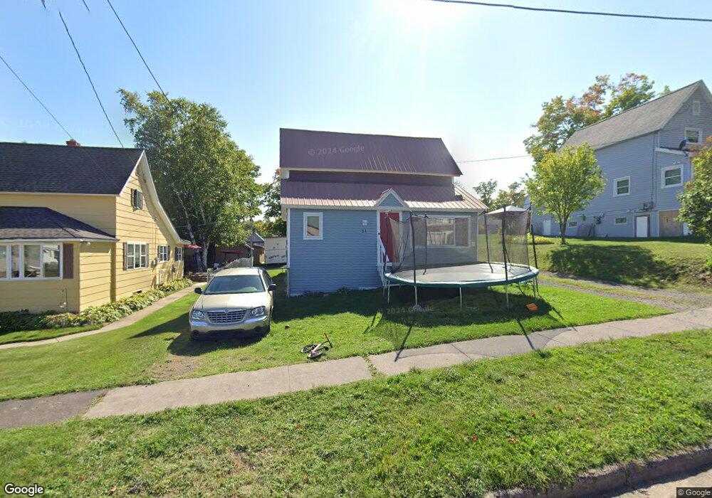
51 2nd St South Range, MI 49963
Estimated Value: $103,657 - $140,000
3
Beds
2
Baths
1,234
Sq Ft
$103/Sq Ft
Est. Value
About This Home
This home is located at 51 2nd St, South Range, MI 49963 and is currently estimated at $127,164, approximately $103 per square foot. 51 2nd St is a home located in Houghton County with nearby schools including South Range Elementary School and Jeffers High School.
Ownership History
Date
Name
Owned For
Owner Type
Purchase Details
Closed on
Sep 14, 2023
Sold by
Schaerer Charles and Schaerer Laura G
Bought by
Hutson Jamie A and Hutson Ashley N
Current Estimated Value
Home Financials for this Owner
Home Financials are based on the most recent Mortgage that was taken out on this home.
Original Mortgage
$90,909
Outstanding Balance
$89,066
Interest Rate
7.2%
Mortgage Type
New Conventional
Estimated Equity
$38,098
Purchase Details
Closed on
May 5, 2017
Sold by
Soper James L and Soper Suetta A
Bought by
Schaerer Charles and Schaerer Laura G
Home Financials for this Owner
Home Financials are based on the most recent Mortgage that was taken out on this home.
Original Mortgage
$23,400
Interest Rate
4.14%
Mortgage Type
New Conventional
Purchase Details
Closed on
May 1, 2003
Sold by
Soper James L and Soper Suetta A
Bought by
Soper James L and Soper Suetta A
Create a Home Valuation Report for This Property
The Home Valuation Report is an in-depth analysis detailing your home's value as well as a comparison with similar homes in the area
Purchase History
| Date | Buyer | Sale Price | Title Company |
|---|---|---|---|
| Hutson Jamie A | $90,000 | M&M Title | |
| Schaerer Charles | $33,400 | Copper Range Abs & Title | |
| Soper James L | $40,000 | -- |
Source: Public Records
Mortgage History
| Date | Status | Borrower | Loan Amount |
|---|---|---|---|
| Open | Hutson Jamie A | $90,909 | |
| Previous Owner | Schaerer Charles | $23,400 |
Source: Public Records
Tax History
| Year | Tax Paid | Tax Assessment Tax Assessment Total Assessment is a certain percentage of the fair market value that is determined by local assessors to be the total taxable value of land and additions on the property. | Land | Improvement |
|---|---|---|---|---|
| 2025 | $1,590 | $43,334 | $0 | $0 |
| 2024 | $16 | $36,484 | $0 | $0 |
| 2023 | $1,144 | $33,903 | $0 | $0 |
| 2022 | $1,227 | $30,245 | $0 | $0 |
| 2021 | $1,199 | $24,969 | $0 | $0 |
| 2020 | $1,183 | $24,451 | $0 | $0 |
| 2019 | $1,183 | $24,438 | $0 | $0 |
| 2018 | $1,237 | $25,590 | $0 | $0 |
| 2017 | $828 | $24,505 | $0 | $0 |
| 2016 | -- | $23,729 | $0 | $0 |
| 2015 | -- | $23,750 | $0 | $0 |
| 2014 | -- | $22,422 | $0 | $0 |
Source: Public Records
Map
Nearby Homes
- 46 Stanton Ave
- 0 Tbd Baltic Onkalos Corner Rd
- TBD Baltic-Onkalo's Corner Rd
- TBD Huron St
- 52275 N Superior Rd
- 47302 Janovosky Rd
- 42936 Superior Rd
- 46396 Maple St
- TBD-undeveloped Oak Ridge Ln
- 1906 White Oak Ln
- TBD Razorback Dr Unit Part of Lot 22, Enti
- 1506 Sugar Maple Ln
- 1504 Sugar Maple Ln
- 15710 Coles Creek Rd
- 47212 Main St
- TBD4 Upper Massie Rd
- TBD1 Upper Massie Rd
- 19336 W Edwards Ave
- TBD A B C Navy Stream
- 19990 Henry St
Your Personal Tour Guide
Ask me questions while you tour the home.