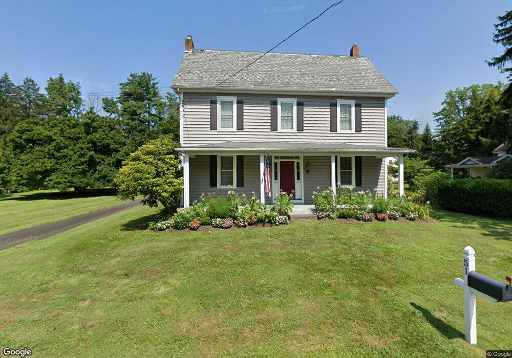
51 Aarons Ave Doylestown, PA 18901
Estimated Value: $490,290 - $594,000
3
Beds
1
Bath
2,082
Sq Ft
$259/Sq Ft
Est. Value
About This Home
This home is located at 51 Aarons Ave, Doylestown, PA 18901 and is currently estimated at $538,823, approximately $258 per square foot. 51 Aarons Ave is a home located in Bucks County with nearby schools including Simon Butler Elementary, Unami Middle School, and Central Bucks High School - South.
Ownership History
Date
Name
Owned For
Owner Type
Purchase Details
Closed on
Aug 29, 2024
Sold by
Rothrock John H and Rothrock Lana L
Bought by
Rothrock John H and Rothrock Lana L
Current Estimated Value
Purchase Details
Closed on
May 19, 2010
Sold by
Petronis Linda D and Petronis John
Bought by
Rothrock Lana L and Rothrock John H
Purchase Details
Closed on
Mar 5, 1999
Sold by
Urban Freda
Bought by
Petronis Linda D and Rothrock Lana L
Create a Home Valuation Report for This Property
The Home Valuation Report is an in-depth analysis detailing your home's value as well as a comparison with similar homes in the area
Home Values in the Area
Average Home Value in this Area
Purchase History
| Date | Buyer | Sale Price | Title Company |
|---|---|---|---|
| Rothrock John H | -- | None Listed On Document | |
| Rothrock Lana L | -- | None Available | |
| Petronis Linda D | -- | -- |
Source: Public Records
Tax History
| Year | Tax Paid | Tax Assessment Tax Assessment Total Assessment is a certain percentage of the fair market value that is determined by local assessors to be the total taxable value of land and additions on the property. | Land | Improvement |
|---|---|---|---|---|
| 2025 | $3,866 | $19,200 | $5,280 | $13,920 |
| 2024 | $3,866 | $19,200 | $5,280 | $13,920 |
| 2023 | $3,597 | $19,200 | $5,280 | $13,920 |
| 2022 | $3,519 | $19,200 | $5,280 | $13,920 |
| 2021 | $3,455 | $19,200 | $5,280 | $13,920 |
| 2020 | $3,455 | $19,200 | $5,280 | $13,920 |
| 2019 | $3,378 | $19,200 | $5,280 | $13,920 |
| 2018 | $3,378 | $19,200 | $5,280 | $13,920 |
| 2017 | $3,354 | $19,200 | $5,280 | $13,920 |
| 2016 | $3,354 | $19,200 | $5,280 | $13,920 |
| 2015 | -- | $19,200 | $5,280 | $13,920 |
| 2014 | -- | $19,200 | $5,280 | $13,920 |
Source: Public Records
Map
Nearby Homes
- 204 Woodland Dr
- 10 W Butler Ave
- 8 E Butler Ave
- 11 W Butler Ave
- Lot 9 Butler
- 94 Sioux Rd
- 120 Beulah Rd
- 77 Lenape Dr
- 106 S Shady Retreat Rd
- 240 Green Valley Way
- 349 W Butler Ave
- 325 Mystic View Cir
- 60 Cedar Dr
- 130 Jameson Way Unit 12 WARWICK END
- 12 Carousel Cir
- 128 Jameson Way Unit 11 WARWICK INTERIOR
- 124 Jameson Way Unit 9 WARWICK INTERIOR
- 126 Jameson Way Unit 10 WARWICK INTERIOR
- 122 Jameson Way Unit 8 STRATFORD INTERIOR
- 120 Jameson Way Unit 7 WARWICK END
Your Personal Tour Guide
Ask me questions while you tour the home.