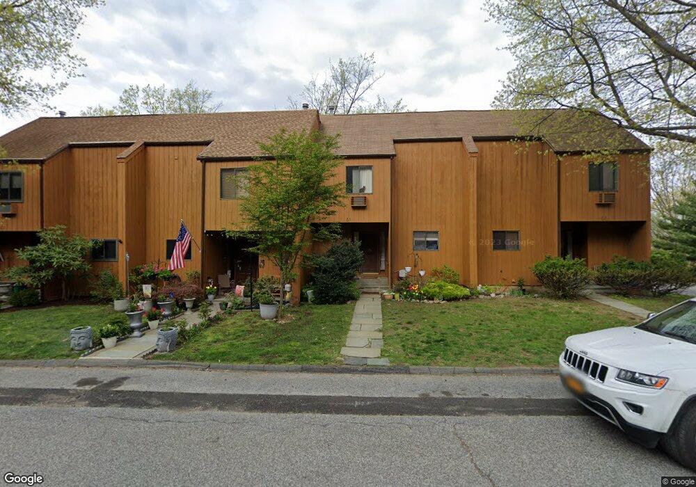
51 Amber Dr Croton On Hudson, NY 10520
Estimated Value: $559,726 - $611,000
3
Beds
2
Baths
1,456
Sq Ft
$402/Sq Ft
Est. Value
About This Home
This home is located at 51 Amber Dr, Croton On Hudson, NY 10520 and is currently estimated at $584,682, approximately $401 per square foot. 51 Amber Dr is a home located in Westchester County with nearby schools including Frank G. Lindsey Elementary School, Blue Mountain Middle School, and Hendrick Hudson High School.
Ownership History
Date
Name
Owned For
Owner Type
Purchase Details
Closed on
Oct 31, 2022
Sold by
Grimm Marjorie
Bought by
Marjorie A Grimm Irrevocable Trust
Current Estimated Value
Home Financials for this Owner
Home Financials are based on the most recent Mortgage that was taken out on this home.
Original Mortgage
$370,000
Interest Rate
6.36%
Purchase Details
Closed on
Feb 1, 2005
Sold by
Obenauer Clifford and Obenauer Michelle
Bought by
Grimm Marjorie
Home Financials for this Owner
Home Financials are based on the most recent Mortgage that was taken out on this home.
Original Mortgage
$166,000
Interest Rate
5.78%
Mortgage Type
Purchase Money Mortgage
Purchase Details
Closed on
Jul 20, 1998
Sold by
St George Kathleen
Bought by
Obenauer Michelle and Obenauer Clifford
Create a Home Valuation Report for This Property
The Home Valuation Report is an in-depth analysis detailing your home's value as well as a comparison with similar homes in the area
Home Values in the Area
Average Home Value in this Area
Purchase History
| Date | Buyer | Sale Price | Title Company |
|---|---|---|---|
| Marjorie A Grimm Irrevocable Trust | -- | -- | |
| Grimm Marjorie | $407,000 | The Judicial Title Ins Agenc | |
| Obenauer Michelle | $180,000 | -- |
Source: Public Records
Mortgage History
| Date | Status | Borrower | Loan Amount |
|---|---|---|---|
| Previous Owner | Marjorie A Grimm Irrevocable Trust | $370,000 | |
| Previous Owner | Grimm Marjorie | $166,000 |
Source: Public Records
Tax History Compared to Growth
Tax History
| Year | Tax Paid | Tax Assessment Tax Assessment Total Assessment is a certain percentage of the fair market value that is determined by local assessors to be the total taxable value of land and additions on the property. | Land | Improvement |
|---|---|---|---|---|
| 2024 | $10,246 | $4,750 | $100 | $4,650 |
| 2023 | $9,742 | $4,750 | $100 | $4,650 |
| 2022 | $9,710 | $4,750 | $100 | $4,650 |
| 2021 | $9,436 | $4,750 | $100 | $4,650 |
| 2020 | $9,137 | $4,750 | $100 | $4,650 |
| 2019 | $7,375 | $4,750 | $100 | $4,650 |
| 2018 | $12,539 | $4,750 | $100 | $4,650 |
| 2017 | $3,307 | $4,750 | $100 | $4,650 |
| 2016 | $9,986 | $4,750 | $100 | $4,650 |
| 2015 | -- | $4,750 | $100 | $4,650 |
| 2014 | -- | $4,750 | $100 | $4,650 |
| 2013 | -- | $4,750 | $100 | $4,650 |
Source: Public Records
Map
Nearby Homes
- 5 Robin Ln
- 12 Scenic Dr Unit K
- 13 Scenic Dr Unit U
- 13 Scenic Dr Unit M
- 13 Scenic Dr Unit D
- 14 Scenic Dr Unit 14T
- 15 Scenic Dr Unit D
- 15 Scenic Dr Unit E
- 15 Scenic Dr Unit K
- 16 Scenic Dr Unit X
- 16 Scenic Dr Unit S
- 16 Scenic Dr Unit N
- 16 Scenic Dr Unit M
- 8 Prickly Pear Hill Rd
- 3 Prickly Pear Hill Rd
- 1260 Albany Post Rd
- 14 Amalfi Dr
- 152 Old Post Rd N
- Lot 18 Wolf Rd
- 114 Laurel Hill Rd