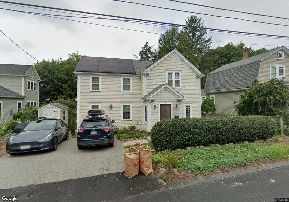
51 Baker Ave Lexington, MA 02421
East Lexington NeighborhoodEstimated Value: $1,051,000 - $1,388,339
3
Beds
3
Baths
2,124
Sq Ft
$601/Sq Ft
Est. Value
About This Home
This home is located at 51 Baker Ave, Lexington, MA 02421 and is currently estimated at $1,277,085, approximately $601 per square foot. 51 Baker Ave is a home located in Middlesex County with nearby schools including Bowman Elementary School, Jonas Clarke Middle School, and Lexington High School.
Ownership History
Date
Name
Owned For
Owner Type
Purchase Details
Closed on
Oct 16, 2013
Sold by
Hammond 2Nd Thomas
Bought by
Hammond 2Nd Thomas and Hammond Susan
Current Estimated Value
Purchase Details
Closed on
Mar 30, 2004
Sold by
Herman Louise F and Huggins Maria
Bought by
Hammond Susan and Hammond Thomas
Create a Home Valuation Report for This Property
The Home Valuation Report is an in-depth analysis detailing your home's value as well as a comparison with similar homes in the area
Home Values in the Area
Average Home Value in this Area
Purchase History
| Date | Buyer | Sale Price | Title Company |
|---|---|---|---|
| Hammond 2Nd Thomas | -- | -- | |
| Hammond 2Nd Thomas | -- | -- | |
| Hammond Susan | $391,000 | -- |
Source: Public Records
Mortgage History
| Date | Status | Borrower | Loan Amount |
|---|---|---|---|
| Previous Owner | Hammond 2Nd Thomas | $315,000 | |
| Previous Owner | Hammond 2Nd Thomas | $315,000 | |
| Previous Owner | Hammond 2Nd Thomas | $275,000 |
Source: Public Records
Tax History
| Year | Tax Paid | Tax Assessment Tax Assessment Total Assessment is a certain percentage of the fair market value that is determined by local assessors to be the total taxable value of land and additions on the property. | Land | Improvement |
|---|---|---|---|---|
| 2025 | $14,945 | $1,222,000 | $598,000 | $624,000 |
| 2024 | $14,051 | $1,147,000 | $569,000 | $578,000 |
| 2023 | $13,754 | $1,058,000 | $517,000 | $541,000 |
| 2022 | $13,193 | $956,000 | $470,000 | $486,000 |
| 2021 | $13,095 | $910,000 | $448,000 | $462,000 |
| 2020 | $12,603 | $897,000 | $448,000 | $449,000 |
| 2019 | $12,101 | $857,000 | $427,000 | $430,000 |
| 2018 | $8,040 | $818,000 | $406,000 | $412,000 |
| 2017 | $5,785 | $672,000 | $375,000 | $297,000 |
| 2016 | $9,402 | $644,000 | $357,000 | $287,000 |
| 2015 | $9,035 | $608,000 | $324,000 | $284,000 |
| 2014 | $9,011 | $581,000 | $289,000 | $292,000 |
Source: Public Records
Map
Nearby Homes
- 82 Oak St
- 4 Aerial St
- 122 Sylvia St
- 120 Massachusetts Ave Unit 120
- 451 Appleton St
- 64 Browning Rd
- 20 Homer Rd
- 12 Arnold St
- 32 Moon Hill Rd
- 847 Massachusetts Ave
- 15 Bird Hill Rd
- 211 Florence Ave
- 991 Massachusetts Ave
- 53 Birch Hill Rd
- 16 Lily Pond Ln Unit 16
- 25 Maple St
- 7 Park Avenue Extension
- 20 Maple St
- 278 Hillside Ave
- 231 Wachusett Ave
Your Personal Tour Guide
Ask me questions while you tour the home.