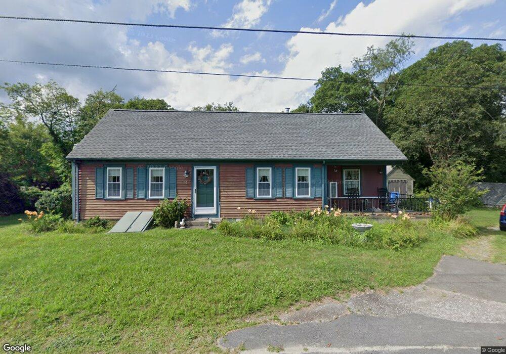
51 Brian St Westport, MA 02790
South Westport NeighborhoodEstimated Value: $586,000 - $681,000
3
Beds
--
Bath
1,200
Sq Ft
$522/Sq Ft
Est. Value
About This Home
This home is located at 51 Brian St, Westport, MA 02790 and is currently estimated at $625,887, approximately $521 per square foot. 51 Brian St is a home located in Bristol County with nearby schools including Alice A. Macomber Primary School, Westport Elementary School, and Westport Middle-High School.
Ownership History
Date
Name
Owned For
Owner Type
Purchase Details
Closed on
Jan 26, 2010
Sold by
Sprogis David Carl
Bought by
Sprogis David H and Sprogis Bradford A
Current Estimated Value
Purchase Details
Closed on
Sep 30, 2009
Sold by
Sprogis David Carl
Bought by
Sprogis David H and Sprogis Bradford A
Purchase Details
Closed on
Jul 18, 1969
Bought by
Sprogis David H and Sprogis Bradford A
Create a Home Valuation Report for This Property
The Home Valuation Report is an in-depth analysis detailing your home's value as well as a comparison with similar homes in the area
Home Values in the Area
Average Home Value in this Area
Purchase History
| Date | Buyer | Sale Price | Title Company |
|---|---|---|---|
| Sprogis David H | -- | -- | |
| Sprogis David H | -- | -- | |
| Sprogis David H | -- | -- |
Source: Public Records
Tax History Compared to Growth
Tax History
| Year | Tax Paid | Tax Assessment Tax Assessment Total Assessment is a certain percentage of the fair market value that is determined by local assessors to be the total taxable value of land and additions on the property. | Land | Improvement |
|---|---|---|---|---|
| 2025 | $4,667 | $626,500 | $493,300 | $133,200 |
| 2024 | $4,538 | $587,100 | $457,000 | $130,100 |
| 2023 | $4,508 | $552,400 | $423,200 | $129,200 |
| 2022 | $4,035 | $475,800 | $374,800 | $101,000 |
| 2021 | $3,732 | $432,900 | $340,700 | $92,200 |
| 2020 | $3,535 | $419,300 | $327,100 | $92,200 |
| 2019 | $3,403 | $411,500 | $327,100 | $84,400 |
| 2018 | $3,944 | $482,700 | $415,700 | $67,000 |
| 2017 | $3,855 | $483,700 | $415,700 | $68,000 |
| 2016 | $3,798 | $480,200 | $415,700 | $64,500 |
| 2015 | $3,907 | $492,700 | $426,900 | $65,800 |
Source: Public Records
Map
Nearby Homes
- 1881 Main Rd
- 1702 Drift Rd
- 1702J Drift Rd
- 1749 Main Rd
- 238-242 E Beach Rd
- 1580 Main Rd
- 19 Seabury Ln
- 304 Brayton Point Rd
- 189 Brayton Point Rd
- 99 Sylvia Ln
- 1346 Main Rd Unit B
- Lot 2 Horseneck Rd
- 255 John Dyer Rd
- 245 John Dyer Rd
- 225 Hixbridge Rd
- 18 Old Barn Rd
- 17 Quail Trail
- Lot 2E Horseneck Rd
- 920 Drift Rd
- 128 Maple Ave