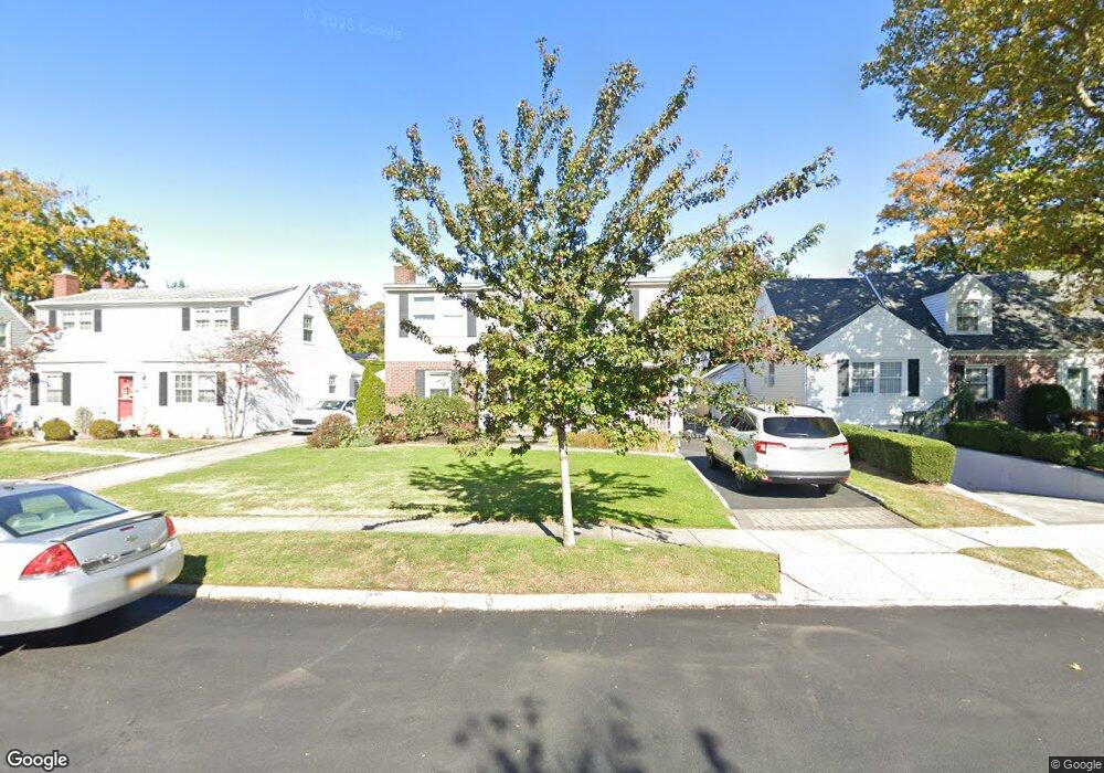
51 Briarcliff Dr Merrick, NY 11566
Estimated Value: $874,206 - $1,071,000
4
Beds
3
Baths
1,896
Sq Ft
$513/Sq Ft
Est. Value
About This Home
This home is located at 51 Briarcliff Dr, Merrick, NY 11566 and is currently estimated at $972,603, approximately $512 per square foot. 51 Briarcliff Dr is a home located in Nassau County with nearby schools including Burcham Elementary School, Merrick Avenue Middle School, and Waynoka High School.
Ownership History
Date
Name
Owned For
Owner Type
Purchase Details
Closed on
Apr 19, 2012
Sold by
Sirva Relocation Credit Llc
Bought by
Radica Peter M and Radica Jennifer
Current Estimated Value
Home Financials for this Owner
Home Financials are based on the most recent Mortgage that was taken out on this home.
Original Mortgage
$408,000
Outstanding Balance
$281,810
Interest Rate
3.91%
Mortgage Type
Purchase Money Mortgage
Estimated Equity
$690,793
Purchase Details
Closed on
Jun 20, 2007
Sold by
Barry Raymond
Bought by
Clements Jeffrey
Create a Home Valuation Report for This Property
The Home Valuation Report is an in-depth analysis detailing your home's value as well as a comparison with similar homes in the area
Home Values in the Area
Average Home Value in this Area
Purchase History
| Date | Buyer | Sale Price | Title Company |
|---|---|---|---|
| Radica Peter M | $510,000 | Mkmn29577 | |
| Sirva Relocation Credit Llc | $510,000 | Mkmn29577 | |
| Clements Jeffrey | $557,500 | -- |
Source: Public Records
Mortgage History
| Date | Status | Borrower | Loan Amount |
|---|---|---|---|
| Open | Sirva Relocation Credit Llc | $408,000 | |
| Closed | Radica Peter M | $408,000 |
Source: Public Records
Tax History Compared to Growth
Tax History
| Year | Tax Paid | Tax Assessment Tax Assessment Total Assessment is a certain percentage of the fair market value that is determined by local assessors to be the total taxable value of land and additions on the property. | Land | Improvement |
|---|---|---|---|---|
| 2025 | $14,681 | $541 | $171 | $370 |
| 2024 | $3,971 | $537 | $170 | $367 |
| 2023 | $13,952 | $591 | $187 | $404 |
| 2022 | $13,952 | $572 | $181 | $391 |
| 2021 | $17,458 | $587 | $186 | $401 |
| 2020 | $13,794 | $811 | $546 | $265 |
| 2019 | $13,694 | $869 | $548 | $321 |
| 2018 | $13,828 | $927 | $0 | $0 |
| 2017 | $9,550 | $985 | $526 | $459 |
| 2016 | $13,957 | $1,043 | $557 | $486 |
| 2015 | $4,526 | $1,096 | $585 | $511 |
| 2014 | $4,526 | $1,096 | $585 | $511 |
| 2013 | $4,167 | $1,080 | $585 | $495 |
Source: Public Records
Map
Nearby Homes
- 1531 Merrick Ave
- 37 Orchard St
- 2005 Abbot Ave
- 1580 Little Whaleneck Rd
- 1617 Richard Ave
- 1706 Old Mill Rd
- 1750 Henry Rd
- 101 Northridge Ave
- 1680 Lake Ave
- 12 Washington Dr
- 2207 Van Nostrand Ave
- 843 Jerusalem Ave
- 1650 Bridge St
- 1360 Powell Ave
- 2 Garfield St
- 526 Park Ave
- 2245 Van Nostrand Ave
- 1800 Remson Ave
- 2360 Hamilton Rd
- 1772 Rose St
- 49 Briarcliff Dr
- 53 Briarcliff Dr
- 47 Briarcliff Dr
- 1422 Manor Ct
- 1424 Manor Ct
- 50 Briarcliff Dr
- 1420 Manor Ct
- 45 Briarcliff Dr
- 46 Briarcliff Dr
- 36 Wellington Rd
- 43 Briarcliff Dr
- 27 Wellington Rd
- 44 Briarcliff Dr
- 1418 Manor Ct
- 1410 Manor Ct
- 34 Wellington Rd
- 34 Briarcliff Dr
- 1435 Briarcliff Dr
- 41 Briarcliff Dr
- 25 Wellington Rd