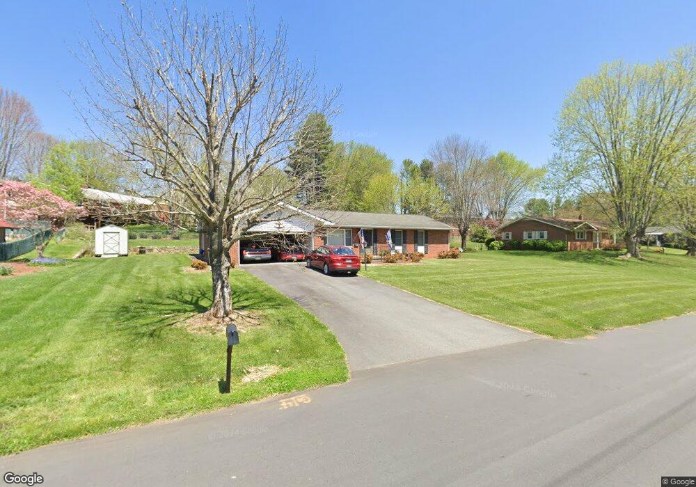
51 Broad St Waynesville, NC 28786
Estimated Value: $393,131 - $501,000
3
Beds
2
Baths
1,593
Sq Ft
$274/Sq Ft
Est. Value
About This Home
This home is located at 51 Broad St, Waynesville, NC 28786 and is currently estimated at $436,533, approximately $274 per square foot. 51 Broad St is a home located in Haywood County with nearby schools including Hazelwood Elementary, Waynesville Middle, and Tuscola High.
Ownership History
Date
Name
Owned For
Owner Type
Purchase Details
Closed on
Aug 22, 2025
Sold by
Cooper Robert Dennis and Cooper Patricia K
Bought by
Dennis And Patty Cooper Revocable Trust and Cooper
Current Estimated Value
Purchase Details
Closed on
Mar 14, 2019
Sold by
Cooper Patricia K and Estate Of Mary Nancy Lou Kirch
Bought by
Cooper Patricia K
Purchase Details
Closed on
May 18, 2016
Sold by
Rogers Lucy W and Rogers Russell
Bought by
Kirchner Nancy
Purchase Details
Closed on
May 11, 2010
Sold by
Schandevel Patricia Ann and Schandevel James
Bought by
Rogers M Russell and Rogers Lucy W
Create a Home Valuation Report for This Property
The Home Valuation Report is an in-depth analysis detailing your home's value as well as a comparison with similar homes in the area
Home Values in the Area
Average Home Value in this Area
Purchase History
| Date | Buyer | Sale Price | Title Company |
|---|---|---|---|
| Dennis And Patty Cooper Revocable Trust | -- | None Listed On Document | |
| Dennis And Patty Cooper Revocable Trust | -- | None Listed On Document | |
| Cooper Patricia K | -- | None Available | |
| Kirchner Nancy | -- | None Available | |
| Rogers M Russell | $225,000 | None Available |
Source: Public Records
Tax History Compared to Growth
Tax History
| Year | Tax Paid | Tax Assessment Tax Assessment Total Assessment is a certain percentage of the fair market value that is determined by local assessors to be the total taxable value of land and additions on the property. | Land | Improvement |
|---|---|---|---|---|
| 2025 | -- | $227,600 | $56,000 | $171,600 |
| 2024 | $1,411 | $227,600 | $56,000 | $171,600 |
| 2023 | $1,411 | $227,600 | $56,000 | $171,600 |
| 2022 | $1,377 | $227,600 | $56,000 | $171,600 |
| 2021 | $1,377 | $227,600 | $56,000 | $171,600 |
| 2020 | $1,241 | $185,000 | $45,500 | $139,500 |
| 2019 | $1,246 | $185,000 | $45,500 | $139,500 |
| 2018 | $1,246 | $185,000 | $45,500 | $139,500 |
| 2017 | $541 | $185,000 | $0 | $0 |
| 2016 | $556 | $196,300 | $0 | $0 |
| 2015 | $1,275 | $196,300 | $0 | $0 |
| 2014 | $531 | $196,300 | $0 | $0 |
Source: Public Records
Map
Nearby Homes
- 204 Oakdale Rd
- 154 Lowell St
- 71 Auburn Park Dr
- 158 Morning Dr
- 508 Pigeon St
- 30 Babb St
- 161 S Hill St
- 149 Short St
- 684 Woodfield Dr
- 671 S Haywood St Unit 108B
- 152 Springview Dr
- 84 S Hill St
- 111 Digging Seng Trail
- 111 Digging Seng Trail Unit 138
- 622 S Haywood St Unit 207
- 169 East St
- TBD Adams St Unit 1
- 9999 Cavalier Dr
- 147 Preservation Way
- 156 Burma Rd