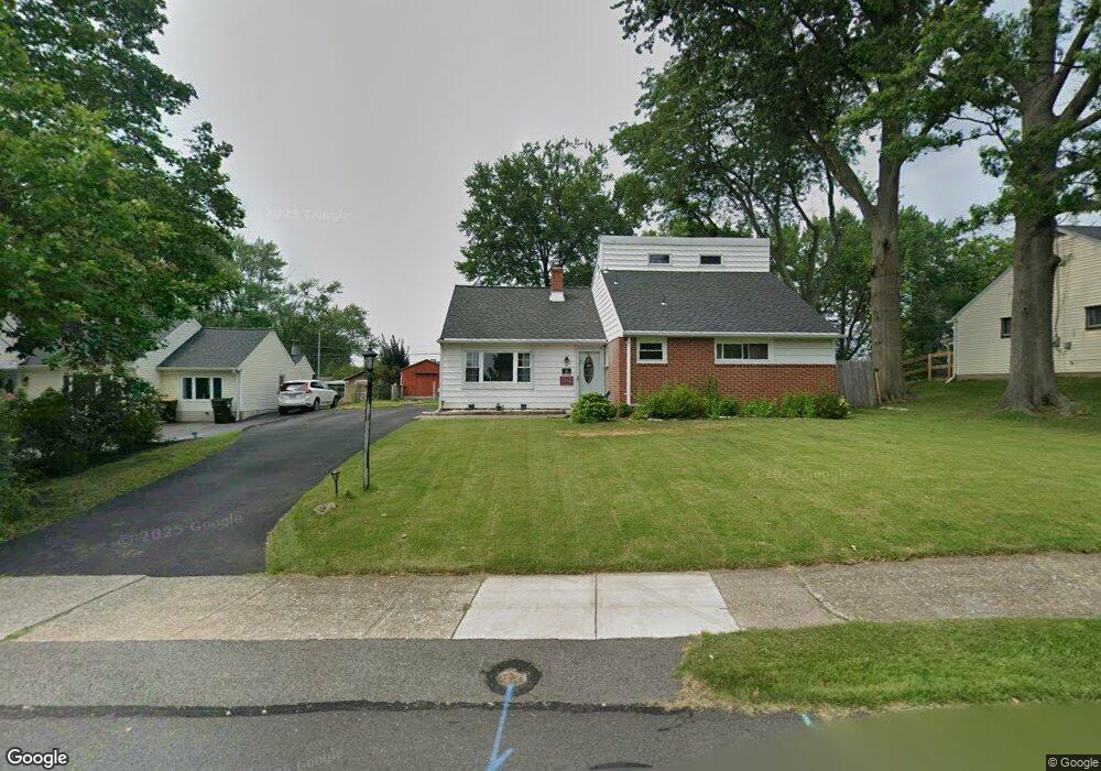
51 Burnside Ave Norristown, PA 19403
West Norriton Township NeighborhoodEstimated Value: $425,000 - $467,396
3
Beds
3
Baths
2,212
Sq Ft
$200/Sq Ft
Est. Value
About This Home
This home is located at 51 Burnside Ave, Norristown, PA 19403 and is currently estimated at $442,599, approximately $200 per square foot. 51 Burnside Ave is a home located in Montgomery County with nearby schools including Charles Blockson Middle School, Paul V Fly Elementary School, and East Norriton Middle School.
Ownership History
Date
Name
Owned For
Owner Type
Purchase Details
Closed on
Mar 20, 1979
Bought by
Horne Joseph R and Horne Lynn D
Current Estimated Value
Create a Home Valuation Report for This Property
The Home Valuation Report is an in-depth analysis detailing your home's value as well as a comparison with similar homes in the area
Home Values in the Area
Average Home Value in this Area
Purchase History
| Date | Buyer | Sale Price | Title Company |
|---|---|---|---|
| Horne Joseph R | $47,500 | -- |
Source: Public Records
Tax History Compared to Growth
Tax History
| Year | Tax Paid | Tax Assessment Tax Assessment Total Assessment is a certain percentage of the fair market value that is determined by local assessors to be the total taxable value of land and additions on the property. | Land | Improvement |
|---|---|---|---|---|
| 2025 | $5,739 | $117,450 | -- | -- |
| 2024 | $5,739 | $117,450 | -- | -- |
| 2023 | $5,675 | $117,450 | $0 | $0 |
| 2022 | $5,637 | $117,450 | $0 | $0 |
| 2021 | $5,602 | $117,450 | $0 | $0 |
| 2020 | $5,435 | $117,450 | $0 | $0 |
| 2019 | $5,314 | $117,450 | $0 | $0 |
| 2018 | $4,089 | $117,450 | $0 | $0 |
| 2017 | $5,017 | $117,450 | $0 | $0 |
| 2016 | $4,971 | $117,450 | $0 | $0 |
| 2015 | $4,606 | $117,450 | $0 | $0 |
| 2014 | $4,606 | $117,450 | $0 | $0 |
Source: Public Records
Map
Nearby Homes
- 37 Burnside Ave
- 32 Miami Rd
- 2055 W Marshall St
- 68 Jefferson Ave
- 136 Markley Farm Cir
- 2020 Davis Dr
- 2020 Sterigere St
- 709 Middleton Place
- 1107 Middleton Place
- 2008 Hemlock Rd
- 1749 W Marshall St
- 00 Arden Dr Unit METHACTON SCHOOL
- 1104 Arden Dr Unit METHACTON SCHOOL
- 108 N Prospect Ave
- 137 Avondale Rd
- 166 Hoover Ave
- 1613 Countryside Ln
- 2044 Mill Rd
- 155 Avondale Rd
- 1635 W Marshall W Marshall St
- 53 Burnside Ave
- 49 Burnside Ave
- 55 Burnside Ave
- 47 Burnside Ave
- 52 Crawford Dr
- 54 Crawford Dr
- 50 Burnside Ave
- 2077 W Marshall St
- 57 Burnside Ave
- 54 Burnside Ave
- 56 Crawford Dr
- 50 Crawford Dr
- 45 Burnside Ave
- 56 Burnside Ave
- 2075 W Marshall St
- 59 Burnside Ave
- 58 Crawford Dr
- 58 Burnside Ave
- 43 Burnside Ave
- 2073 W Marshall St