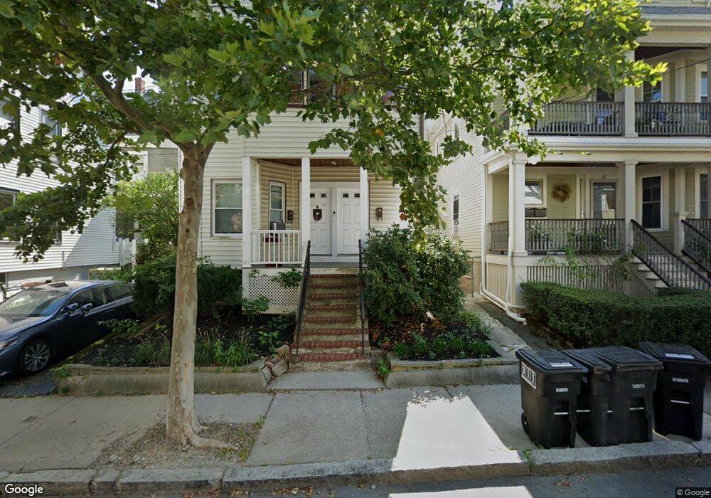
51 Burnside Ave Somerville, MA 02144
Porter Square NeighborhoodEstimated Value: $1,276,000 - $1,542,000
5
Beds
2
Baths
2,645
Sq Ft
$529/Sq Ft
Est. Value
About This Home
This home is located at 51 Burnside Ave, Somerville, MA 02144 and is currently estimated at $1,398,339, approximately $528 per square foot. 51 Burnside Ave is a home located in Middlesex County with nearby schools including Somerville High School, Saint Theresa School, and St. Clement Elementary School.
Ownership History
Date
Name
Owned For
Owner Type
Purchase Details
Closed on
Mar 13, 2025
Sold by
Hurley Sean P and Hurley Elizabeth A
Bought by
Nicholson Kerry and Sherin Zachary
Current Estimated Value
Home Financials for this Owner
Home Financials are based on the most recent Mortgage that was taken out on this home.
Original Mortgage
$700,000
Outstanding Balance
$695,873
Interest Rate
6.95%
Mortgage Type
Purchase Money Mortgage
Estimated Equity
$702,466
Purchase Details
Closed on
Sep 26, 2016
Sold by
Avenue 49-51 Burnside
Bought by
Hurley Sean P and Hurley Elizabeth A
Home Financials for this Owner
Home Financials are based on the most recent Mortgage that was taken out on this home.
Original Mortgage
$800,000
Interest Rate
4%
Mortgage Type
Adjustable Rate Mortgage/ARM
Create a Home Valuation Report for This Property
The Home Valuation Report is an in-depth analysis detailing your home's value as well as a comparison with similar homes in the area
Home Values in the Area
Average Home Value in this Area
Purchase History
| Date | Buyer | Sale Price | Title Company |
|---|---|---|---|
| Nicholson Kerry | $1,525,000 | None Available | |
| Nicholson Kerry | $1,525,000 | None Available | |
| Hurley Sean P | -- | -- | |
| Hurley Sean P | -- | -- | |
| Hurley Sean P | -- | -- |
Source: Public Records
Mortgage History
| Date | Status | Borrower | Loan Amount |
|---|---|---|---|
| Open | Nicholson Kerry | $700,000 | |
| Closed | Nicholson Kerry | $700,000 | |
| Previous Owner | Hurley Sean P | $800,000 |
Source: Public Records
Tax History
| Year | Tax Paid | Tax Assessment Tax Assessment Total Assessment is a certain percentage of the fair market value that is determined by local assessors to be the total taxable value of land and additions on the property. | Land | Improvement |
|---|---|---|---|---|
| 2025 | $16,232 | $1,487,800 | $759,000 | $728,800 |
| 2024 | $15,515 | $1,474,800 | $759,000 | $715,800 |
| 2023 | $14,739 | $1,425,400 | $759,000 | $666,400 |
| 2022 | $13,529 | $1,329,000 | $722,800 | $606,200 |
| 2021 | $13,145 | $1,290,000 | $717,600 | $572,400 |
| 2020 | $12,197 | $1,208,800 | $670,200 | $538,600 |
| 2019 | $12,002 | $1,115,400 | $653,600 | $461,800 |
| 2018 | $11,162 | $986,900 | $594,200 | $392,700 |
| 2017 | $10,098 | $865,300 | $560,600 | $304,700 |
| 2016 | $8,701 | $694,400 | $417,200 | $277,200 |
| 2015 | $8,323 | $660,000 | $385,200 | $274,800 |
Source: Public Records
Map
Nearby Homes
- 49 Cherry St Unit 1
- 79 Willow Ave
- 353 Summer St Unit 310
- 32-40 White St
- 10 Beech St Unit 4
- 10 Beech St Unit 1
- 10 Beech St Unit 3
- 7 Beech St Unit 319
- 7 Beech St Unit 317
- 371 Highland Ave
- 20 Mossland St
- 167 Albion St
- 156 Albion St Unit 1
- 16 Rogers Ave
- 13 Warwick St
- 68 Winslow Ave
- 18 Upland Rd Unit 1
- 7 Russell St Unit 1
- 3 Arlington St Unit 44
- 227 Highland Ave Unit 2
- 49 Burnside Ave
- 49 Burnside Ave Unit 1
- 47 Burnside Ave
- 47 Burnside Ave Unit 1
- 296 Summer St Unit 3
- 296 Summer St Unit 2
- 296 Summer St Unit 1
- 298 Summer St
- 292 Summer St
- 292 Summer St Unit 2
- 292 Summer St Unit 1
- 46 Hancock St
- 48 Hancock St Unit 3
- 46 Hancock St Unit 2
- 48 Hancock St Unit 6
- 48 Hancock St
- 45 Burnside Ave
- 44 Hancock St Unit 1
- 44 Hancock St
- 44 Hancock St Unit 3
Your Personal Tour Guide
Ask me questions while you tour the home.