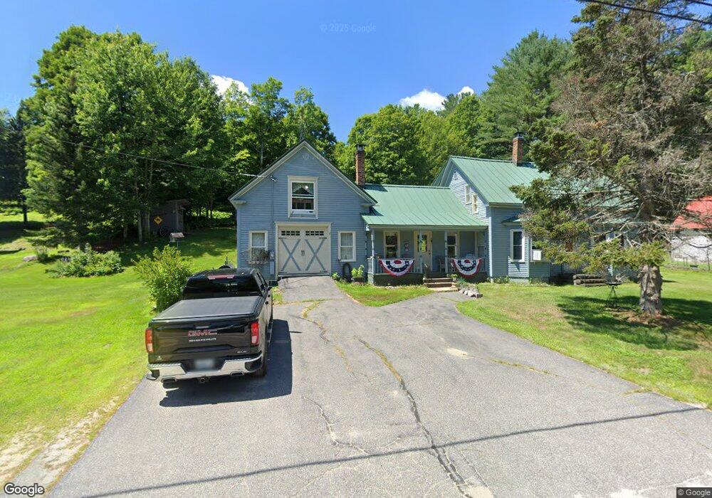
51 Butterfield Rd Sumner, ME 04292
Estimated Value: $201,000 - $355,000
4
Beds
1
Bath
2,500
Sq Ft
$123/Sq Ft
Est. Value
About This Home
This home is located at 51 Butterfield Rd, Sumner, ME 04292 and is currently estimated at $308,019, approximately $123 per square foot. 51 Butterfield Rd is a home located in Oxford County with nearby schools including Hartford-Sumner Elementary School, Buckfield Junior/Senior High School, and West Sumner Christian School.
Ownership History
Date
Name
Owned For
Owner Type
Purchase Details
Closed on
Oct 6, 2009
Sold by
Pewitt Kevin R
Bought by
Thornton Charles P
Current Estimated Value
Home Financials for this Owner
Home Financials are based on the most recent Mortgage that was taken out on this home.
Original Mortgage
$132,653
Outstanding Balance
$86,797
Interest Rate
5.12%
Mortgage Type
FHA
Estimated Equity
$221,222
Create a Home Valuation Report for This Property
The Home Valuation Report is an in-depth analysis detailing your home's value as well as a comparison with similar homes in the area
Home Values in the Area
Average Home Value in this Area
Purchase History
| Date | Buyer | Sale Price | Title Company |
|---|---|---|---|
| Thornton Charles P | -- | -- |
Source: Public Records
Mortgage History
| Date | Status | Borrower | Loan Amount |
|---|---|---|---|
| Open | Thornton Charles P | $132,653 |
Source: Public Records
Tax History Compared to Growth
Tax History
| Year | Tax Paid | Tax Assessment Tax Assessment Total Assessment is a certain percentage of the fair market value that is determined by local assessors to be the total taxable value of land and additions on the property. | Land | Improvement |
|---|---|---|---|---|
| 2024 | $3,570 | $274,627 | $64,220 | $210,407 |
| 2023 | $2,925 | $138,631 | $42,100 | $96,531 |
| 2022 | $2,863 | $138,631 | $42,100 | $96,531 |
| 2021 | $2,863 | $138,631 | $42,100 | $96,531 |
| 2020 | $2,863 | $138,631 | $42,100 | $96,531 |
| 2019 | $2,821 | $138,631 | $42,100 | $96,531 |
| 2018 | $2,676 | $138,631 | $42,100 | $96,531 |
| 2017 | $2,537 | $138,631 | $42,100 | $96,531 |
| 2016 | $2,350 | $138,631 | $42,100 | $96,531 |
| 2015 | $2,274 | $138,631 | $42,100 | $96,531 |
| 2014 | -- | $138,631 | $42,100 | $96,531 |
| 2013 | -- | $138,631 | $42,100 | $96,531 |
Source: Public Records
Map
Nearby Homes
- 117 Gammon Rd
- 329 Sumner Rd
- 186 Old Sumner Rd
- Lot A Blackberry Ln
- Lot B Blackberry Ln
- 209 Old Sumner Rd
- 66 Ridge Rd
- Lot C Fern Way
- 729 Main St
- 18 Thurlow Dr
- 203 Stetson Rd
- 42 Front St
- 33 High St
- 20 Front St
- 21 Jones Dr
- 15 Front St
- 14 Tucker Rd
- Lots 10&11 Davenport Rd
- U22 LOT 29 McRc Right of Way
- 216 Brock School Rd
- 57 Butterfield Rd
- 47 Butterfield Rd
- 63 Butterfield Rd
- TBD Butterfield Rd
- 41 Butterfield Rd
- 37 Butterfield Rd
- 80 Old State Rt 140
- 88 Old State Rt 140
- 21 Butterfield Rd
- 7 Woodard Ln
- 81 Old State Rt 140
- 80 Butterfield Rd
- 15 Butterfield Rd
- 14 Butterfield Rd
- 85 Old State Rt 140
- 112 Old State Rt 140
- 11 Butterfield Rd
- 112 Old State Route 140
- 97 Butterfield Rd
- 0 Main Street (Route 140) Unit 1044012