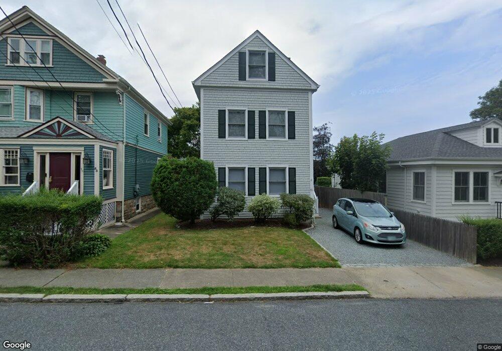
51 Carroll Ave Newport, RI 02840
Fifth Ward NeighborhoodEstimated Value: $866,000 - $1,085,345
3
Beds
2
Baths
1,346
Sq Ft
$721/Sq Ft
Est. Value
About This Home
This home is located at 51 Carroll Ave, Newport, RI 02840 and is currently estimated at $971,086, approximately $721 per square foot. 51 Carroll Ave is a home located in Newport County with nearby schools including Rogers High School, St Michael's Country Day School, and St George's School.
Ownership History
Date
Name
Owned For
Owner Type
Purchase Details
Closed on
Apr 13, 2007
Sold by
Griffiths Jon C
Bought by
Byrne Alan and Byrne Hilary
Current Estimated Value
Home Financials for this Owner
Home Financials are based on the most recent Mortgage that was taken out on this home.
Original Mortgage
$270,000
Interest Rate
6.24%
Mortgage Type
Purchase Money Mortgage
Purchase Details
Closed on
Apr 2, 1999
Sold by
Jenkins Michael David and Jenkins David C
Bought by
Griffiths Jon C
Create a Home Valuation Report for This Property
The Home Valuation Report is an in-depth analysis detailing your home's value as well as a comparison with similar homes in the area
Home Values in the Area
Average Home Value in this Area
Purchase History
| Date | Buyer | Sale Price | Title Company |
|---|---|---|---|
| Byrne Alan | $360,000 | -- | |
| Griffiths Jon C | $130,000 | -- |
Source: Public Records
Mortgage History
| Date | Status | Borrower | Loan Amount |
|---|---|---|---|
| Open | Griffiths Jon C | $270,000 | |
| Closed | Griffiths Jon C | $270,000 | |
| Previous Owner | Griffiths Jon C | $210,000 | |
| Previous Owner | Griffiths Jon C | $130,000 |
Source: Public Records
Tax History Compared to Growth
Tax History
| Year | Tax Paid | Tax Assessment Tax Assessment Total Assessment is a certain percentage of the fair market value that is determined by local assessors to be the total taxable value of land and additions on the property. | Land | Improvement |
|---|---|---|---|---|
| 2025 | $6,119 | $852,200 | $366,900 | $485,300 |
| 2024 | $5,940 | $852,200 | $366,900 | $485,300 |
| 2023 | $5,577 | $562,200 | $239,900 | $322,300 |
| 2022 | $5,361 | $557,900 | $239,900 | $318,000 |
| 2021 | $5,205 | $557,900 | $239,900 | $318,000 |
| 2020 | $4,359 | $424,000 | $219,300 | $204,700 |
| 2019 | $4,359 | $424,000 | $219,300 | $204,700 |
| 2018 | $4,236 | $424,000 | $219,300 | $204,700 |
| 2017 | $4,049 | $361,200 | $156,800 | $204,400 |
| 2016 | $3,948 | $361,200 | $156,800 | $204,400 |
| 2015 | $3,854 | $361,200 | $156,800 | $204,400 |
| 2014 | $4,151 | $344,200 | $133,300 | $210,900 |
Source: Public Records
Map
Nearby Homes
- 70 Carroll Ave Unit 905
- 70 Carroll Ave Unit 510
- 13 Vaughan Ave
- 99 Roseneath Ave
- 17 Meikle Ave Unit 19
- 0 Meikle Ave
- 39 Connection St
- 91 Houston Ave
- 129 Ruggles Ave
- 57 Clinton St Unit 57C
- 63 Coggeshall Ave
- 46 Chastellux Ave Unit M6
- 45 Hammond St Unit 2
- 604 Thames & 4 Dixon St
- 6 Sharon Ct
- 1 Harbor View Dr
- 519 Bellevue Ave Unit 1W
- 35 Chastellux Ave Unit I
- 62 Dixon St
- 553 Bellevue Ave Unit 14
- 53 Carroll Ave
- 49 Carroll Ave
- 14 Old Fort Rd
- 47 Carroll Ave
- 16 Old Fort Rd
- 55 Carroll Ave
- 70 Carroll Ave Unit 1108
- 70 Carroll Ave Unit 312
- 70 Carroll Ave Unit 111
- 70 Carroll Ave Unit 504
- 70 Carroll Ave Unit 908
- 70 Carroll Ave Unit 1102
- 70 Carroll Ave Unit 912
- 70 Carroll Ave Unit 403
- 70 Carroll Ave Unit 508
- 70 Carroll Ave Unit 1003
- 70 Carroll Ave Unit 803
- 70 Carroll Ave Unit 205
- 70 Carroll Ave Unit 1107
- 70 Carroll Ave Unit 806