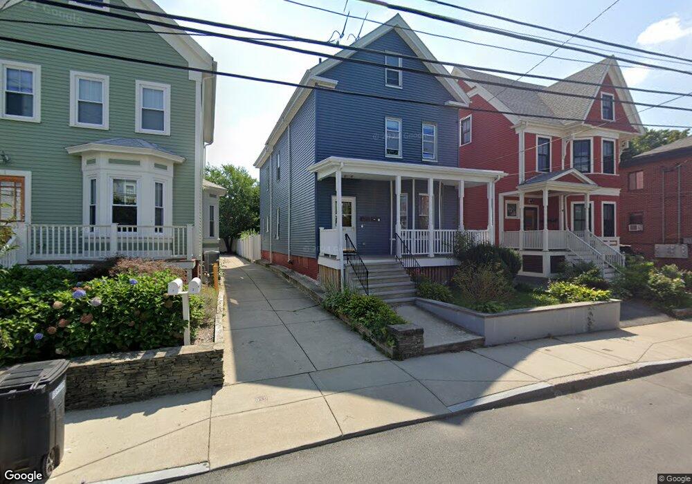
51 Cedar St Somerville, MA 02143
Porter Square NeighborhoodEstimated Value: $1,006,000 - $1,329,000
3
Beds
2
Baths
2,020
Sq Ft
$602/Sq Ft
Est. Value
About This Home
This home is located at 51 Cedar St, Somerville, MA 02143 and is currently estimated at $1,215,093, approximately $601 per square foot. 51 Cedar St is a home located in Middlesex County with nearby schools including Somerville High School, Saint Theresa School, and St. Clement Elementary School.
Ownership History
Date
Name
Owned For
Owner Type
Purchase Details
Closed on
Aug 26, 2021
Sold by
Bottari Anthony R
Bought by
Fodera Carole A and Bottari Richard A
Current Estimated Value
Purchase Details
Closed on
Aug 26, 2016
Sold by
Hall St Llc
Bought by
Hall Street Rt
Purchase Details
Closed on
Dec 8, 2015
Sold by
Talmo Nt
Bought by
Hall Street Rt
Home Financials for this Owner
Home Financials are based on the most recent Mortgage that was taken out on this home.
Original Mortgage
$2,100,800
Interest Rate
3.83%
Mortgage Type
Purchase Money Mortgage
Create a Home Valuation Report for This Property
The Home Valuation Report is an in-depth analysis detailing your home's value as well as a comparison with similar homes in the area
Home Values in the Area
Average Home Value in this Area
Purchase History
| Date | Buyer | Sale Price | Title Company |
|---|---|---|---|
| Fodera Carole A | -- | None Available | |
| Hall Street Rt | $635,000 | -- | |
| Hall Street Rt | $925,000 | -- |
Source: Public Records
Mortgage History
| Date | Status | Borrower | Loan Amount |
|---|---|---|---|
| Previous Owner | Hall Street Rt | $2,100,800 |
Source: Public Records
Tax History
| Year | Tax Paid | Tax Assessment Tax Assessment Total Assessment is a certain percentage of the fair market value that is determined by local assessors to be the total taxable value of land and additions on the property. | Land | Improvement |
|---|---|---|---|---|
| 2025 | $10,833 | $992,900 | $641,900 | $351,000 |
| 2024 | $10,380 | $986,700 | $641,900 | $344,800 |
| 2023 | $10,152 | $981,800 | $641,900 | $339,900 |
| 2022 | $9,548 | $937,900 | $611,300 | $326,600 |
| 2021 | $9,075 | $890,600 | $582,200 | $308,400 |
| 2020 | $8,575 | $849,900 | $559,800 | $290,100 |
| 2019 | $7,833 | $728,000 | $486,800 | $241,200 |
| 2018 | $7,435 | $657,400 | $442,500 | $214,900 |
| 2017 | $7,282 | $624,000 | $417,500 | $206,500 |
| 2016 | $7,140 | $569,800 | $381,800 | $188,000 |
Source: Public Records
Map
Nearby Homes
- 49 Cherry St Unit 1
- 20 Mossland St
- 32-40 White St
- 156 Albion St Unit 1
- 79 Willow Ave
- 167 Albion St
- 148 Lowell St Unit 3
- 10 Beech St Unit 4
- 10 Beech St Unit 1
- 10 Beech St Unit 3
- 227 Highland Ave Unit 2
- 227 Highland Ave Unit 3
- 227 Highland Ave Unit 1
- 355 Highland Ave Unit 3
- 161 Lowell St Unit 1
- 125 Lowell St Unit 3B
- 125 Lowell St Unit 5C
- 13 Warwick St
- 7 Beech St Unit 319
- 7 Beech St Unit 317
- 51 Cedar St Unit 3R
- 51 Cedar St
- 51 Cedar St Unit 2R
- 53 Cedar St
- 53 Cedar St Unit 3R
- 53 Cedar St Unit 2
- 53 Cedar St Unit 1
- 49 Cedar St
- 49 Cedar St Unit 3R
- 49 Cedar St
- 49 Cedar St Unit 1
- 49 Cedar St Unit 2
- 55 Cedar St
- 55 Cedar St Unit 59-1R
- 55 Cedar St Unit 59-2R
- 55 Cedar St Unit 59-3R
- 55 Cedar St Unit 6
- 55 Cedar St
- 55 Cedar St Unit 1
- 55 Cedar St Unit 2L
Your Personal Tour Guide
Ask me questions while you tour the home.