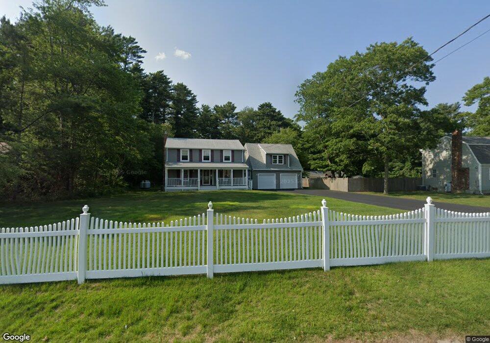
51 Davenport Rd Plymouth, MA 02360
Estimated Value: $648,000 - $690,570
3
Beds
2
Baths
2,600
Sq Ft
$260/Sq Ft
Est. Value
About This Home
This home is located at 51 Davenport Rd, Plymouth, MA 02360 and is currently estimated at $676,393, approximately $260 per square foot. 51 Davenport Rd is a home located in Plymouth County with nearby schools including Manomet Elementary School, Plymouth Community Intermediate, and Plymouth North High School.
Ownership History
Date
Name
Owned For
Owner Type
Purchase Details
Closed on
Mar 28, 2005
Sold by
Hanson Irene M and Guest Marnie E
Bought by
Hanson Irene M and Streeter Deborah J
Current Estimated Value
Home Financials for this Owner
Home Financials are based on the most recent Mortgage that was taken out on this home.
Original Mortgage
$95,000
Outstanding Balance
$48,322
Interest Rate
5.56%
Mortgage Type
Purchase Money Mortgage
Estimated Equity
$628,071
Purchase Details
Closed on
Nov 29, 1990
Sold by
Crowell Warren R
Bought by
Streeter Deborah J
Create a Home Valuation Report for This Property
The Home Valuation Report is an in-depth analysis detailing your home's value as well as a comparison with similar homes in the area
Home Values in the Area
Average Home Value in this Area
Purchase History
| Date | Buyer | Sale Price | Title Company |
|---|---|---|---|
| Hanson Irene M | -- | -- | |
| Streeter Deborah J | $139,000 | -- | |
| Streeter Deborah J | $139,000 | -- |
Source: Public Records
Mortgage History
| Date | Status | Borrower | Loan Amount |
|---|---|---|---|
| Open | Streeter Deborah J | $95,000 | |
| Previous Owner | Streeter Deborah J | $80,000 | |
| Previous Owner | Streeter Deborah J | $25,000 |
Source: Public Records
Tax History Compared to Growth
Tax History
| Year | Tax Paid | Tax Assessment Tax Assessment Total Assessment is a certain percentage of the fair market value that is determined by local assessors to be the total taxable value of land and additions on the property. | Land | Improvement |
|---|---|---|---|---|
| 2025 | $6,367 | $501,700 | $224,800 | $276,900 |
| 2024 | $6,057 | $470,600 | $204,900 | $265,700 |
| 2023 | $5,854 | $427,000 | $184,900 | $242,100 |
| 2022 | $5,559 | $360,300 | $174,300 | $186,000 |
| 2021 | $5,606 | $346,900 | $174,300 | $172,600 |
| 2020 | $5,392 | $329,800 | $158,600 | $171,200 |
| 2019 | $5,285 | $319,500 | $148,100 | $171,400 |
| 2018 | $5,063 | $307,600 | $137,600 | $170,000 |
| 2017 | $4,830 | $291,300 | $137,600 | $153,700 |
| 2016 | $4,595 | $282,400 | $127,100 | $155,300 |
| 2015 | $4,331 | $278,700 | $121,800 | $156,900 |
| 2014 | $4,159 | $274,900 | $121,800 | $153,100 |
Source: Public Records
Map
Nearby Homes
- 11 April Way
- 18 Highview Rd
- 0 Bogside Dr
- 39 Miter Dr Unit 8-1
- 115 Andrews Way
- 82 Miter Dr Unit 2-1
- 221 Beaver Dam Rd
- 221 Beaver Dam Rd Unit 1
- 79 Miter Dr Unit 7-2
- 88 Miter Dr Unit 1-1
- 90 Miter Dr Unit 1-3
- 32 Ray Rd
- 87 Miter Dr Unit 6-1
- 91 Miter Dr Unit 18-1
- 91 Miter Dr Unit 16-1
- 91 Miter Dr Unit 18-2
- 91 Miter Dr Unit 16-3
- The Hickory Plan at Alden's Reach - Attached & Detached Single Family Homes
- The Pine Plan at Alden's Reach - Attached & Detached Single Family Homes
- The Oak Plan at Alden's Reach - Attached & Detached Single Family Homes
- 55 Davenport Rd
- 47 Davenport Rd
- 54 Davenport Rd
- 43 Davenport Rd
- 50 Davenport Rd
- 59 Davenport Rd
- 58 Davenport Rd
- 39 Davenport Rd
- 46 Davenport Rd
- 22 October Ln
- 42 Davenport Rd
- 35 Davenport Rd
- 38 Davenport Rd
- 64 Davenport Rd
- 63 Davenport Rd
- 16 October Ln
- 34 Davenport Rd
- 31 Davenport Rd
- 19 October Ln
- 15 October Ln