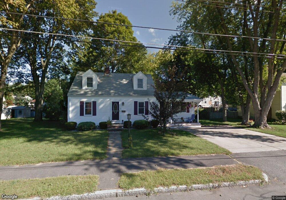
51 Forrester Rd Wakefield, MA 01880
Lakeside NeighborhoodEstimated Value: $766,000 - $872,000
3
Beds
2
Baths
1,620
Sq Ft
$501/Sq Ft
Est. Value
About This Home
This home is located at 51 Forrester Rd, Wakefield, MA 01880 and is currently estimated at $811,710, approximately $501 per square foot. 51 Forrester Rd is a home located in Middlesex County with nearby schools including Wakefield Memorial High School, St Joseph School, and Odyssey Day School.
Ownership History
Date
Name
Owned For
Owner Type
Purchase Details
Closed on
Apr 21, 1994
Sold by
Roberto Mark C and Roberto Dayna A
Bought by
Gallant John J and Gallant Carolyn A
Current Estimated Value
Home Financials for this Owner
Home Financials are based on the most recent Mortgage that was taken out on this home.
Original Mortgage
$90,000
Interest Rate
7.6%
Mortgage Type
Purchase Money Mortgage
Purchase Details
Closed on
Sep 8, 1987
Sold by
Delvisco I Est
Bought by
Roberts Mark C
Home Financials for this Owner
Home Financials are based on the most recent Mortgage that was taken out on this home.
Original Mortgage
$146,000
Interest Rate
10.28%
Mortgage Type
Purchase Money Mortgage
Create a Home Valuation Report for This Property
The Home Valuation Report is an in-depth analysis detailing your home's value as well as a comparison with similar homes in the area
Home Values in the Area
Average Home Value in this Area
Purchase History
| Date | Buyer | Sale Price | Title Company |
|---|---|---|---|
| Gallant John J | $185,000 | -- | |
| Roberts Mark C | $183,000 | -- |
Source: Public Records
Mortgage History
| Date | Status | Borrower | Loan Amount |
|---|---|---|---|
| Closed | Roberts Mark C | $90,000 | |
| Previous Owner | Roberts Mark C | $140,000 | |
| Previous Owner | Roberts Mark C | $140,000 | |
| Previous Owner | Roberts Mark C | $146,000 |
Source: Public Records
Tax History
| Year | Tax Paid | Tax Assessment Tax Assessment Total Assessment is a certain percentage of the fair market value that is determined by local assessors to be the total taxable value of land and additions on the property. | Land | Improvement |
|---|---|---|---|---|
| 2025 | $8,022 | $706,800 | $396,900 | $309,900 |
| 2024 | $7,406 | $658,300 | $369,200 | $289,100 |
| 2023 | $7,080 | $603,600 | $344,600 | $259,000 |
| 2022 | $6,639 | $538,900 | $307,700 | $231,200 |
| 2021 | $6,413 | $503,800 | $281,300 | $222,500 |
| 2020 | $6,031 | $472,300 | $263,700 | $208,600 |
| 2019 | $5,655 | $440,800 | $246,100 | $194,700 |
| 2018 | $5,453 | $421,100 | $235,100 | $186,000 |
| 2017 | $5,129 | $393,600 | $219,800 | $173,800 |
| 2016 | $5,125 | $379,900 | $217,000 | $162,900 |
| 2015 | $4,784 | $354,900 | $202,700 | $152,200 |
| 2014 | $4,426 | $346,300 | $197,800 | $148,500 |
Source: Public Records
Map
Nearby Homes
- 270 Lowell St
- 29 Cordis St
- 67 Woodcrest Dr
- 25 Juniper Ave
- 57 Wave Ave
- 159 Main St
- 50 Quannapowitt Pkwy
- 16 Pleasant St
- 68 Preston St Unit 6D
- 43-45 Crescent St
- 10 Wakefield Ave Unit B
- 3 Carnation Cir Unit C
- 12 Heritage Ln
- 39 Cedar St
- 35 Richardson St Unit 2
- 62 Foundry St Unit 310
- 62 Foundry St Unit 204
- 62 Foundry St Unit 402
- 62 Foundry St Unit 507
- 62 Foundry St Unit 208
- 49 Forrester Rd
- 55 Forrester Rd
- 309 Lowell St
- 305 Lowell St
- 50 Forrester Rd
- 45 Forrester Rd
- 54 Forrester Rd
- 59 Forrester Rd
- 311 Lowell St
- 315 Lowell St
- 48 Forrester Rd
- 58 Forrester Rd
- 44 Forrester Rd
- 301 Lowell St
- 41 Forrester Rd
- 63 Forrester Rd
- 60 Forrester Rd
- 319 Lowell St
- 310 Lowell St
- 5 Magnolia Terrace
Your Personal Tour Guide
Ask me questions while you tour the home.