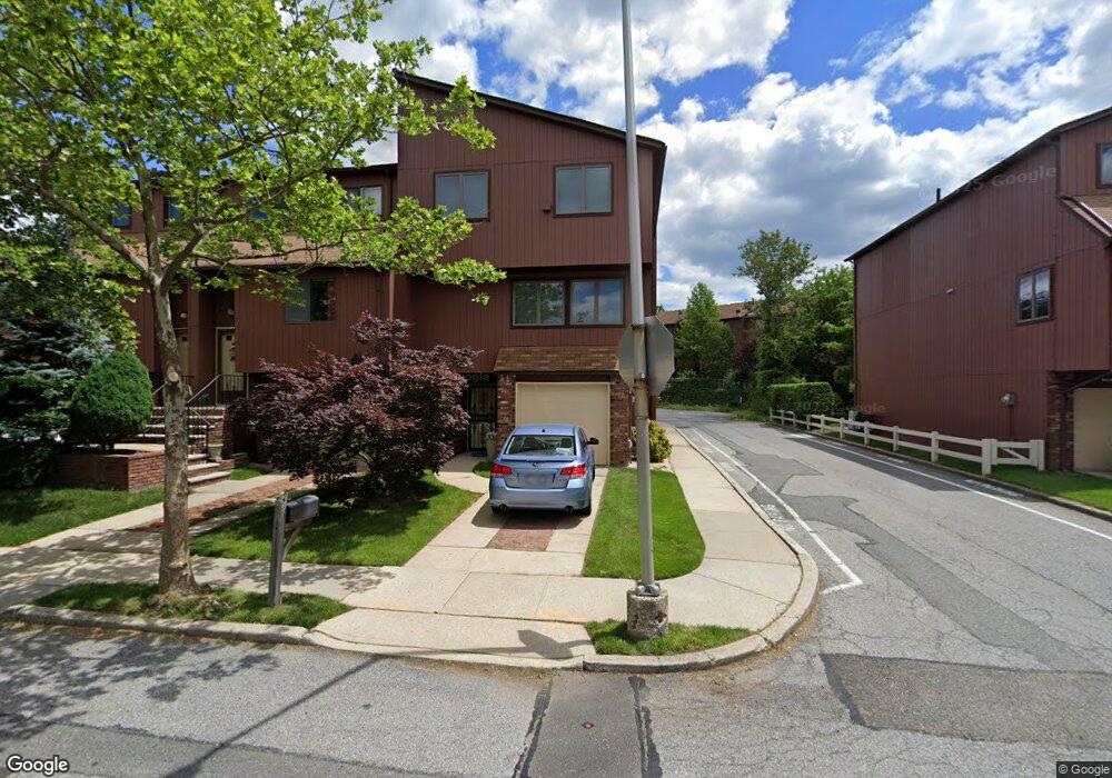
51 Gateway Dr Unit 177 Staten Island, NY 10304
Concord NeighborhoodEstimated Value: $753,000 - $854,000
--
Bed
--
Bath
2,363
Sq Ft
$336/Sq Ft
Est. Value
About This Home
This home is located at 51 Gateway Dr Unit 177, Staten Island, NY 10304 and is currently estimated at $794,724, approximately $336 per square foot. 51 Gateway Dr Unit 177 is a home located in Richmond County with nearby schools including P.S. 48 - William C. Wilcox, I.S. 49 Berta A Dreyfus, and New Dorp High School.
Ownership History
Date
Name
Owned For
Owner Type
Purchase Details
Closed on
Feb 1, 2005
Sold by
Desantis Victor and Desantis Carol Keegan
Bought by
Russo Joseph and Russo Jeanie
Current Estimated Value
Home Financials for this Owner
Home Financials are based on the most recent Mortgage that was taken out on this home.
Original Mortgage
$240,000
Interest Rate
4.75%
Mortgage Type
Fannie Mae Freddie Mac
Create a Home Valuation Report for This Property
The Home Valuation Report is an in-depth analysis detailing your home's value as well as a comparison with similar homes in the area
Home Values in the Area
Average Home Value in this Area
Purchase History
| Date | Buyer | Sale Price | Title Company |
|---|---|---|---|
| Russo Joseph | $467,000 | Regal Title Agency |
Source: Public Records
Mortgage History
| Date | Status | Borrower | Loan Amount |
|---|---|---|---|
| Previous Owner | Russo Joseph | $240,000 |
Source: Public Records
Tax History Compared to Growth
Tax History
| Year | Tax Paid | Tax Assessment Tax Assessment Total Assessment is a certain percentage of the fair market value that is determined by local assessors to be the total taxable value of land and additions on the property. | Land | Improvement |
|---|---|---|---|---|
| 2025 | $6,179 | $44,616 | $4,713 | $39,903 |
| 2024 | $6,460 | $36,453 | $5,726 | $30,727 |
| 2023 | $5,813 | $30,344 | $5,800 | $24,544 |
| 2022 | $5,145 | $30,221 | $6,489 | $23,732 |
| 2021 | $5,380 | $27,006 | $6,489 | $20,517 |
| 2020 | $5,776 | $29,514 | $6,489 | $23,025 |
| 2019 | $5,642 | $28,489 | $6,489 | $22,000 |
| 2018 | $5,158 | $26,765 | $6,337 | $20,428 |
| 2017 | $4,848 | $25,250 | $6,489 | $18,761 |
| 2016 | $4,543 | $24,276 | $6,489 | $17,787 |
| 2015 | $4,396 | $23,905 | $6,489 | $17,416 |
| 2014 | $4,396 | $24,494 | $6,190 | $18,304 |
Source: Public Records
Map
Nearby Homes
- 63 Gateway Dr Unit 172
- 164 Stonegate Dr
- 89 Columbus Ave
- 62 Columbus Ave
- 31 Alan Loop Unit 65
- 98 N Railroad Ave
- 72 Alan Loop
- 22 Scranton St
- 25 Marie St
- 23 Marie St
- 81 Providence St
- 16 Tacoma St
- 4 Sheridan Ave
- 84 Sheridan Ave
- 1160 Richmond Rd Unit 7B
- 1160 Richmond Rd Unit 6A
- 1160 Richmond Rd Unit 2F
- 69 Fayette Ave
- 24 Roosevelt St
- 32 Hunton St
- 53 Gateway Dr
- 55 Gateway Dr
- 27 Gateway Dr
- 57 Gateway Dr Unit 174
- 25 Gateway Dr Unit 161
- 61 Gateway Dr Unit 173
- 23 Gateway Dr Unit 162
- 35 Gateway Dr Unit 178
- 21 Gateway Dr
- 65 Gateway Dr Unit 171
- 19 Gateway Dr Unit 164
- 37 Gateway Dr Unit 179
- 67 Gateway Dr Unit 170
- 39 Gateway Dr Unit 180
- 30 Gateway Dr Unit 155
- 17 Gateway Dr
- 36 Gateway Dr
- 32 Gateway Dr Unit 156
- 34 Gateway Dr Unit 154
- 28 Gateway Dr