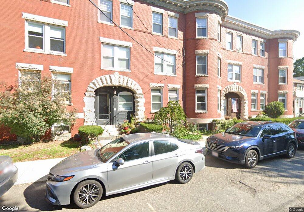
51 Gorham Ave Unit 1 Brookline, MA 02445
Brookline Village NeighborhoodEstimated Value: $807,000 - $1,065,000
2
Beds
1
Bath
1,200
Sq Ft
$739/Sq Ft
Est. Value
About This Home
This home is located at 51 Gorham Ave Unit 1, Brookline, MA 02445 and is currently estimated at $886,758, approximately $738 per square foot. 51 Gorham Ave Unit 1 is a home located in Norfolk County with nearby schools including Pierce School, Brookline High School, and Edward M. Kennedy Academy for Health Careers.
Ownership History
Date
Name
Owned For
Owner Type
Purchase Details
Closed on
Sep 18, 2009
Sold by
51 Gorham Llc
Bought by
Paktinat Mahnaz
Current Estimated Value
Home Financials for this Owner
Home Financials are based on the most recent Mortgage that was taken out on this home.
Original Mortgage
$320,000
Outstanding Balance
$210,234
Interest Rate
5.28%
Mortgage Type
Purchase Money Mortgage
Estimated Equity
$676,524
Create a Home Valuation Report for This Property
The Home Valuation Report is an in-depth analysis detailing your home's value as well as a comparison with similar homes in the area
Home Values in the Area
Average Home Value in this Area
Purchase History
| Date | Buyer | Sale Price | Title Company |
|---|---|---|---|
| Paktinat Mahnaz | $400,000 | -- |
Source: Public Records
Mortgage History
| Date | Status | Borrower | Loan Amount |
|---|---|---|---|
| Open | Paktinat Mahnaz | $320,000 |
Source: Public Records
Tax History
| Year | Tax Paid | Tax Assessment Tax Assessment Total Assessment is a certain percentage of the fair market value that is determined by local assessors to be the total taxable value of land and additions on the property. | Land | Improvement |
|---|---|---|---|---|
| 2025 | $7,398 | $749,500 | $0 | $749,500 |
| 2024 | $7,179 | $734,800 | $0 | $734,800 |
| 2023 | $7,146 | $716,800 | $0 | $716,800 |
| 2022 | $7,162 | $702,800 | $0 | $702,800 |
| 2021 | $6,327 | $645,600 | $0 | $645,600 |
| 2020 | $6,040 | $639,200 | $0 | $639,200 |
| 2019 | $5,704 | $608,800 | $0 | $608,800 |
| 2018 | $5,650 | $597,300 | $0 | $597,300 |
| 2017 | $5,464 | $553,000 | $0 | $553,000 |
| 2016 | $5,238 | $502,700 | $0 | $502,700 |
| 2015 | $4,881 | $457,000 | $0 | $457,000 |
| 2014 | $4,750 | $417,000 | $0 | $417,000 |
Source: Public Records
Map
Nearby Homes
- 71 Greenough St Unit 71-1
- 75 Greenough St Unit 2
- 140 Sumner Rd Unit 1
- 441 Washington St Unit 5
- 401 Washington St Unit 6
- 11 Goodwin Place Unit 1
- 11 Goodwin Place Unit 11-1
- 11 Goodwin Place Unit 11-2
- 12 Goodwin Place Unit 12-1
- 12 Goodwin Place Unit 12-2
- 370 Washington St
- 8 Leverett St Unit 3
- 12 Thayer St
- 24 Blake Rd
- 236 Walnut St
- 80 Park St Unit 75
- 84 Winthrop Rd Unit 1
- 84 Winthrop Rd
- 15 Colbourne Crescent Unit 2
- 70 Park St Unit 17
- 51 Gorham Ave Unit 3
- 51 Gorham Ave Unit 2
- 51 Gorham Ave Unit G
- 60 Greenough St Unit 5
- 60 Greenough St Unit 4
- 60 Greenough St Unit 3
- 53 Gorham Ave Unit 53
- 53 Gorham Ave Unit 1b
- 49 Gorham Ave
- 49 Gorham Ave Unit 2
- 49 Gorham Ave Unit 3
- 58 Greenough St Unit 3
- 58 Greenough St Unit 2
- 58 Greenough St Unit 1
- 58 Greenough St Unit 58-1
- 60 Gorham Ave Unit 9
- 60 Gorham Ave Unit D
- 60 Gorham Ave
- 60 Gorham Ave
- 60 Gorham Ave Unit 12
Your Personal Tour Guide
Ask me questions while you tour the home.