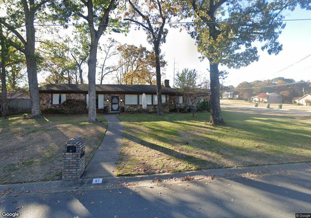
51 Greenview Ct Sherwood, AR 72120
Estimated Value: $274,000 - $288,350
--
Bed
2
Baths
2,202
Sq Ft
$127/Sq Ft
Est. Value
About This Home
This home is located at 51 Greenview Ct, Sherwood, AR 72120 and is currently estimated at $280,088, approximately $127 per square foot. 51 Greenview Ct is a home located in Pulaski County with nearby schools including Sherwood Elementary School, Sylvan Hills Middle School, and Sylvan Hills High School.
Ownership History
Date
Name
Owned For
Owner Type
Purchase Details
Closed on
Sep 20, 2024
Sold by
Miller Jimmie D and Miller Nellie O
Bought by
Dimatteo Maighdlin L
Current Estimated Value
Home Financials for this Owner
Home Financials are based on the most recent Mortgage that was taken out on this home.
Original Mortgage
$274,928
Outstanding Balance
$271,849
Interest Rate
6.49%
Mortgage Type
FHA
Estimated Equity
$8,239
Purchase Details
Closed on
May 22, 2013
Sold by
Iverson Gary
Bought by
Faithland Residential Property #17 Llc
Purchase Details
Closed on
Dec 3, 2001
Sold by
Custom George
Bought by
Mitchell Randall and Mitchell Demita
Create a Home Valuation Report for This Property
The Home Valuation Report is an in-depth analysis detailing your home's value as well as a comparison with similar homes in the area
Home Values in the Area
Average Home Value in this Area
Purchase History
| Date | Buyer | Sale Price | Title Company |
|---|---|---|---|
| Dimatteo Maighdlin L | $280,000 | None Listed On Document | |
| Faithland Residential Property #17 Llc | $23,000 | Pulaski County Title | |
| Mitchell Randall | $1,000 | Standard Abstract & Title Co |
Source: Public Records
Mortgage History
| Date | Status | Borrower | Loan Amount |
|---|---|---|---|
| Open | Dimatteo Maighdlin L | $274,928 |
Source: Public Records
Tax History Compared to Growth
Tax History
| Year | Tax Paid | Tax Assessment Tax Assessment Total Assessment is a certain percentage of the fair market value that is determined by local assessors to be the total taxable value of land and additions on the property. | Land | Improvement |
|---|---|---|---|---|
| 2025 | $2,368 | $45,453 | $6,600 | $38,853 |
| 2024 | $1,177 | $45,453 | $6,600 | $38,853 |
| 2023 | $1,177 | $45,453 | $6,600 | $38,853 |
| 2022 | $1,409 | $45,453 | $6,600 | $38,853 |
| 2021 | $1,327 | $31,380 | $6,000 | $25,380 |
| 2020 | $944 | $31,380 | $6,000 | $25,380 |
| 2019 | $944 | $31,380 | $6,000 | $25,380 |
| 2018 | $969 | $31,380 | $6,000 | $25,380 |
| 2017 | $955 | $31,380 | $6,000 | $25,380 |
| 2016 | $955 | $30,600 | $6,600 | $24,000 |
| 2015 | $1,147 | $22,583 | $6,600 | $15,983 |
| 2014 | $1,147 | $22,583 | $6,600 | $15,983 |
Source: Public Records
Map
Nearby Homes
- 701 Club Rd
- 4636 Brandywine Cove
- 11 Daniel Dr
- 7625 Highway 107
- 8320 Holiday Dr
- 1 Sherwood - Multi Package Properties Dr
- 401 Country Club Rd
- 307 Country Club Rd
- 135 W Lee Ave
- 201 Delmont Ave
- 8000 Pinto Trail
- +/- 8.16 Acres Windchime Ave
- 8602 Patricia Lynn Ln
- 1800 Palomino Dr
- 00 E Kiehl Ave
- 0 E Kiehl Ave Unit 24041678
- 1301 Stafford Rd
- 4690 Hollyridge Cove
- 1300 Stafford Rd
- 8109 Oak Ridge Rd
- 51 Greenview Cir
- 49 Greenview Cir
- 800 Club Rd
- 50 Greenview Cir
- 47 Greenview Cir
- 717 Club Rd
- 34 Club Cir
- 48 Greenview Cir
- 803 Club Rd
- 713 Club Rd
- 32 Club Cir
- 1 Greenview Cir
- 3 Greenview Cir
- 46 Greenview Cir
- 45 Greenview Cir
- 30 Club Cir
- 0 Greenview Cir
- 711 Club Rd
- 5 Greenview Cir
- 0 Club Rd Unit 16009110