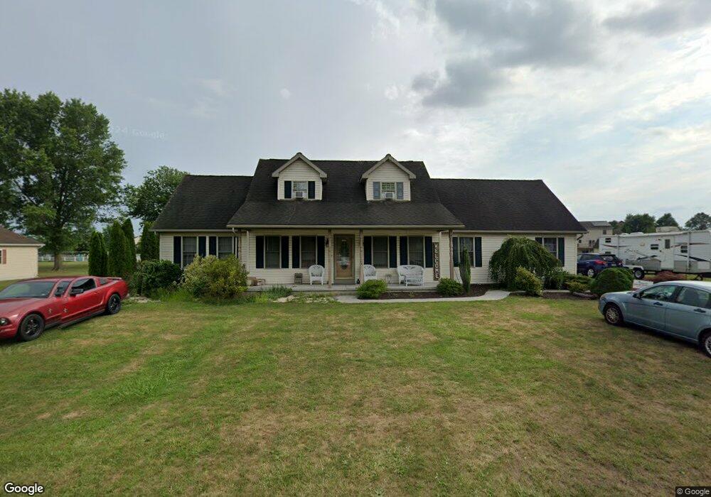
51 Groft Dr Unit 20 New Oxford, PA 17350
Estimated Value: $331,000 - $381,000
3
Beds
3
Baths
1,736
Sq Ft
$209/Sq Ft
Est. Value
About This Home
This home is located at 51 Groft Dr Unit 20, New Oxford, PA 17350 and is currently estimated at $363,201, approximately $209 per square foot. 51 Groft Dr Unit 20 is a home located in Adams County with nearby schools including New Oxford Senior High School, St. Teresa of Calcutta Catholic School - Conewago Campus, and Oxford Christian Academy.
Ownership History
Date
Name
Owned For
Owner Type
Purchase Details
Closed on
Nov 28, 2017
Sold by
Groft Diane
Bought by
Shafer Richard A and Shafer Jan M
Current Estimated Value
Home Financials for this Owner
Home Financials are based on the most recent Mortgage that was taken out on this home.
Original Mortgage
$220,924
Outstanding Balance
$184,438
Interest Rate
3.62%
Mortgage Type
FHA
Estimated Equity
$178,763
Purchase Details
Closed on
Apr 29, 2010
Sold by
Storms Thomas A and Storms Annette M
Bought by
Storms Annette M and Groft Diane
Home Financials for this Owner
Home Financials are based on the most recent Mortgage that was taken out on this home.
Original Mortgage
$234,839
Interest Rate
5.25%
Mortgage Type
FHA
Create a Home Valuation Report for This Property
The Home Valuation Report is an in-depth analysis detailing your home's value as well as a comparison with similar homes in the area
Home Values in the Area
Average Home Value in this Area
Purchase History
| Date | Buyer | Sale Price | Title Company |
|---|---|---|---|
| Shafer Richard A | $225,000 | None Available | |
| Storms Annette M | -- | -- |
Source: Public Records
Mortgage History
| Date | Status | Borrower | Loan Amount |
|---|---|---|---|
| Open | Shafer Richard A | $220,924 | |
| Previous Owner | Storms Annette M | $234,839 |
Source: Public Records
Tax History Compared to Growth
Tax History
| Year | Tax Paid | Tax Assessment Tax Assessment Total Assessment is a certain percentage of the fair market value that is determined by local assessors to be the total taxable value of land and additions on the property. | Land | Improvement |
|---|---|---|---|---|
| 2025 | $4,912 | $214,300 | $49,900 | $164,400 |
| 2024 | $4,520 | $214,300 | $49,900 | $164,400 |
| 2023 | $4,345 | $214,300 | $49,900 | $164,400 |
| 2022 | $4,205 | $214,300 | $49,900 | $164,400 |
| 2021 | $4,092 | $214,300 | $49,900 | $164,400 |
| 2020 | $3,991 | $214,300 | $49,900 | $164,400 |
| 2019 | $3,904 | $214,300 | $49,900 | $164,400 |
| 2018 | $3,800 | $213,300 | $49,900 | $163,400 |
| 2017 | $3,634 | $213,300 | $49,900 | $163,400 |
| 2016 | -- | $213,300 | $49,900 | $163,400 |
| 2015 | -- | $213,300 | $49,900 | $163,400 |
| 2014 | -- | $213,300 | $49,900 | $163,400 |
Source: Public Records
Map
Nearby Homes
- 212 Onyx Rd
- 157 Linda Dr
- 76 Kohler School Rd
- 97 Sherrill Dr
- 0 Irishtown Rd
- 297 S Water St Unit 1
- 64 Sherill Dr
- 120 Kohler Mill Rd
- 141 Oxford Blvd
- 201 S Water St
- 254 Mount Misery Rd
- 304 W High St
- 415 Lincoln Way W
- 1 Oxford Ct Unit 45
- 1820 York Rd
- 307 Lincoln Way W
- 77 E Locust Ln Unit 51
- 104 Lincoln Way W
- 25 Commerce St
- 225 Brick Ln
- 61 Groft Dr Unit 19
- 44 Groft Dr Unit 24
- 56 Groft Dr Unit 25
- 33 Groft Dr Unit 21
- 24 Groft Dr Unit 23
- 66 Groft Dr Unit 26
- 73 Groft Dr Unit 18
- 820 Poplar Rd Unit 57
- 836 Poplar Rd Unit 58
- 812 Poplar Rd Unit 56
- 80 Groft Dr Unit 27
- 764 Poplar Rd
- 85 Groft Dr Unit 17
- 850 Poplar Rd Unit 59
- 786 Poplar Rd Unit 55
- 730 Poplar Rd
- 90 Groft Dr Unit 28
- 872 Poplar Rd Unit 60
- 5 Reba Dr Unit 54
- 749 Poplar Rd Unit 2