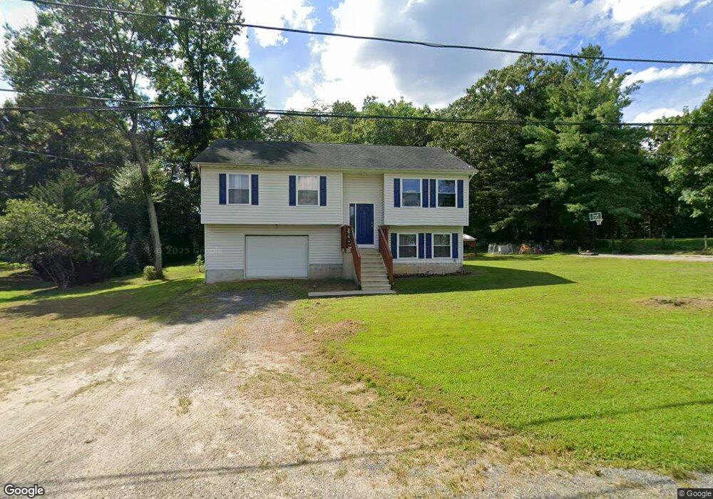
51 Hollis Cir Elkton, MD 21921
Estimated Value: $347,931 - $413,000
4
Beds
2
Baths
2,816
Sq Ft
$131/Sq Ft
Est. Value
About This Home
This home is located at 51 Hollis Cir, Elkton, MD 21921 and is currently estimated at $369,983, approximately $131 per square foot. 51 Hollis Cir is a home located in Cecil County with nearby schools including Elk Neck Elementary School, North East Middle School, and North East High School.
Ownership History
Date
Name
Owned For
Owner Type
Purchase Details
Closed on
Nov 8, 1993
Sold by
Ivey
Bought by
Long Gary R
Current Estimated Value
Home Financials for this Owner
Home Financials are based on the most recent Mortgage that was taken out on this home.
Original Mortgage
$120,600
Interest Rate
6.83%
Purchase Details
Closed on
Jul 28, 1982
Sold by
Atlantic Federal Savings & Loan As
Bought by
Ivey Michael D and Ivey Johnnie B
Home Financials for this Owner
Home Financials are based on the most recent Mortgage that was taken out on this home.
Original Mortgage
$46,400
Interest Rate
16.75%
Create a Home Valuation Report for This Property
The Home Valuation Report is an in-depth analysis detailing your home's value as well as a comparison with similar homes in the area
Home Values in the Area
Average Home Value in this Area
Purchase History
| Date | Buyer | Sale Price | Title Company |
|---|---|---|---|
| Long Gary R | $120,000 | -- | |
| Ivey Michael D | $58,000 | -- |
Source: Public Records
Mortgage History
| Date | Status | Borrower | Loan Amount |
|---|---|---|---|
| Closed | Long Gary R | $120,600 | |
| Previous Owner | Ivey Michael D | $46,400 |
Source: Public Records
Tax History Compared to Growth
Tax History
| Year | Tax Paid | Tax Assessment Tax Assessment Total Assessment is a certain percentage of the fair market value that is determined by local assessors to be the total taxable value of land and additions on the property. | Land | Improvement |
|---|---|---|---|---|
| 2025 | $3,064 | $278,633 | $0 | $0 |
| 2024 | $2,575 | $261,800 | $82,600 | $179,200 |
| 2023 | $2,226 | $259,500 | $0 | $0 |
| 2022 | $2,957 | $257,200 | $0 | $0 |
| 2021 | $2,898 | $254,900 | $82,600 | $172,300 |
| 2020 | $2,886 | $245,033 | $0 | $0 |
| 2019 | $2,772 | $235,167 | $0 | $0 |
| 2018 | $2,659 | $225,300 | $97,600 | $127,700 |
| 2017 | $2,659 | $225,300 | $0 | $0 |
| 2016 | $2,566 | $225,300 | $0 | $0 |
| 2015 | $2,566 | $227,300 | $0 | $0 |
| 2014 | $2,547 | $227,300 | $0 | $0 |
Source: Public Records
Map
Nearby Homes
- 10 King Richard Dr
- 1 Robin Hood Dr
- Lot#2, Lot#3, Lot#4 Old Elk Neck Rd
- 1132 Nottingham Rd
- 153 Nicholas Dr
- 2324 Oldfield Point Rd
- 2966 Old Elk Neck Rd
- 9.85 ac Water Front Oldfield Point Rd
- 4043A Blue Ball Rd
- 261 W Main St
- 29 River Mist Dr
- 134 Wesley St
- 0 Scotland Point Rd
- 5 Kings Ct
- 10 Saddler Ave
- 0 W Main St Unit MDCC2016174
- 2616 Old Elk Neck Rd
- 916 N Bridge St
- 12 Heather Ct
- 00 Singerly Rd
- 43 Hollis Cir
- 63 Hollis Cir
- 55 Hollis Cir
- 93 Hollis Cir
- 31 Hollis Cir
- 69 Hollis Cir
- 57 Hollis Cir
- LOT 1 Hollis Cir
- 108 Hollis Cir
- 59 Hollis Cir
- 92 Hollis Cir
- 11 Hollis Cir
- 8 Hollis Cir
- 111 Hollis Cir
- 79 Hollis Cir
- 1936 E Old Philadelphia Rd
- 1888 E Old Philadelphia Rd
- 130 Hollis Cir
- 1924 E Old Philadelphia Rd
- 1 Hollis Cir