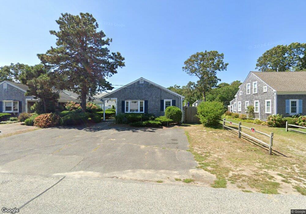
51 Inman Rd Unit 6 Dennis Port, MA 02639
Dennis Port NeighborhoodEstimated Value: $367,000 - $407,000
2
Beds
1
Bath
446
Sq Ft
$879/Sq Ft
Est. Value
About This Home
This home is located at 51 Inman Rd Unit 6, Dennis Port, MA 02639 and is currently estimated at $391,960, approximately $878 per square foot. 51 Inman Rd Unit 6 is a home located in Barnstable County with nearby schools including Dennis-Yarmouth Regional High School and St. Pius X. School.
Ownership History
Date
Name
Owned For
Owner Type
Purchase Details
Closed on
Oct 23, 2025
Sold by
Yurkovsky Gregory U
Bought by
Gregory Yurkovsky 2025 Ft and Yurkovsky
Current Estimated Value
Purchase Details
Closed on
Apr 2, 2012
Sold by
Yurkovsky Gregory U
Bought by
Chuprin Alexander and Chuprin Tamara
Purchase Details
Closed on
Jul 27, 2007
Sold by
Kopito Kathryn B and Kopito Michael
Bought by
Yurkovsky Gregory U
Purchase Details
Closed on
Apr 22, 2002
Sold by
Eiseman Elizabeth J and Eiseman Richard A
Bought by
Kopito Kathryn B and Kopito Michael
Home Financials for this Owner
Home Financials are based on the most recent Mortgage that was taken out on this home.
Original Mortgage
$90,000
Interest Rate
6.85%
Mortgage Type
Purchase Money Mortgage
Create a Home Valuation Report for This Property
The Home Valuation Report is an in-depth analysis detailing your home's value as well as a comparison with similar homes in the area
Home Values in the Area
Average Home Value in this Area
Purchase History
| Date | Buyer | Sale Price | Title Company |
|---|---|---|---|
| Gregory Yurkovsky 2025 Ft | -- | -- | |
| Chuprin Alexander | $62,500 | -- | |
| Chuprin Alexander | $62,500 | -- | |
| Chuprin Alexander | $62,500 | -- | |
| Yurkovsky Gregory U | $184,000 | -- | |
| Yurkovsky Gregory U | $184,000 | -- | |
| Kopito Kathryn B | $125,000 | -- | |
| Kopito Kathryn B | $125,000 | -- |
Source: Public Records
Mortgage History
| Date | Status | Borrower | Loan Amount |
|---|---|---|---|
| Previous Owner | Kopito Kathryn B | $90,000 |
Source: Public Records
Tax History Compared to Growth
Tax History
| Year | Tax Paid | Tax Assessment Tax Assessment Total Assessment is a certain percentage of the fair market value that is determined by local assessors to be the total taxable value of land and additions on the property. | Land | Improvement |
|---|---|---|---|---|
| 2025 | $1,672 | $386,200 | $0 | $386,200 |
| 2024 | $1,442 | $328,500 | $0 | $328,500 |
| 2023 | $1,272 | $272,300 | $0 | $272,300 |
| 2022 | $1,230 | $219,600 | $0 | $219,600 |
| 2021 | $1,193 | $197,900 | $0 | $197,900 |
| 2020 | $1,268 | $207,900 | $0 | $207,900 |
| 2019 | $1,249 | $202,500 | $0 | $202,500 |
| 2018 | $1,224 | $193,100 | $0 | $193,100 |
| 2017 | $1,188 | $193,100 | $0 | $193,100 |
| 2016 | $929 | $142,200 | $0 | $142,200 |
| 2015 | $607 | $94,800 | $0 | $94,800 |
| 2014 | $602 | $94,800 | $0 | $94,800 |
Source: Public Records
Map
Nearby Homes
- 11 Ocean Park W
- 1 E Belmont Unit 630
- 9 Chase Ave Unit 6
- 1 Belmont Rd Unit 630
- 1 Belmont Rd Unit 513
- 26 Manning Rd
- 402 Old Wharf Rd
- 402 Old Wharf Rd
- 405 Old Wharf Rd Unit B204
- 405 Old Wharf Rd Unit B204
- 159 Center St Unit 22
- 102 Sea St
- 12 Cross St
- 3 Fairbanks Dr
- 73 Division St
- 22 Ferncliff Rd
- 148 Belmont Rd
- 19 Riverway
- 19 Riverway
- 37-A Beach Hills Rd
- 51 Inman Rd Unit 5
- 51 Inman Rd Unit 4
- 51 Inman Rd
- 49 Inman Rd Unit 3
- 49 Inman Rd Unit 2
- 49 Inman Rd Unit 1
- 49 Inman Rd
- 55 Inman Rd
- 38 Birch Hill Rd
- 42 Birch Hill Rd
- 36 Birch Hill Rd
- 45 Inman Rd
- 54 Inman Rd
- 46 Inman Rd
- 65 Inman Rd Unit D
- 65 Inman Rd Unit F
- 65 Inman Rd Unit C
- 65 Inman Rd Unit Y
- 65 Inman Rd Unit E
- 65 Inman Rd