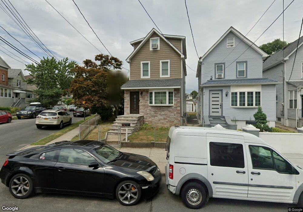
51 Laforge Ave Staten Island, NY 10302
Port Richmond NeighborhoodEstimated Value: $474,615 - $518,000
--
Bed
4
Baths
1,104
Sq Ft
$456/Sq Ft
Est. Value
About This Home
This home is located at 51 Laforge Ave, Staten Island, NY 10302 and is currently estimated at $503,154, approximately $455 per square foot. 51 Laforge Ave is a home located in Richmond County with nearby schools including P.S. 22 Graniteville, I.S. 51 Edwin Markham, and Port Richmond High School.
Ownership History
Date
Name
Owned For
Owner Type
Purchase Details
Closed on
Jul 19, 2022
Sold by
Macri Calogerina Frank J
Bought by
Vachris Victoria and Vachris Connor
Current Estimated Value
Purchase Details
Closed on
Apr 12, 2001
Sold by
Macri Anthony and Macri Madeline
Bought by
Macri Frank J and Macri Calogerina
Home Financials for this Owner
Home Financials are based on the most recent Mortgage that was taken out on this home.
Original Mortgage
$65,000
Interest Rate
6.88%
Mortgage Type
Seller Take Back
Create a Home Valuation Report for This Property
The Home Valuation Report is an in-depth analysis detailing your home's value as well as a comparison with similar homes in the area
Home Values in the Area
Average Home Value in this Area
Purchase History
| Date | Buyer | Sale Price | Title Company |
|---|---|---|---|
| Vachris Victoria | $420,000 | None Listed On Document | |
| Macri Frank J | -- | -- |
Source: Public Records
Mortgage History
| Date | Status | Borrower | Loan Amount |
|---|---|---|---|
| Previous Owner | Macri Frank J | $65,000 |
Source: Public Records
Tax History Compared to Growth
Tax History
| Year | Tax Paid | Tax Assessment Tax Assessment Total Assessment is a certain percentage of the fair market value that is determined by local assessors to be the total taxable value of land and additions on the property. | Land | Improvement |
|---|---|---|---|---|
| 2025 | $4,375 | $29,640 | $6,442 | $23,198 |
| 2024 | $4,375 | $25,980 | $7,294 | $18,686 |
| 2023 | $4,173 | $20,548 | $6,802 | $13,746 |
| 2022 | $3,870 | $23,820 | $8,700 | $15,120 |
| 2021 | $3,849 | $24,960 | $8,700 | $16,260 |
| 2020 | $3,871 | $22,800 | $8,700 | $14,100 |
| 2019 | $3,797 | $23,280 | $8,700 | $14,580 |
| 2018 | $3,491 | $17,123 | $7,808 | $9,315 |
| 2017 | $3,293 | $16,154 | $8,456 | $7,698 |
| 2016 | $3,047 | $15,240 | $8,700 | $6,540 |
| 2015 | $3,161 | $16,800 | $7,260 | $9,540 |
| 2014 | $3,161 | $16,472 | $7,118 | $9,354 |
Source: Public Records
Map
Nearby Homes
- 38 Laforge Ave
- 28 Hooker Place
- 13 Laforge Ave
- 11 Laforge Ave
- 145 Clinton Place
- 469 Port Richmond Ave
- 152 Port Richmond Ave
- 98 Saint Josephs Ave
- 47 Montell St
- 28 Clinton Place
- 209 Nicholas Ave
- 231 Charles Ave
- 211 Morningstar Rd
- 162 John St
- 471 Heberton Ave
- 145 Morningside Ave Unit 2C
- 646 Port Richmond Ave
- 646-662 Port Richmond Ave
- 306 Morningstar Rd
- 322 Morningstar Rd
- 49 Laforge Ave
- 3 Laforge Place
- 47 Laforge Ave
- 41 Laforge Ave
- 43 Laforge Ave
- 12 Laforge Place
- 8 Laforge Place
- 14 Laforge Place
- 20 Laforge Place
- 10 Laforge Place
- 6 Laforge Place
- 39 Laforge Ave
- 30 Laforge Place
- 46-48 Laforge Ave
- 37 Laforge Ave
- 32 Laforge Place
- 112 Burden Ave
- 42 Laforge Ave Unit A
- 42 Laforge Ave
- 40 Laforge Ave