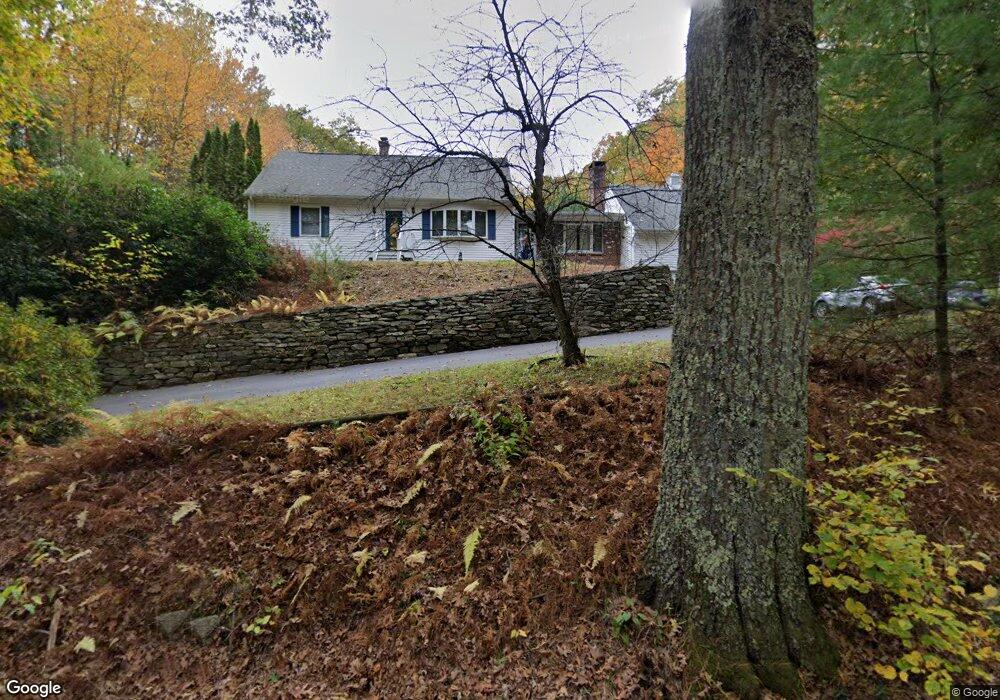
51 Larned Rd Oxford, MA 01540
Estimated Value: $526,000 - $622,000
5
Beds
3
Baths
2,431
Sq Ft
$234/Sq Ft
Est. Value
About This Home
This home is located at 51 Larned Rd, Oxford, MA 01540 and is currently estimated at $568,833, approximately $233 per square foot. 51 Larned Rd is a home located in Worcester County with nearby schools including Alfred M Chaffee, Oxford High School, and Clara Barton Elementary School.
Ownership History
Date
Name
Owned For
Owner Type
Purchase Details
Closed on
Mar 15, 2001
Sold by
Constantine Stephen P and Rodrigues Adelia
Bought by
Kelley Neil T and Kelley Julie A
Current Estimated Value
Purchase Details
Closed on
Jun 30, 1998
Sold by
Johnson Christopher V and Johnson Loretta C
Bought by
Constantine Stephen P and Rodriguez Adelia
Create a Home Valuation Report for This Property
The Home Valuation Report is an in-depth analysis detailing your home's value as well as a comparison with similar homes in the area
Home Values in the Area
Average Home Value in this Area
Purchase History
| Date | Buyer | Sale Price | Title Company |
|---|---|---|---|
| Kelley Neil T | $217,400 | -- | |
| Constantine Stephen P | $166,500 | -- |
Source: Public Records
Mortgage History
| Date | Status | Borrower | Loan Amount |
|---|---|---|---|
| Open | Constantine Stephen P | $36,900 | |
| Open | Constantine Stephen P | $202,000 | |
| Closed | Constantine Stephen P | $36,900 |
Source: Public Records
Tax History Compared to Growth
Tax History
| Year | Tax Paid | Tax Assessment Tax Assessment Total Assessment is a certain percentage of the fair market value that is determined by local assessors to be the total taxable value of land and additions on the property. | Land | Improvement |
|---|---|---|---|---|
| 2025 | $60 | $472,200 | $108,100 | $364,100 |
| 2024 | $6,198 | $459,800 | $100,500 | $359,300 |
| 2023 | $5,744 | $421,100 | $89,700 | $331,400 |
| 2022 | $5,656 | $350,000 | $69,600 | $280,400 |
| 2021 | $5,414 | $327,500 | $66,000 | $261,500 |
| 2020 | $5,166 | $310,100 | $66,000 | $244,100 |
| 2019 | $4,457 | $261,700 | $65,800 | $195,900 |
| 2018 | $4,520 | $261,700 | $65,800 | $195,900 |
| 2017 | $4,533 | $269,000 | $65,800 | $203,200 |
| 2016 | $4,591 | $271,200 | $65,800 | $205,400 |
| 2015 | $4,282 | $271,200 | $65,800 | $205,400 |
| 2014 | $4,215 | $281,000 | $65,800 | $215,200 |
Source: Public Records
Map
Nearby Homes
- 62 Larned Rd
- 28 Holly St
- 13 Maid Marion St
- 8 Bacon St
- 4 Corey Dr
- 137 Main St
- 138 Main St
- 18 Mckinstry Dr
- 3 Willow St
- 7 Dudley Rd
- 20 Drury Ln
- 72 Charlton St
- 124 Charlton St Unit F
- 4 Toria Heights Rd
- 9 Howarth Rd
- Lots 1+16 Pierpont Rd
- L0T 3 History Dr
- 2 Potter Village Rd
- 4 History Dr
- L0T 11 History Dr