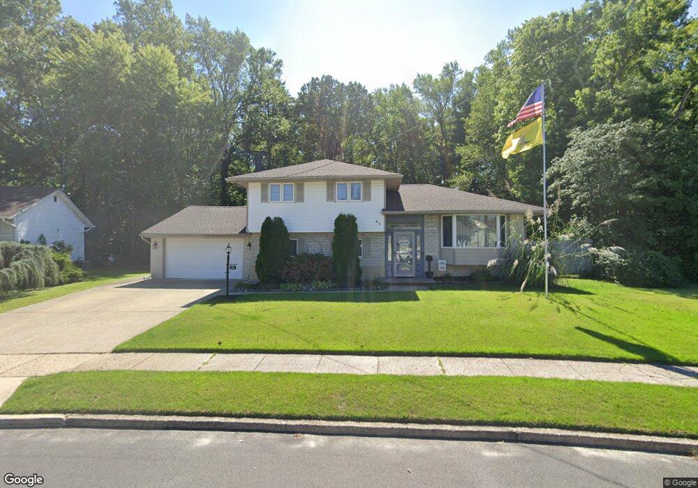
51 Lillian Place Glendora, NJ 08029
Estimated Value: $336,521 - $409,000
--
Bed
--
Bath
1,919
Sq Ft
$198/Sq Ft
Est. Value
About This Home
This home is located at 51 Lillian Place, Glendora, NJ 08029 and is currently estimated at $379,630, approximately $197 per square foot. 51 Lillian Place is a home located in Camden County with nearby schools including Glen Landing Middle School, Triton High School, and St. Teresa Regional School.
Ownership History
Date
Name
Owned For
Owner Type
Purchase Details
Closed on
May 25, 1999
Sold by
Harrison James M
Bought by
Gallagher Timothy W and Gallagher Cheryl
Current Estimated Value
Home Financials for this Owner
Home Financials are based on the most recent Mortgage that was taken out on this home.
Original Mortgage
$131,186
Outstanding Balance
$33,363
Interest Rate
6.85%
Mortgage Type
FHA
Estimated Equity
$346,267
Create a Home Valuation Report for This Property
The Home Valuation Report is an in-depth analysis detailing your home's value as well as a comparison with similar homes in the area
Home Values in the Area
Average Home Value in this Area
Purchase History
| Date | Buyer | Sale Price | Title Company |
|---|---|---|---|
| Gallagher Timothy W | $132,000 | -- |
Source: Public Records
Mortgage History
| Date | Status | Borrower | Loan Amount |
|---|---|---|---|
| Open | Gallagher Timothy W | $131,186 |
Source: Public Records
Tax History Compared to Growth
Tax History
| Year | Tax Paid | Tax Assessment Tax Assessment Total Assessment is a certain percentage of the fair market value that is determined by local assessors to be the total taxable value of land and additions on the property. | Land | Improvement |
|---|---|---|---|---|
| 2025 | $9,525 | $225,400 | $62,300 | $163,100 |
| 2024 | $9,208 | $225,400 | $62,300 | $163,100 |
| 2023 | $9,208 | $225,400 | $62,300 | $163,100 |
| 2022 | $9,158 | $225,400 | $62,300 | $163,100 |
| 2021 | $8,966 | $225,400 | $62,300 | $163,100 |
| 2020 | $8,973 | $225,400 | $62,300 | $163,100 |
| 2019 | $8,775 | $225,400 | $62,300 | $163,100 |
| 2018 | $8,737 | $225,400 | $62,300 | $163,100 |
| 2017 | $10,179 | $225,400 | $62,300 | $163,100 |
| 2016 | $8,268 | $225,400 | $62,300 | $163,100 |
| 2015 | $7,675 | $225,400 | $62,300 | $163,100 |
| 2014 | $7,630 | $225,400 | $62,300 | $163,100 |
Source: Public Records
Map
Nearby Homes
- 2400 Hartford Dr
- 27 Lillian Place
- 711 George Ln
- 13 Albert Rd
- 200 E 9th Ave
- 32 Reagan Rd
- 30 Reagan Rd
- 24 Reagan Rd
- 26 Reagan Rd
- DELMAR Plan at Ashbrook Landing
- 22 Reagan Rd
- 28 Reagan Rd
- 300 3rd Ave
- 217 3rd Ave
- 410 Sheffield Ct
- 810 Central Ave
- 230 E Evesham Rd Unit B-1
- 1100 Central Ave
- 327 E Evesham Rd
- 30 12th Ave
- 53 Lillian Place
- 49 Lillian Place
- 696 Thorny Ln
- 50 Lillian Place
- 55 Lillian Place
- 49 Stephen Dr
- 48 Lillian Place
- 694 Thorny Ln
- 54 Stephen Dr
- 47 Stephen Dr
- 47 Lillian Place
- 46 Lillian Place
- 45 Stephen Dr
- 692 Thorny Ln
- 52 Stephen Dr
- 695 Thorny Ln
- 45 Lillian Place
- 43 Stephen Dr
- 512 Thorny Ln
- 50 Stephen Dr