
Seller's Agent in 2025
Judy Korzenowski
Coldwell Banker Realty - Newton
(617) 969-2121
2 in this area
80 Total Sales
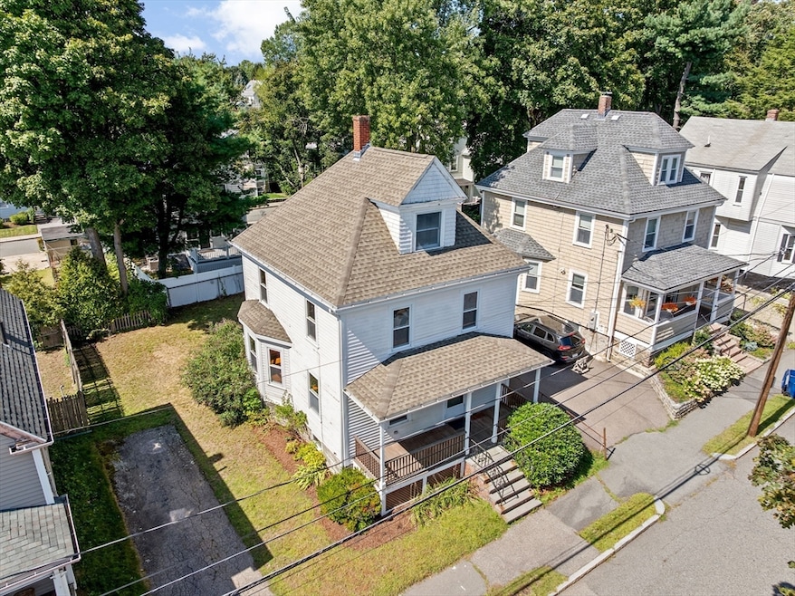
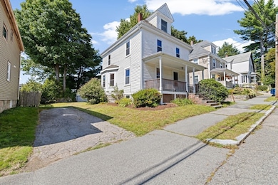
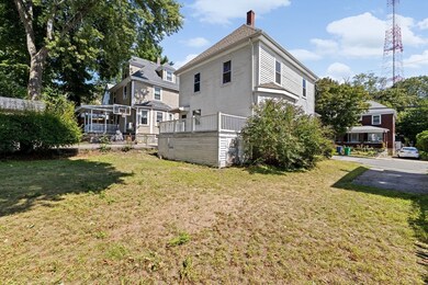
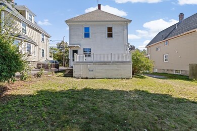
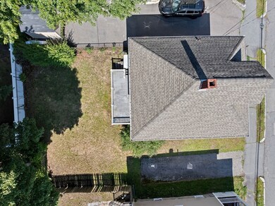
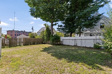
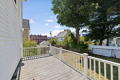
Nestled on a smaller level lot, this historic, 1880s SF home offers a unique opportunity for restoration enthusiasts. Boasting 3 BRs & 1 bath, the property features classic architectural details including original moldings, HW floors & stained glass windows that hint at the charm that once filled the walls. The 1st floor has a living room, charming dining room w/built in cabinet & a good size kitchen that has modern appliances. It currently leads to a back deck & nice yard. The 3rd floor has the potential to become a 4th BR or home office. Although unfinished, the basement is home to the laundry and walks out to the back yard. Located in a desirable neighborhood, this diamond in the rough is perfect for those looking to invest in a project w/historical significance. Off street parking for at least 2 cars, 51 Linden St is a blank canvas ripe for its next transformation!
Last Agent to Sell the Property
Coldwell Banker Realty - Newton Listed on: 09/10/2025
| Date | Type | Sale Price | Title Company |
|---|---|---|---|
| Deed | $860,000 | -- | |
| Deed | -- | -- | |
| Deed | -- | -- |
| Date | Status | Loan Amount | Loan Type |
|---|---|---|---|
| Previous Owner | $25,000 | No Value Available | |
| Previous Owner | $25,000 | No Value Available |
| Date | Event | Price | List to Sale | Price per Sq Ft |
|---|---|---|---|---|
| 09/30/2025 09/30/25 | Sold | $860,000 | +23.0% | $682 / Sq Ft |
| 09/17/2025 09/17/25 | Pending | -- | -- | -- |
| 09/10/2025 09/10/25 | For Sale | $699,000 | -- | $554 / Sq Ft |
| Year | Tax Paid | Tax Assessment Tax Assessment Total Assessment is a certain percentage of the fair market value that is determined by local assessors to be the total taxable value of land and additions on the property. | Land | Improvement |
|---|---|---|---|---|
| 2025 | $6,592 | $672,700 | $0 | $0 |
| 2024 | $6,374 | $0 | $0 | $0 |
| 2023 | $6,001 | $589,500 | $548,600 | $40,900 |
| 2022 | $5,742 | $545,800 | $508,000 | $37,800 |
| 2021 | $5,540 | $514,900 | $479,200 | $35,700 |
| 2020 | $5,376 | $514,900 | $479,200 | $35,700 |
| 2019 | $5,224 | $499,900 | $465,200 | $34,700 |
| 2018 | $3,187 | $454,000 | $419,100 | $34,900 |
| 2017 | $4,763 | $428,300 | $395,400 | $32,900 |
| 2016 | $4,555 | $400,300 | $369,500 | $30,800 |
| 2015 | $4,343 | $374,100 | $345,300 | $28,800 |
Seller's Agent in 2025
Judy Korzenowski
Coldwell Banker Realty - Newton
(617) 969-2121
2 in this area
80 Total Sales
Buyer's Agent in 2025
Jean Tse
Keller Williams Boston MetroWest
(617) 633-3034
1 in this area
85 Total Sales
Source: MLS Property Information Network (MLS PIN)
MLS Number: 73429138
APN: NEWT-000051-000036-000005
Disclaimer: Certain information contained herein is derived from information provided by parties other than Homes.com. All information provided is deemed reliable, but is not guaranteed to be accurate and should be independently verified.
![]() The property listing data and information, or the Images, set forth herein were provided to MLS Property Information Network, Inc. from third party sources, including sellers, lessors and public records, and were compiled by MLS Property Information Network, Inc. The property listing data and information, and the Images, are for the personal, non-commercial use of consumers having a good faith interest in purchasing or leasing listed properties of the type displayed to them and may not be used for any purpose other than to identify prospective properties which such consumers may have a good faith interest in purchasing or leasing. MLS Property Information Network, Inc. and its subscribers disclaim any and all representations and warranties as to the accuracy of the property listing data and information, or as to the accuracy of any of the Images, set forth herein.
The property listing data and information, or the Images, set forth herein were provided to MLS Property Information Network, Inc. from third party sources, including sellers, lessors and public records, and were compiled by MLS Property Information Network, Inc. The property listing data and information, and the Images, are for the personal, non-commercial use of consumers having a good faith interest in purchasing or leasing listed properties of the type displayed to them and may not be used for any purpose other than to identify prospective properties which such consumers may have a good faith interest in purchasing or leasing. MLS Property Information Network, Inc. and its subscribers disclaim any and all representations and warranties as to the accuracy of the property listing data and information, or as to the accuracy of any of the Images, set forth herein.