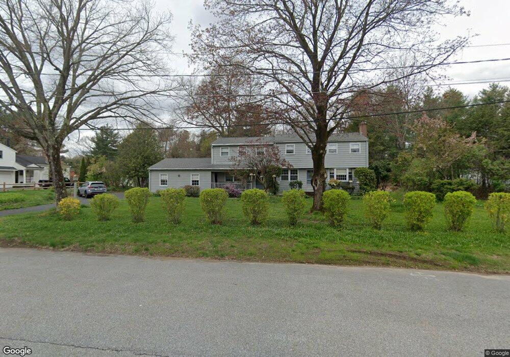
51 Longfellow Rd Concord, MA 01742
Estimated Value: $1,213,000 - $1,375,971
4
Beds
3
Baths
2,443
Sq Ft
$521/Sq Ft
Est. Value
About This Home
This home is located at 51 Longfellow Rd, Concord, MA 01742 and is currently estimated at $1,273,743, approximately $521 per square foot. 51 Longfellow Rd is a home located in Middlesex County with nearby schools including Willard School, Concord Middle School, and Corwin-Russell School at Broccoli Hall.
Ownership History
Date
Name
Owned For
Owner Type
Purchase Details
Closed on
Jun 5, 2003
Sold by
Schwartz Maureen J and Schwartz Norbert V
Bought by
Schwartz Rt
Current Estimated Value
Home Financials for this Owner
Home Financials are based on the most recent Mortgage that was taken out on this home.
Original Mortgage
$60,000
Interest Rate
5.83%
Purchase Details
Closed on
Sep 1, 1977
Bought by
Schwartz Norbert and Schwartz Maureen J
Create a Home Valuation Report for This Property
The Home Valuation Report is an in-depth analysis detailing your home's value as well as a comparison with similar homes in the area
Home Values in the Area
Average Home Value in this Area
Purchase History
| Date | Buyer | Sale Price | Title Company |
|---|---|---|---|
| Schwartz Rt | -- | -- | |
| Schwartz Norbert | $68,000 | -- |
Source: Public Records
Mortgage History
| Date | Status | Borrower | Loan Amount |
|---|---|---|---|
| Open | Schwartz Norbert | $85,000 | |
| Closed | Schwartz Rt | $60,000 |
Source: Public Records
Tax History Compared to Growth
Tax History
| Year | Tax Paid | Tax Assessment Tax Assessment Total Assessment is a certain percentage of the fair market value that is determined by local assessors to be the total taxable value of land and additions on the property. | Land | Improvement |
|---|---|---|---|---|
| 2025 | $154 | $1,164,300 | $613,400 | $550,900 |
| 2024 | $15,287 | $1,164,300 | $613,400 | $550,900 |
| 2023 | $14,373 | $1,109,000 | $584,200 | $524,800 |
| 2022 | $13,370 | $905,800 | $467,300 | $438,500 |
| 2021 | $13,210 | $897,400 | $467,300 | $430,100 |
| 2020 | $12,801 | $899,600 | $467,300 | $432,300 |
| 2019 | $12,113 | $853,600 | $453,800 | $399,800 |
| 2018 | $11,529 | $806,800 | $412,500 | $394,300 |
| 2017 | $11,471 | $815,300 | $421,000 | $394,300 |
| 2016 | $11,292 | $811,200 | $421,000 | $390,200 |
| 2015 | $10,306 | $721,200 | $363,800 | $357,400 |
Source: Public Records
Map
Nearby Homes
- 40 Rookery Ln Unit 5
- 72 Rookery Ln Unit 3
- 121 White Pond Way Unit 121
- 24 Rookery Ln Unit 6
- 56 Rookery Ln Unit 4
- 401 Emery Ln Unit 104
- 37 Wolf Pine Way
- 497 Old Road to 9 Acre Corner
- 42 Dakin Rd
- 114 Upland Rd
- 16 Blacksmith Dr
- 12 S Meadow Ridge Unit 12
- 12 S Meadow Ridge
- 111 Central St
- 70 McCallar Ln
- 369 Border Rd
- 102 Highland St
- 1053 Main St
- 24 Concord Greene Unit 7
- 1687 Main St
- 35 Longfellow Rd
- 154 Paul Revere Rd
- 38 Longfellow Rd
- 140 Paul Revere Rd
- 30 Jennie Dugan Rd
- 366 Powder Mill Rd
- 10 Longfellow Rd
- 125 Paul Revere Rd
- 384 Powder Mill Rd
- 22 Jennie Dugan Rd
- 400 Powder Mill Rd
- 400 Powder Mill Rd
- 414 Powder Mill Rd
- 116 Paul Revere Rd
- Lot 3A (C) Powder Mill Rd
- Lot 2 (B) Powder Mill Rd
- Lot C Powder Mill Rd
- Lot B Powder Mill Rd
- 346 Powder Mill Rd
- 385 Powder Mill Rd