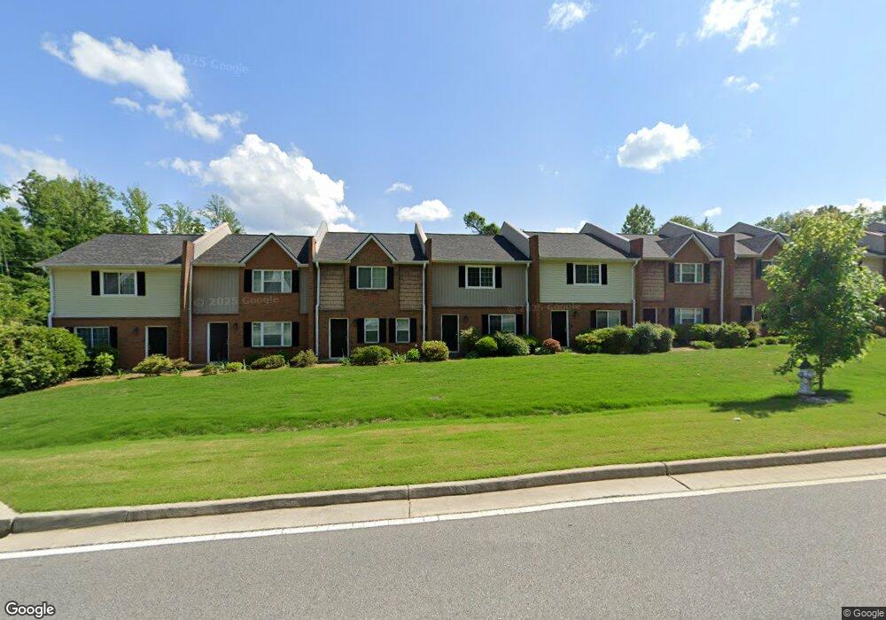
51 Mcintosh Pkwy Newnan, GA 30263
Estimated Value: $173,920 - $234,000
3
Beds
3
Baths
1,320
Sq Ft
$151/Sq Ft
Est. Value
About This Home
This home is located at 51 Mcintosh Pkwy, Newnan, GA 30263 and is currently estimated at $199,480, approximately $151 per square foot. 51 Mcintosh Pkwy is a home located in Coweta County with nearby schools including White Oak Elementary School, Arnall Middle School, and East Coweta High School.
Ownership History
Date
Name
Owned For
Owner Type
Purchase Details
Closed on
May 21, 2010
Sold by
Phillips Kenneth M
Bought by
Capital Value Dynamics Llc
Current Estimated Value
Purchase Details
Closed on
Nov 5, 2009
Sold by
Wachovia Mtg
Bought by
Phillips Kenneth M
Purchase Details
Closed on
Sep 2, 2008
Sold by
Malone Rudolph V and Malone Joanne Y
Bought by
Wachovia Mortgage Corp
Purchase Details
Closed on
Feb 18, 2005
Sold by
Ass Prbblebrook Lane
Bought by
Washington Crossing Llc
Purchase Details
Closed on
Oct 29, 1998
Bought by
Ass Pebblebrook Lane
Purchase Details
Closed on
Jan 1, 1992
Bought by
Pebblebrook Lane Ass
Purchase Details
Closed on
Jan 4, 1990
Bought by
Jackson Carey
Purchase Details
Closed on
Oct 3, 1988
Bought by
Ford Richard P and Ford Car
Create a Home Valuation Report for This Property
The Home Valuation Report is an in-depth analysis detailing your home's value as well as a comparison with similar homes in the area
Home Values in the Area
Average Home Value in this Area
Purchase History
| Date | Buyer | Sale Price | Title Company |
|---|---|---|---|
| Capital Value Dynamics Llc | $31,800 | -- | |
| Phillips Kenneth M | $27,800 | -- | |
| Wachovia Mortgage Corp | $84,550 | -- | |
| Wachovia Mortgage Corporation | $84,600 | -- | |
| Washington Crossing Llc | -- | -- | |
| Ass Pebblebrook Lane | -- | -- | |
| Pebblebrook Lane Ass | -- | -- | |
| Jackson Carey | $45,000 | -- | |
| Ford Richard P | -- | -- |
Source: Public Records
Tax History Compared to Growth
Tax History
| Year | Tax Paid | Tax Assessment Tax Assessment Total Assessment is a certain percentage of the fair market value that is determined by local assessors to be the total taxable value of land and additions on the property. | Land | Improvement |
|---|---|---|---|---|
| 2024 | $887 | $38,816 | $3,000 | $35,816 |
| 2023 | $887 | $33,300 | $3,000 | $30,300 |
| 2022 | $738 | $30,344 | $3,000 | $27,344 |
| 2021 | $816 | $30,344 | $3,000 | $27,344 |
| 2020 | $841 | $36,008 | $3,000 | $33,008 |
| 2019 | $371 | $12,337 | $2,250 | $10,087 |
| 2018 | $373 | $12,337 | $2,250 | $10,087 |
| 2017 | $371 | $12,337 | $2,250 | $10,087 |
| 2016 | $371 | $12,337 | $2,250 | $10,087 |
| 2015 | $372 | $12,337 | $2,250 | $10,087 |
| 2014 | $381 | $12,337 | $2,250 | $10,087 |
Source: Public Records
Map
Nearby Homes
- 30 Pinson St
- 81 Chastain Cir
- 123 Chastain Cir
- 36 Mitchell St
- 0 Davis St Unit 10606043
- 34 Umber Ln Unit LOT 13
- 10 Umber Ln Unit LOT 3
- 12 Burch Ave
- 10 Burch Ave
- 75 Pinson St
- 34 Russet Way Unit LOT 57
- 28 Russet Way Unit LOT 60
- 23 Dewey St
- 145 Greison Trail
- 40 Wilcoxon St
- 139 Greison Trail
- 20 Salbide Ave
- 21 Umber Ln Unit LOT 24
- 22 Umber Ln Unit LOT 8
- 23 Umber Ln Unit LOT 23
- 53 Mcintosh Pkwy
- 49 Mcintosh Pkwy
- 55 Mcintosh Pkwy
- 47 Mcintosh Pkwy
- 45 Mcintosh Pkwy
- 57 Mcintosh Pkwy
- 43 Mcintosh Pkwy
- 41 Mcintosh Pkwy
- 39 Mcintosh Pkwy
- 37 Mcintosh Pkwy
- 35 Mcintosh Pkwy
- 44 Mcintosh Pkwy
- 42 Mcintosh Pkwy
- 40 Mcintosh Pkwy
- 38 Mcintosh Pkwy
- 36 Mcintosh Pkwy
- 8 E Broad Ln
- 34 Mcintosh Pkwy
- 6 E Broad Ln
- 4 E Broad Ln