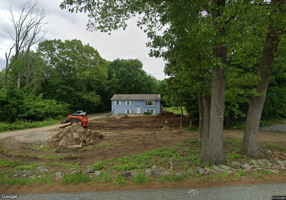
51 Miller Rd Preston, CT 06365
Estimated Value: $341,000 - $449,000
2
Beds
1
Bath
1,056
Sq Ft
$377/Sq Ft
Est. Value
About This Home
This home is located at 51 Miller Rd, Preston, CT 06365 and is currently estimated at $397,973, approximately $376 per square foot. 51 Miller Rd is a home located in New London County with nearby schools including St. Joseph School and St. Patrick Cathedral School.
Ownership History
Date
Name
Owned For
Owner Type
Purchase Details
Closed on
Feb 10, 2025
Sold by
Nylen Susan P
Bought by
Riegel Anthony T and Riegel Linda D
Current Estimated Value
Home Financials for this Owner
Home Financials are based on the most recent Mortgage that was taken out on this home.
Original Mortgage
$260,000
Outstanding Balance
$258,461
Interest Rate
6.93%
Mortgage Type
Stand Alone Refi Refinance Of Original Loan
Estimated Equity
$139,512
Purchase Details
Closed on
Mar 20, 1984
Bought by
Nylen Michael K and Nylen Susan P
Create a Home Valuation Report for This Property
The Home Valuation Report is an in-depth analysis detailing your home's value as well as a comparison with similar homes in the area
Home Values in the Area
Average Home Value in this Area
Purchase History
| Date | Buyer | Sale Price | Title Company |
|---|---|---|---|
| Riegel Anthony T | -- | None Available | |
| Riegel Anthony T | -- | None Available | |
| Nylen Michael K | $71,500 | -- |
Source: Public Records
Mortgage History
| Date | Status | Borrower | Loan Amount |
|---|---|---|---|
| Open | Riegel Anthony T | $260,000 | |
| Closed | Riegel Anthony T | $260,000 | |
| Previous Owner | Nylen Michael K | $79,800 | |
| Previous Owner | Nylen Michael K | $30,000 | |
| Previous Owner | Nylen Michael K | $140,000 |
Source: Public Records
Tax History Compared to Growth
Tax History
| Year | Tax Paid | Tax Assessment Tax Assessment Total Assessment is a certain percentage of the fair market value that is determined by local assessors to be the total taxable value of land and additions on the property. | Land | Improvement |
|---|---|---|---|---|
| 2024 | $4,983 | $213,220 | $94,220 | $119,000 |
| 2023 | $4,893 | $213,220 | $94,220 | $119,000 |
| 2022 | $4,500 | $161,400 | $90,800 | $70,600 |
| 2021 | $4,348 | $161,400 | $90,800 | $70,600 |
| 2020 | $4,342 | $161,400 | $90,800 | $70,600 |
| 2019 | $4,266 | $161,400 | $90,800 | $70,600 |
| 2018 | $4,201 | $161,400 | $90,800 | $70,600 |
| 2017 | $3,703 | $154,300 | $90,800 | $63,500 |
| 2016 | $3,665 | $154,300 | $90,800 | $63,500 |
| 2015 | $3,549 | $154,300 | $90,800 | $63,500 |
| 2014 | $3,571 | $154,300 | $90,800 | $63,500 |
Source: Public Records
Map
Nearby Homes
- 59 Long Society Rd
- 63 Route 165
- 4 Wilderness Acres
- 17 Daniel St
- 6 Stanton Ln
- 168 Corning Rd
- 79 Roosevelt Ave
- 296 Hamilton Ave Unit 7
- 296 Hamilton Ave Unit 30
- 105 Stonington Rd
- 67 Corning Rd Unit 3
- 67 Corning Rd Unit 22
- 39 Doolittle Rd
- 625 N Main St Unit 627
- 313 Central Ave
- 287 Central Ave
- 146 Route 2
- 197 Central Ave
- 21 Stonington Rd
- 188 Central Ave