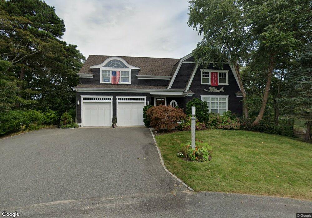
51 Oyster Shell Ln East Falmouth, MA 2536
Estimated Value: $1,745,000 - $2,914,000
4
Beds
4
Baths
3,652
Sq Ft
$608/Sq Ft
Est. Value
About This Home
This home is located at 51 Oyster Shell Ln, East Falmouth, MA 2536 and is currently estimated at $2,219,238, approximately $607 per square foot. 51 Oyster Shell Ln is a home located in Barnstable County with nearby schools including East Falmouth Elementary School, Morse Pond School, and Lawrence School.
Ownership History
Date
Name
Owned For
Owner Type
Purchase Details
Closed on
Mar 21, 2008
Sold by
Bournes Pond Rt and Sanidas
Bought by
Augusta Julene M
Current Estimated Value
Home Financials for this Owner
Home Financials are based on the most recent Mortgage that was taken out on this home.
Original Mortgage
$350,000
Outstanding Balance
$218,162
Interest Rate
5.75%
Mortgage Type
Purchase Money Mortgage
Estimated Equity
$2,001,076
Create a Home Valuation Report for This Property
The Home Valuation Report is an in-depth analysis detailing your home's value as well as a comparison with similar homes in the area
Home Values in the Area
Average Home Value in this Area
Purchase History
| Date | Buyer | Sale Price | Title Company |
|---|---|---|---|
| Augusta Julene M | $400,000 | -- |
Source: Public Records
Mortgage History
| Date | Status | Borrower | Loan Amount |
|---|---|---|---|
| Open | Augusta Julene M | $350,000 |
Source: Public Records
Tax History Compared to Growth
Tax History
| Year | Tax Paid | Tax Assessment Tax Assessment Total Assessment is a certain percentage of the fair market value that is determined by local assessors to be the total taxable value of land and additions on the property. | Land | Improvement |
|---|---|---|---|---|
| 2025 | $11,950 | $2,035,800 | $764,600 | $1,271,200 |
| 2024 | $10,208 | $1,625,400 | $664,900 | $960,500 |
| 2023 | $10,092 | $1,458,400 | $631,700 | $826,700 |
| 2022 | $9,979 | $1,239,600 | $563,200 | $676,400 |
| 2021 | $9,812 | $1,154,400 | $563,200 | $591,200 |
| 2020 | $9,476 | $1,103,200 | $512,000 | $591,200 |
| 2019 | $9,299 | $1,086,300 | $512,000 | $574,300 |
| 2018 | $9,196 | $1,069,300 | $512,000 | $557,300 |
| 2017 | $8,913 | $1,044,900 | $512,000 | $532,900 |
| 2016 | $8,746 | $1,044,900 | $512,000 | $532,900 |
| 2015 | $8,558 | $1,044,900 | $512,000 | $532,900 |
| 2014 | $8,086 | $992,100 | $512,000 | $480,100 |
Source: Public Records
Map
Nearby Homes
- 472 & 474 Davisville Rd
- 473 Davisville Rd
- LOTA Commodore Ln
- 37 Seashell Ln
- 23 N Bournes Pond Rd
- 23 N Bournes Pond Rd
- 16A Pacheco Path
- 16 Pacheco Path Unit 1-A100-B
- 16 Pacheco Path
- 241 Davisville Rd
- 53 Eel River Rd
- 84 Portside Cir
- 21 Kilmer Rd
- 15 Beach St
- 58 Striper Ln
- Lot 2 Pine Grove Ave
- 26 Sanddollar Cir
- 0 Tobey Ln
- 381 Seacoast Shores Blvd
- 224 Menauhant Rd
- 45 Oyster Shell Ln
- 52 Oyster Shell Ln
- 52 Oyster Shell Ln
- 44 Oyster Shell Ln
- 430 Davisville Rd Unit 4
- 430 Davisville Rd Unit 3
- 430 Davisville Rd Unit 2
- 430 Davisville Rd Unit 1
- 430 Davisville Rd
- 37 Oyster Shell Ln
- 33 Oyster Shell Ln
- 49 Captain Davis Ln
- 61 Moonpenny Ln
- 59 Moonpenny Ln
- 45 Captain Davis Ln
- 65 Moonpenny Ln
- 67 Moonpenny Ln
- 50 Captain Davis Ln
- 32 Oyster Shell Ln
- 37 Captain Davis Ln