Estimated Value: $274,000 - $287,000
Studio
2
Baths
1,940
Sq Ft
$146/Sq Ft
Est. Value
About This Home
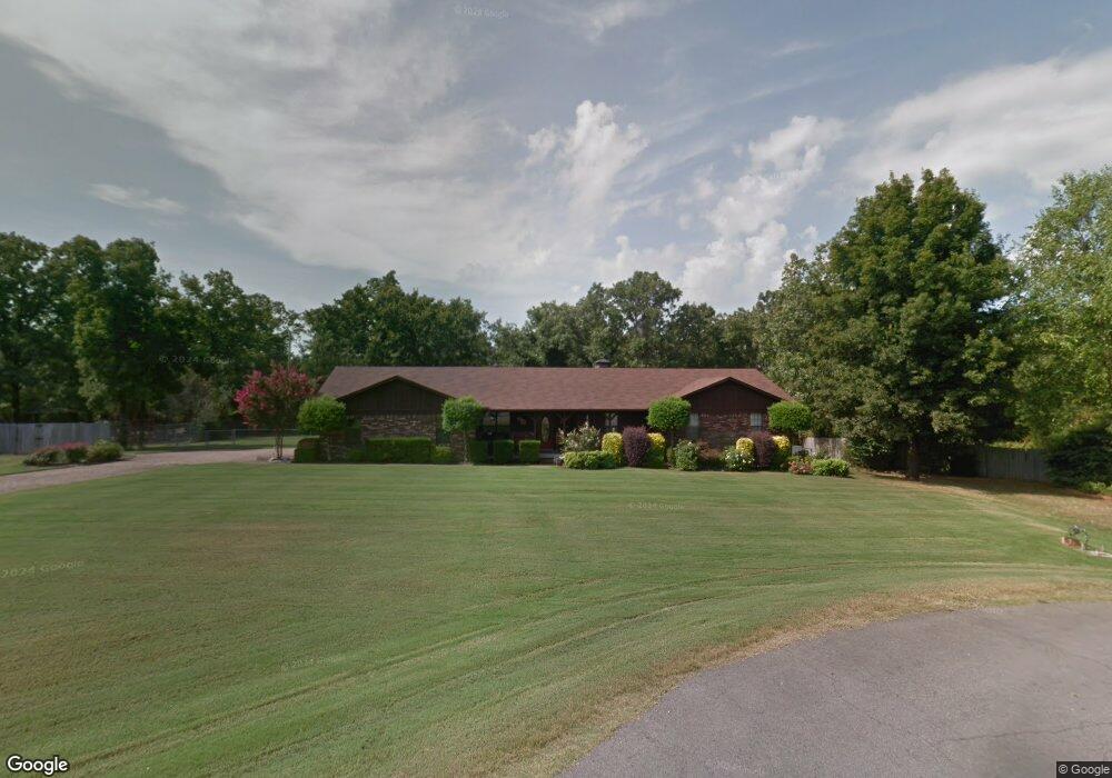
This home is located at 51 Ridge Rd, Cabot, AR 72023 and is currently estimated at $283,105, approximately $145 per square foot. 51 Ridge Rd is a home located in Lonoke County with nearby schools including Northside Elementary School, Cabot Junior High North, and Cabot Middle School North.
Ownership History
Date
Name
Owned For
Owner Type
Purchase Details
Closed on
Feb 5, 2021
Sold by
Jundt Renee H and Jundt Barry G
Bought by
Black Jody A and Black James Eric
Current Estimated Value
Home Financials for this Owner
Home Financials are based on the most recent Mortgage that was taken out on this home.
Original Mortgage
$227,617
Outstanding Balance
$203,225
Interest Rate
2.6%
Mortgage Type
VA
Estimated Equity
$79,880
Purchase Details
Closed on
Aug 2, 1990
Bought by
Haller
Purchase Details
Closed on
Mar 30, 1990
Bought by
Eddy
Create a Home Valuation Report for This Property
The Home Valuation Report is an in-depth analysis detailing your home's value as well as a comparison with similar homes in the area
Purchase History
| Date | Buyer | Sale Price | Title Company |
|---|---|---|---|
| Black Jody A | $222,500 | Lenders Title Company | |
| Haller | $87,000 | -- | |
| Haller | $87,000 | -- | |
| Eddy | $13,900 | -- |
Source: Public Records
Mortgage History
| Date | Status | Borrower | Loan Amount |
|---|---|---|---|
| Open | Black Jody A | $227,617 |
Source: Public Records
Tax History
| Year | Tax Paid | Tax Assessment Tax Assessment Total Assessment is a certain percentage of the fair market value that is determined by local assessors to be the total taxable value of land and additions on the property. | Land | Improvement |
|---|---|---|---|---|
| 2025 | $1,323 | $34,340 | $3,800 | $30,540 |
| 2024 | $1,323 | $34,340 | $3,800 | $30,540 |
| 2023 | $1,323 | $34,340 | $3,800 | $30,540 |
| 2022 | $1,373 | $34,340 | $3,800 | $30,540 |
| 2021 | $1,354 | $34,340 | $3,800 | $30,540 |
| 2020 | $1,272 | $32,350 | $3,800 | $28,550 |
| 2019 | $1,272 | $32,350 | $3,800 | $28,550 |
| 2018 | $1,248 | $32,350 | $3,800 | $28,550 |
| 2017 | $1,485 | $32,350 | $3,800 | $28,550 |
| 2016 | $1,248 | $32,350 | $3,800 | $28,550 |
| 2015 | $1,217 | $31,720 | $3,800 | $27,920 |
| 2014 | $1,217 | $31,720 | $3,800 | $27,920 |
Source: Public Records
Map
Nearby Homes
- 41 Sunset Ln
- 40 Sunset Ln
- 3A W Main St
- 00 W Main St
- 24 Sunset Ln
- 0 Tract F Hwy 89
- 0 Tract G Hwy 89
- 0 Tract E Hwy 89
- 0 Tract C Hwy 89
- 18 Suncrest Dr
- 582 Crepe Myrtle Loop
- 0 N Rockwood Rd Unit W. Main Street
- 505 Sweet Gum Ct
- 519 Crepe Myrtle Loop
- 26 Calvados Ct
- 35 N Sunland Dr
- 509 Crepe Myrtle Loop
- 55 Mount Tabor W
- 0 W Main St Unit 23029338
- 3060 W Main St Unit Hwy 89
Your Personal Tour Guide
Ask me questions while you tour the home.