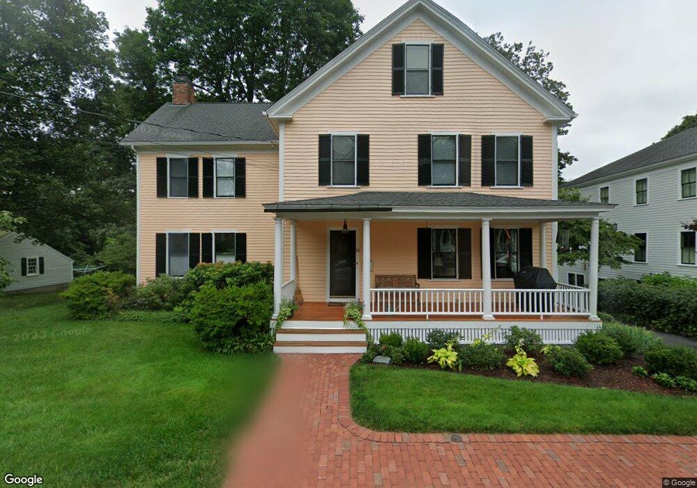
51 Riverside Ave Concord, MA 01742
Estimated Value: $1,584,000 - $1,722,000
5
Beds
3
Baths
2,672
Sq Ft
$614/Sq Ft
Est. Value
About This Home
This home is located at 51 Riverside Ave, Concord, MA 01742 and is currently estimated at $1,640,789, approximately $614 per square foot. 51 Riverside Ave is a home located in Middlesex County with nearby schools including Thoreau Elementary School, Concord Middle School, and Nashoba Brooks School.
Ownership History
Date
Name
Owned For
Owner Type
Purchase Details
Closed on
Aug 1, 1985
Bought by
Kussin Karl F and Kussin Sarah H
Current Estimated Value
Create a Home Valuation Report for This Property
The Home Valuation Report is an in-depth analysis detailing your home's value as well as a comparison with similar homes in the area
Home Values in the Area
Average Home Value in this Area
Purchase History
| Date | Buyer | Sale Price | Title Company |
|---|---|---|---|
| Kussin Karl F | $186,000 | -- |
Source: Public Records
Mortgage History
| Date | Status | Borrower | Loan Amount |
|---|---|---|---|
| Open | Kussin Karl F | $425,000 | |
| Closed | Kussin Karl F | $60,000 | |
| Closed | Kussin Karl F | $36,000 |
Source: Public Records
Tax History Compared to Growth
Tax History
| Year | Tax Paid | Tax Assessment Tax Assessment Total Assessment is a certain percentage of the fair market value that is determined by local assessors to be the total taxable value of land and additions on the property. | Land | Improvement |
|---|---|---|---|---|
| 2025 | $174 | $1,310,400 | $568,200 | $742,200 |
| 2024 | $16,839 | $1,282,500 | $568,200 | $714,300 |
| 2023 | $14,321 | $1,105,000 | $516,600 | $588,400 |
| 2022 | $15,610 | $1,057,600 | $413,200 | $644,400 |
| 2021 | $14,571 | $989,900 | $413,200 | $576,700 |
| 2020 | $14,125 | $992,600 | $413,200 | $579,400 |
| 2019 | $12,980 | $914,700 | $401,200 | $513,500 |
| 2018 | $12,036 | $842,300 | $382,100 | $460,200 |
| 2017 | $11,802 | $838,800 | $363,900 | $474,900 |
| 2016 | $11,357 | $815,900 | $363,900 | $452,000 |
| 2015 | $10,635 | $744,200 | $337,000 | $407,200 |
Source: Public Records
Map
Nearby Homes
- 111 Central St
- 114 Upland Rd
- 102 Highland St
- 70 McCallar Ln
- 54 Maple St
- 12 S Meadow Ridge Unit 12
- 12 S Meadow Ridge
- 1053 Main St
- 16 Concord Greene Unit 5
- 24 Concord Greene Unit 7
- 29 Concord Greene Unit 3
- 1687 Main St
- 27 Water St
- 88 Wright Rd
- 70 Hillside Ave
- 37 Water St
- 10 Wright Rd
- 79-81 Assabet Ave
- 488 Elm St
- 855 Barretts Mill Rd
- 57 Riverside Ave
- 39 Riverside Ave
- 69 Riverside Ave
- 56 Riverside Ave
- 50 Riverside Ave
- 67 Riverside Ave
- 65 Riverside Ave
- 65 Riverside Ave Unit 65
- 67 Riverside Ave Unit 67
- 67 Riverside Ave Unit 1
- 73 Pine St
- 73 Pine St Unit 73
- 73 Pine St Unit 3
- 42 Riverside Ave
- 42 Riverside Ave Unit 42
- 31 Riverside Ave
- 51 Pine St
- 32 Riverside Ave
- 45 Pine St
- 21 Riverside Ave