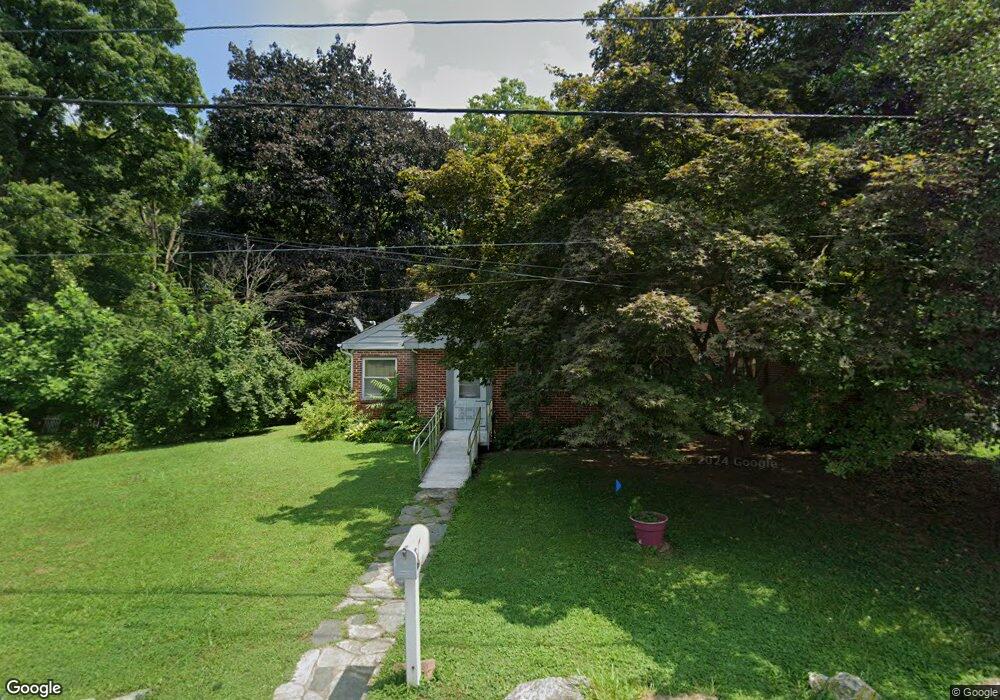
51 Riverside Ave Lancaster, PA 17602
Conestoga Woods NeighborhoodEstimated Value: $281,000 - $311,000
2
Beds
1
Bath
1,122
Sq Ft
$262/Sq Ft
Est. Value
About This Home
This home is located at 51 Riverside Ave, Lancaster, PA 17602 and is currently estimated at $293,528, approximately $261 per square foot. 51 Riverside Ave is a home located in Lancaster County with nearby schools including Burrowes Elementary School, Wickersham Elementary School, and Lincoln Middle School.
Ownership History
Date
Name
Owned For
Owner Type
Purchase Details
Closed on
Oct 27, 2000
Sold by
Denlinger Willis B
Bought by
Nentwig Lloyd C and Nentwig Mary E
Current Estimated Value
Home Financials for this Owner
Home Financials are based on the most recent Mortgage that was taken out on this home.
Original Mortgage
$82,000
Outstanding Balance
$30,000
Interest Rate
7.78%
Estimated Equity
$263,528
Create a Home Valuation Report for This Property
The Home Valuation Report is an in-depth analysis detailing your home's value as well as a comparison with similar homes in the area
Home Values in the Area
Average Home Value in this Area
Purchase History
| Date | Buyer | Sale Price | Title Company |
|---|---|---|---|
| Nentwig Lloyd C | $102,600 | -- |
Source: Public Records
Mortgage History
| Date | Status | Borrower | Loan Amount |
|---|---|---|---|
| Open | Nentwig Lloyd C | $82,000 |
Source: Public Records
Tax History Compared to Growth
Tax History
| Year | Tax Paid | Tax Assessment Tax Assessment Total Assessment is a certain percentage of the fair market value that is determined by local assessors to be the total taxable value of land and additions on the property. | Land | Improvement |
|---|---|---|---|---|
| 2025 | $3,518 | $122,000 | $33,200 | $88,800 |
| 2024 | $3,518 | $122,000 | $33,200 | $88,800 |
| 2023 | $3,437 | $122,000 | $33,200 | $88,800 |
| 2022 | $3,232 | $122,000 | $33,200 | $88,800 |
| 2021 | $3,135 | $122,000 | $33,200 | $88,800 |
| 2020 | $3,135 | $122,000 | $33,200 | $88,800 |
| 2019 | $3,068 | $122,000 | $33,200 | $88,800 |
| 2018 | $3,913 | $122,000 | $33,200 | $88,800 |
| 2017 | $3,403 | $104,100 | $33,400 | $70,700 |
| 2016 | $3,341 | $104,100 | $33,400 | $70,700 |
| 2015 | $451 | $104,100 | $33,400 | $70,700 |
| 2014 | $2,350 | $104,100 | $33,400 | $70,700 |
Source: Public Records
Map
Nearby Homes
- 1036 E King St
- 911 E King St
- 153 N Broad St
- 817 E Orange St
- 850 E Madison St
- 742 E Fulton St
- 305 Conestoga Blvd
- 665 Lehigh Ave
- 661 Lehigh Ave
- 659 Lehigh Ave
- 604 E End Ave
- 121 S Marshall St
- 249 N Marshall St
- 610 E Madison St
- 516 Conestoga Greenway Trail
- 528 E Orange St
- 522 E Orange St
- 415 Lampeter Rd
- 654 New Holland Ave
- 424 Lampeter Rd
- 49 Riverside Ave Unit 1
- 49 Riverside Ave
- 1395 E Orange St
- 47 Riverside Ave
- 56 Riverside Ave
- 54 Riverside Ave
- 45 Riverside Ave
- 52 Riverside Ave
- 1407 Clark St
- 48 Riverside Ave
- 50 Riverside Ave
- 1409 Clark St
- 1240 E Orange St
- 46 Riverside Ave
- 1309 Clark St
- 1307 Clark St
- 1411 Clark St
- 37 Riverside Ave
- 38 Riverside Ave
- 1226 E Orange St