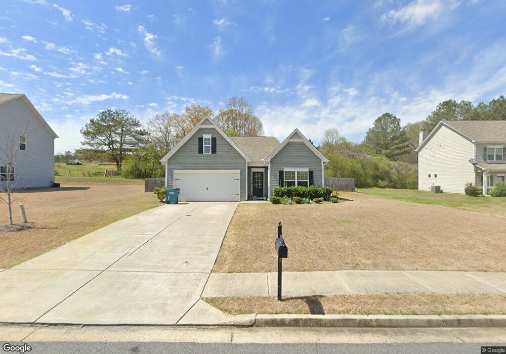
51 Robin Rd Unit 21 Adairsville, GA 30103
Estimated Value: $319,000 - $396,000
3
Beds
2
Baths
1,808
Sq Ft
$192/Sq Ft
Est. Value
About This Home
This home is located at 51 Robin Rd Unit 21, Adairsville, GA 30103 and is currently estimated at $347,289, approximately $192 per square foot. 51 Robin Rd Unit 21 is a home located in Bartow County with nearby schools including Adairsville Elementary School, Adairsville Middle School, and Adairsville High School.
Ownership History
Date
Name
Owned For
Owner Type
Purchase Details
Closed on
Aug 13, 2018
Sold by
Sdc Gwinnett Llc
Bought by
Tatham Heather
Current Estimated Value
Home Financials for this Owner
Home Financials are based on the most recent Mortgage that was taken out on this home.
Original Mortgage
$170,225
Outstanding Balance
$147,834
Interest Rate
4.5%
Mortgage Type
New Conventional
Estimated Equity
$199,455
Purchase Details
Closed on
Jun 5, 2018
Sold by
Woody Road Llc
Bought by
Sdc Gwinnett Llc
Create a Home Valuation Report for This Property
The Home Valuation Report is an in-depth analysis detailing your home's value as well as a comparison with similar homes in the area
Home Values in the Area
Average Home Value in this Area
Purchase History
| Date | Buyer | Sale Price | Title Company |
|---|---|---|---|
| Tatham Heather | $180,225 | -- | |
| Sdc Gwinnett Llc | $110,000 | -- |
Source: Public Records
Mortgage History
| Date | Status | Borrower | Loan Amount |
|---|---|---|---|
| Open | Tatham Heather | $170,225 |
Source: Public Records
Tax History Compared to Growth
Tax History
| Year | Tax Paid | Tax Assessment Tax Assessment Total Assessment is a certain percentage of the fair market value that is determined by local assessors to be the total taxable value of land and additions on the property. | Land | Improvement |
|---|---|---|---|---|
| 2024 | $2,716 | $126,438 | $24,800 | $101,638 |
| 2023 | $2,917 | $124,067 | $24,800 | $99,267 |
| 2022 | $2,404 | $101,247 | $13,400 | $87,847 |
| 2021 | $1,923 | $78,700 | $13,400 | $65,300 |
| 2020 | $1,898 | $74,100 | $8,800 | $65,300 |
| 2019 | $1,862 | $74,100 | $8,800 | $65,300 |
| 2018 | $245 | $8,800 | $8,800 | $0 |
| 2017 | $112 | $4,000 | $4,000 | $0 |
| 2016 | $113 | $4,000 | $4,000 | $0 |
| 2015 | $113 | $4,000 | $4,000 | $0 |
| 2014 | $117 | $4,000 | $4,000 | $0 |
| 2013 | -- | $4,000 | $4,000 | $0 |
Source: Public Records
Map
Nearby Homes
- 172 Graham Cir
- 166 Graham Cir
- 32 Starling Ct
- 38 Woody Way NW
- 315 Woody Rd NW
- 11 Sonoma Dr
- 47 Thacker Trail
- Woodridge Plan at The Landing at Miller’s Ferry
- Kensington Plan at The Landing at Miller’s Ferry
- Northwyck Plan at The Landing at Miller’s Ferry
- Richmond Plan at The Landing at Miller’s Ferry
- Brookhaven Plan at The Landing at Miller’s Ferry
- Newport I Plan at The Landing at Miller’s Ferry
- Wesley Plan at The Landing at Miller’s Ferry
- Newport II Plan at The Landing at Miller’s Ferry
- Richardson Plan at The Landing at Miller’s Ferry
- Dewhurst Plan at The Landing at Miller’s Ferry
- 178 Harbor Trail
- 269 Riverboat Dr
- 110 Hardwood Ridge Dr