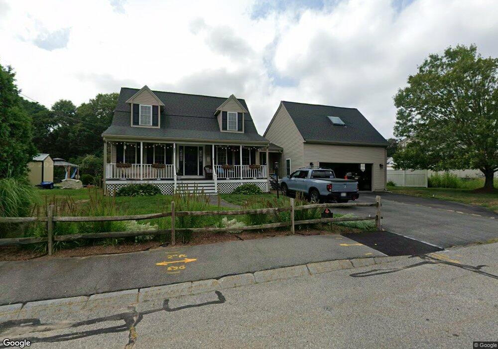
51 Round Table Ln Taunton, MA 02780
Weir Village NeighborhoodEstimated Value: $589,000 - $654,000
3
Beds
2
Baths
1,781
Sq Ft
$345/Sq Ft
Est. Value
About This Home
This home is located at 51 Round Table Ln, Taunton, MA 02780 and is currently estimated at $615,091, approximately $345 per square foot. 51 Round Table Ln is a home located in Bristol County with nearby schools including Elizabeth Pole School, Taunton High School, and John F. Parker Middle School.
Ownership History
Date
Name
Owned For
Owner Type
Purchase Details
Closed on
Oct 2, 1997
Sold by
Maroney Build & Constr
Bought by
Orsini Allan R and Orsini Susan E
Current Estimated Value
Create a Home Valuation Report for This Property
The Home Valuation Report is an in-depth analysis detailing your home's value as well as a comparison with similar homes in the area
Home Values in the Area
Average Home Value in this Area
Purchase History
| Date | Buyer | Sale Price | Title Company |
|---|---|---|---|
| Orsini Allan R | $150,100 | -- |
Source: Public Records
Mortgage History
| Date | Status | Borrower | Loan Amount |
|---|---|---|---|
| Open | Orsini Allan R | $184,200 | |
| Closed | Orsini Allan R | $96,300 | |
| Closed | Orsini Allan R | $140,000 |
Source: Public Records
Tax History
| Year | Tax Paid | Tax Assessment Tax Assessment Total Assessment is a certain percentage of the fair market value that is determined by local assessors to be the total taxable value of land and additions on the property. | Land | Improvement |
|---|---|---|---|---|
| 2025 | $6,056 | $553,600 | $139,800 | $413,800 |
| 2024 | $5,539 | $495,000 | $158,800 | $336,200 |
| 2023 | $5,423 | $450,000 | $158,800 | $291,200 |
| 2022 | $5,173 | $392,500 | $137,700 | $254,800 |
| 2021 | $5,129 | $361,200 | $120,300 | $240,900 |
| 2020 | $1,382 | $330,500 | $120,300 | $210,200 |
| 2019 | $1,422 | $325,400 | $126,100 | $199,300 |
| 2018 | $4,900 | $311,700 | $127,400 | $184,300 |
| 2017 | $4,653 | $296,200 | $120,700 | $175,500 |
| 2016 | $4,491 | $286,400 | $117,200 | $169,200 |
| 2015 | $4,495 | $299,500 | $117,900 | $181,600 |
| 2014 | $4,354 | $298,000 | $117,000 | $181,000 |
Source: Public Records
Map
Nearby Homes
- 0 Hart St Unit 73474079
- 600 County St
- 28 Barbara Rd
- 29 Johnson St Unit C
- 29 Johnson St Unit A
- 29 Johnson St Unit B
- 25 Johnson St Unit B
- 25 Johnson St Unit A
- 25 Johnson St Unit C
- 27 Johnson St Unit C
- 27 Johnson St Unit A
- 27 Johnson St Unit B
- 222 Harris St
- 70 Sandy Hill Rd
- 73 Raymond Ave
- 5 Parcels Cape Highway Route 44
- 0 Cape Highway Route 44 Unit 73474847
- 15 Carlton St
- 28 Linden St
- 36 Linden St
- 45 Sir Joseph Ct
- 61 Round Table Ln
- 50 Round Table Ln
- 35 Sir Joseph Ct
- 34 Round Table Ln
- LOT 247A Roundtable Ln
- 71 Round Table Ln
- 64 Round Table Ln
- 25 Sir Joseph Ct
- 24 Round Table Ln
- 21 Round Table Ln
- 36 Sir Joseph Ct
- 74 Round Table Ln
- 26 Sir Joseph Ct
- 14 Round Table Ln
- 164 Williams St
- LOT 247B Roundtable Ln
- 162 Williams St
- 40 Bruno's Way Unit Lot 2
- 166 Williams St
Your Personal Tour Guide
Ask me questions while you tour the home.