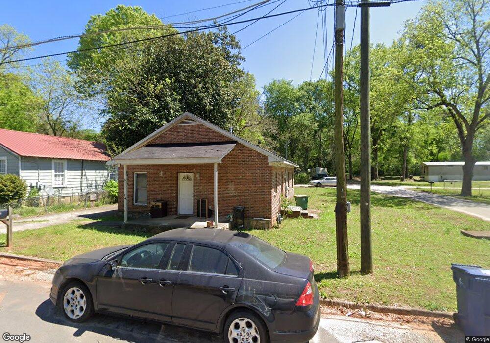
51 S Dublin St Athens, GA 30601
Chicopee-Dudley NeighborhoodEstimated Value: $117,000 - $301,000
3
Beds
2
Baths
1,161
Sq Ft
$177/Sq Ft
Est. Value
About This Home
This home is located at 51 S Dublin St, Athens, GA 30601 and is currently estimated at $205,396, approximately $176 per square foot. 51 S Dublin St is a home located in Clarke County with nearby schools including Gaines Elementary School, Hilsman Middle School, and Cedar Shoals High School.
Ownership History
Date
Name
Owned For
Owner Type
Purchase Details
Closed on
Oct 17, 2016
Sold by
Angela
Bought by
Athens Land Trust Inc
Current Estimated Value
Home Financials for this Owner
Home Financials are based on the most recent Mortgage that was taken out on this home.
Original Mortgage
$53,350
Outstanding Balance
$35,146
Interest Rate
3.5%
Mortgage Type
New Conventional
Estimated Equity
$170,250
Purchase Details
Closed on
May 31, 2007
Sold by
Not Provided
Bought by
Phinazee Angela
Home Financials for this Owner
Home Financials are based on the most recent Mortgage that was taken out on this home.
Original Mortgage
$64,980
Interest Rate
6.12%
Mortgage Type
New Conventional
Create a Home Valuation Report for This Property
The Home Valuation Report is an in-depth analysis detailing your home's value as well as a comparison with similar homes in the area
Home Values in the Area
Average Home Value in this Area
Purchase History
| Date | Buyer | Sale Price | Title Company |
|---|---|---|---|
| Athens Land Trust Inc | $49,900 | -- | |
| Phinazee Angela | $65,000 | -- |
Source: Public Records
Mortgage History
| Date | Status | Borrower | Loan Amount |
|---|---|---|---|
| Open | Athens Land Trust Inc | $53,350 | |
| Previous Owner | Phinazee Angela | $64,980 |
Source: Public Records
Tax History Compared to Growth
Tax History
| Year | Tax Paid | Tax Assessment Tax Assessment Total Assessment is a certain percentage of the fair market value that is determined by local assessors to be the total taxable value of land and additions on the property. | Land | Improvement |
|---|---|---|---|---|
| 2025 | $654 | $21,050 | $0 | $21,050 |
| 2024 | $654 | $22,080 | $0 | $22,080 |
| 2023 | $690 | $20,825 | $0 | $20,825 |
| 2022 | $426 | $13,359 | $0 | $13,359 |
| 2021 | $450 | $13,359 | $0 | $13,359 |
| 2020 | $494 | $14,660 | $0 | $14,660 |
| 2019 | $494 | $14,560 | $0 | $14,560 |
| 2018 | $532 | $15,661 | $0 | $15,661 |
| 2017 | $517 | $15,242 | $0 | $15,242 |
| 2016 | $154 | $14,542 | $0 | $14,542 |
| 2015 | $155 | $14,542 | $0 | $14,542 |
| 2014 | $155 | $14,542 | $0 | $14,542 |
Source: Public Records
Map
Nearby Homes
- 41 S Dublin St
- 121 Head St
- 71 Head St
- 31 S Dublin St
- 150 Head St
- 61 Head St
- 60 S Dublin St
- 1734 E Broad St Unit B
- 1738 E Broad St
- 66 S Dublin St
- 101 Head St
- S Dublin St
- 369 Branch St
- 1748 E Broad St
- 600 Branch St Unit 28
- 600 Branch St
- 1750 E Broad St
- 606 Branch St
- 325 Old Winterville Rd
- 1758 E Broad St