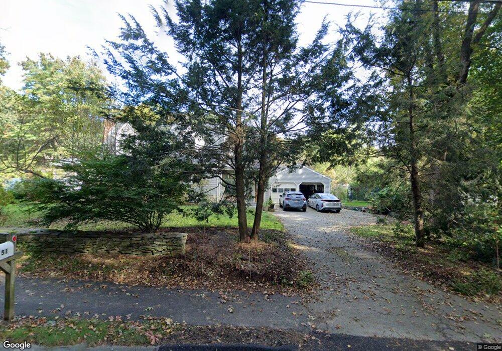
51 Sherman Bridge Rd Wayland, MA 01778
Estimated Value: $1,052,000 - $1,265,000
3
Beds
3
Baths
2,510
Sq Ft
$461/Sq Ft
Est. Value
About This Home
This home is located at 51 Sherman Bridge Rd, Wayland, MA 01778 and is currently estimated at $1,156,189, approximately $460 per square foot. 51 Sherman Bridge Rd is a home located in Middlesex County with nearby schools including Wayland High School, Willow Hill School, and Corwin-Russell School at Broccoli Hall.
Ownership History
Date
Name
Owned For
Owner Type
Purchase Details
Closed on
Feb 20, 2003
Sold by
Smith Jane Thankful and Zehnpfenning Jane S
Bought by
Beinashowitz Jack
Current Estimated Value
Home Financials for this Owner
Home Financials are based on the most recent Mortgage that was taken out on this home.
Original Mortgage
$200,000
Outstanding Balance
$85,842
Interest Rate
5.98%
Mortgage Type
Purchase Money Mortgage
Estimated Equity
$1,070,347
Create a Home Valuation Report for This Property
The Home Valuation Report is an in-depth analysis detailing your home's value as well as a comparison with similar homes in the area
Home Values in the Area
Average Home Value in this Area
Purchase History
| Date | Buyer | Sale Price | Title Company |
|---|---|---|---|
| Beinashowitz Jack | $444,000 | -- | |
| Beinashowitz Jack | $444,000 | -- |
Source: Public Records
Mortgage History
| Date | Status | Borrower | Loan Amount |
|---|---|---|---|
| Open | Beinashowitz Jack | $200,000 | |
| Closed | Beinashowitz Jack | $200,000 |
Source: Public Records
Tax History Compared to Growth
Tax History
| Year | Tax Paid | Tax Assessment Tax Assessment Total Assessment is a certain percentage of the fair market value that is determined by local assessors to be the total taxable value of land and additions on the property. | Land | Improvement |
|---|---|---|---|---|
| 2025 | $16,199 | $1,036,400 | $524,400 | $512,000 |
| 2024 | $15,310 | $986,500 | $499,500 | $487,000 |
| 2023 | $14,840 | $891,300 | $454,200 | $437,100 |
| 2022 | $14,100 | $768,400 | $376,200 | $392,200 |
| 2021 | $6,195 | $734,200 | $342,000 | $392,200 |
| 2020 | $13,039 | $734,200 | $342,000 | $392,200 |
| 2019 | $9,648 | $699,300 | $325,800 | $373,500 |
| 2018 | $5,618 | $660,200 | $325,800 | $334,400 |
| 2017 | $11,599 | $639,400 | $310,200 | $329,200 |
| 2016 | $10,491 | $605,000 | $304,200 | $300,800 |
| 2015 | $10,793 | $586,900 | $304,200 | $282,700 |
Source: Public Records
Map
Nearby Homes
- 15 Lewis Path
- 134 Chestnut Cir
- Lot 5 Sailaway Ln
- 45 N Crescent Cir
- Lot 4 Sailaway Ln
- 2 Betts Way
- 8 Mina Way
- 0 Elm Unit 73282184
- Lot 9 Sailaway Ln
- 4 Betts Way
- 122 Sand Gully Rd N Unit B
- 93 Old Sudbury Rd
- 244 Lincoln Rd
- 941 Concord Rd
- 192 Concord Rd
- 152 S Great Rd
- 17 Glezen Ln
- 56 Rookery Ln Unit 4
- 401 Emery Ln Unit 304
- 121 White Pond Way Unit 121
- 47 Sherman's Bridge Rd
- 47 Sherman Bridge Rd
- 53 Sherman Bridge Rd
- 52 Sherman Bridge Rd
- 55 Sherman Bridge Rd
- 45 Sherman Bridge Rd
- 45 Sherman's Bridge Rd
- 56 Sherman Bridge Rd
- 46 Sherman Bridge Rd
- 44 Sherman Bridge Rd
- 43 Sherman Bridge Rd
- 43 Sherman Bridge Rd Unit 43
- 57 Sherman Bridge Rd
- 209 Oxbow Rd
- 205 Oxbow Rd
- 201 Oxbow Rd
- 50 Sherman Bridge Rd
- 211 Oxbow Rd
- 213 Oxbow Rd
- 39 Sherman Bridge Rd