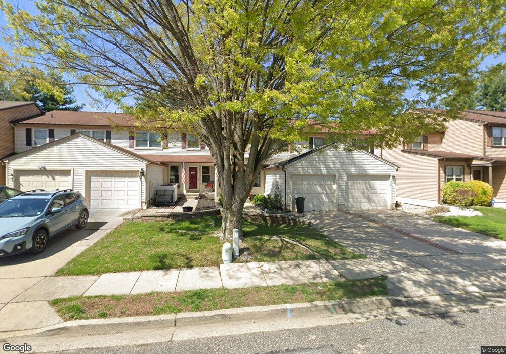
51 Southgate Dr Mount Laurel, NJ 08054
Estimated Value: $386,930 - $419,000
3
Beds
3
Baths
1,546
Sq Ft
$263/Sq Ft
Est. Value
About This Home
This home is located at 51 Southgate Dr, Mount Laurel, NJ 08054 and is currently estimated at $406,233, approximately $262 per square foot. 51 Southgate Dr is a home located in Burlington County with nearby schools including Parkway Elementary School, T.E. Harrington Middle School, and Mount Laurel Hartford School.
Ownership History
Date
Name
Owned For
Owner Type
Purchase Details
Closed on
Jul 9, 2004
Sold by
Kentrus Lois Ellen and Kentrus Albert P
Bought by
Sharp Allison D and Sharp Steven M
Current Estimated Value
Home Financials for this Owner
Home Financials are based on the most recent Mortgage that was taken out on this home.
Original Mortgage
$192,000
Outstanding Balance
$94,929
Interest Rate
6.28%
Mortgage Type
Purchase Money Mortgage
Estimated Equity
$311,304
Create a Home Valuation Report for This Property
The Home Valuation Report is an in-depth analysis detailing your home's value as well as a comparison with similar homes in the area
Home Values in the Area
Average Home Value in this Area
Purchase History
| Date | Buyer | Sale Price | Title Company |
|---|---|---|---|
| Sharp Allison D | $240,000 | Commonwealth Land Title Insu |
Source: Public Records
Mortgage History
| Date | Status | Borrower | Loan Amount |
|---|---|---|---|
| Open | Sharp Allison D | $192,000 |
Source: Public Records
Tax History Compared to Growth
Tax History
| Year | Tax Paid | Tax Assessment Tax Assessment Total Assessment is a certain percentage of the fair market value that is determined by local assessors to be the total taxable value of land and additions on the property. | Land | Improvement |
|---|---|---|---|---|
| 2025 | $6,194 | $196,200 | $59,000 | $137,200 |
| 2024 | $5,961 | $196,200 | $59,000 | $137,200 |
| 2023 | $5,961 | $196,200 | $59,000 | $137,200 |
| 2022 | $5,941 | $196,200 | $59,000 | $137,200 |
| 2021 | $5,829 | $196,200 | $59,000 | $137,200 |
| 2020 | $5,715 | $196,200 | $59,000 | $137,200 |
| 2019 | $5,656 | $196,200 | $59,000 | $137,200 |
| 2018 | $5,613 | $196,200 | $59,000 | $137,200 |
| 2017 | $5,468 | $196,200 | $59,000 | $137,200 |
| 2016 | $5,386 | $196,200 | $59,000 | $137,200 |
| 2015 | $5,323 | $196,200 | $59,000 | $137,200 |
| 2014 | $5,270 | $196,200 | $59,000 | $137,200 |
Source: Public Records
Map
Nearby Homes
- 266 Saint David Dr
- 317 Saint David Dr
- 102 Union Mill Terrace
- 223 Saint David Dr
- 23 Emory Ln
- 402A Cypress Point Cir
- 32 Hearthstone Ln
- 605 605 Augusta Cir
- 605 Augusta Cir Unit 605
- 706 Augusta Cir Unit 706
- 1 Adner Dr
- 31 Quince Ct
- 13 Marcy Ct
- 8 Raven Ct
- 109 Yorktown Dr
- 12 Taconia Ct
- 70B Sumac Ct Unit 70B
- 23 E Oleander Dr
- 130B Birchfield Ct Unit 130B
- 123A Birchfield Ct Unit 123A
- 49 Southgate Dr
- 53 Southgate Dr
- 55 Southgate Dr
- 47 Southgate Dr
- 57 Southgate Dr
- 45 Southgate Dr
- 43 Southgate Dr
- 59 Southgate Dr
- 41 Southgate Dr
- 50 Southgate Dr
- 48 Southgate Dr
- 52 Southgate Dr
- 54 Southgate Dr
- 39 Southgate Dr
- 46 Southgate Dr
- 37 Southgate Dr
- 56 Southgate Dr
- 86 Farnwood Rd
- 84 Farnwood Rd
- 44 Southgate Dr