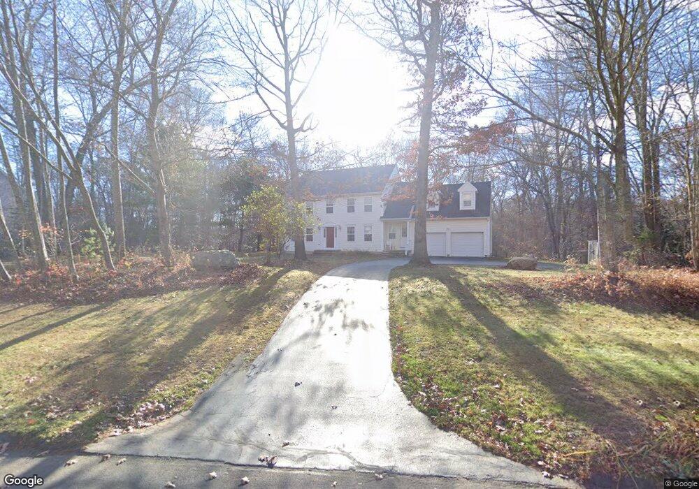
51 Spring Rock Rd East Lyme, CT 06333
Estimated Value: $733,000 - $802,000
4
Beds
4
Baths
2,755
Sq Ft
$276/Sq Ft
Est. Value
About This Home
This home is located at 51 Spring Rock Rd, East Lyme, CT 06333 and is currently estimated at $759,635, approximately $275 per square foot. 51 Spring Rock Rd is a home located in New London County with nearby schools including East Lyme Middle School, East Lyme High School, and Carelot Children's Center - East Lyme.
Ownership History
Date
Name
Owned For
Owner Type
Purchase Details
Closed on
Apr 16, 1998
Sold by
Guevremont Maria T
Bought by
Martenson Christopher and Martenson Rebecca A
Current Estimated Value
Purchase Details
Closed on
Oct 31, 1995
Sold by
Nazarko Prop
Bought by
Deshmukh Devendra R and Deshmukh Gayatri D
Create a Home Valuation Report for This Property
The Home Valuation Report is an in-depth analysis detailing your home's value as well as a comparison with similar homes in the area
Home Values in the Area
Average Home Value in this Area
Purchase History
| Date | Buyer | Sale Price | Title Company |
|---|---|---|---|
| Martenson Christopher | $345,000 | -- | |
| Deshmukh Devendra R | $75,000 | -- |
Source: Public Records
Mortgage History
| Date | Status | Borrower | Loan Amount |
|---|---|---|---|
| Closed | Deshmukh Devendra R | $130,000 | |
| Closed | Deshmukh Devendra R | $100,000 | |
| Closed | Deshmukh Devendra R | $167,000 | |
| Closed | Deshmukh Devendra R | $100,000 |
Source: Public Records
Tax History Compared to Growth
Tax History
| Year | Tax Paid | Tax Assessment Tax Assessment Total Assessment is a certain percentage of the fair market value that is determined by local assessors to be the total taxable value of land and additions on the property. | Land | Improvement |
|---|---|---|---|---|
| 2025 | $9,600 | $342,720 | $101,710 | $241,010 |
| 2024 | $9,031 | $342,720 | $101,710 | $241,010 |
| 2023 | $8,527 | $342,720 | $101,710 | $241,010 |
| 2022 | $8,170 | $342,720 | $101,710 | $241,010 |
| 2021 | $8,442 | $296,100 | $101,710 | $194,390 |
| 2020 | $8,397 | $296,100 | $101,710 | $194,390 |
| 2019 | $8,347 | $296,100 | $101,710 | $194,390 |
| 2018 | $8,098 | $296,100 | $101,710 | $194,390 |
| 2017 | $7,746 | $296,100 | $101,710 | $194,390 |
| 2016 | $7,665 | $302,260 | $101,710 | $200,550 |
| 2015 | $7,469 | $302,260 | $101,710 | $200,550 |
| 2014 | $7,263 | $302,260 | $101,710 | $200,550 |
Source: Public Records
Map
Nearby Homes
- 57 Spring Rock Rd
- Waramaug Plan at Riverside Reserve
- Highland Plan at Riverside Reserve
- Hayward Plan at Riverside Reserve
- Ashford Plan at Riverside Reserve
- Lillinonah Plan at Riverside Reserve
- 16 Twin Valley Rd
- 18 Twin Valley Rd
- 496 Boston Post Rd
- 188 4 Mile River Rd
- 223 N Bride Brook Rd
- 14 Colton Rd
- 270 N Bride Brook Rd
- 15 Freedom Way Unit 92
- 287 Boston Post Rd
- 15 Short Hills Rd
- 420 Boston Post Rd
- 4 Jean Dr
- 23 Lords Meadow Ln
- 13 Willow Ln
- 49 Spring Rock Rd
- 53 Spring Rock Rd
- 55 Spring Rock Rd
- 47 Spring Rock Rd
- 45 Spring Rock Rd
- 22 Over Brook Rd
- 24 Over Brook Rd
- 59 Spring Rock Rd
- 43 Spring Rock Rd
- 48 Spring Rock Rd
- 52 Spring Rock Rd
- 28 Over Brook Rd
- 54 Spring Rock Rd
- 46 Spring Rock Rd
- 41 Spring Rock Rd
- 16 Over Brook Rd
- 56 Spring Rock Rd
- 21 Over Brook Rd
- 27 Over Brook Rd
- 44 Spring Rock Rd