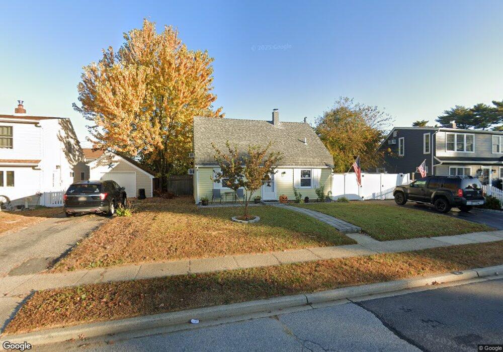
51 Stirrup Ln Levittown, NY 11756
Estimated Value: $494,000 - $707,354
3
Beds
1
Bath
1,050
Sq Ft
$572/Sq Ft
Est. Value
About This Home
This home is located at 51 Stirrup Ln, Levittown, NY 11756 and is currently estimated at $600,677, approximately $572 per square foot. 51 Stirrup Ln is a home located in Nassau County with nearby schools including Gardiners Avenue School, Jonas E. Salk Middle School, and Gen. Douglas MacArthur Senior High School.
Ownership History
Date
Name
Owned For
Owner Type
Purchase Details
Closed on
Jun 4, 2019
Sold by
Hoffmann Gregory
Bought by
Vasilakis Pantelis and Vasilakis Daniel Maria
Current Estimated Value
Home Financials for this Owner
Home Financials are based on the most recent Mortgage that was taken out on this home.
Original Mortgage
$327,275
Outstanding Balance
$287,157
Interest Rate
4.1%
Mortgage Type
New Conventional
Estimated Equity
$313,520
Create a Home Valuation Report for This Property
The Home Valuation Report is an in-depth analysis detailing your home's value as well as a comparison with similar homes in the area
Home Values in the Area
Average Home Value in this Area
Purchase History
| Date | Buyer | Sale Price | Title Company |
|---|---|---|---|
| Vasilakis Pantelis | $344,500 | Judicial Title |
Source: Public Records
Mortgage History
| Date | Status | Borrower | Loan Amount |
|---|---|---|---|
| Open | Vasilakis Pantelis | $327,275 |
Source: Public Records
Tax History Compared to Growth
Tax History
| Year | Tax Paid | Tax Assessment Tax Assessment Total Assessment is a certain percentage of the fair market value that is determined by local assessors to be the total taxable value of land and additions on the property. | Land | Improvement |
|---|---|---|---|---|
| 2025 | $10,674 | $327 | $190 | $137 |
| 2024 | $2,537 | $314 | $182 | $132 |
| 2023 | $10,176 | $346 | $221 | $125 |
| 2022 | $10,176 | $327 | $190 | $137 |
| 2021 | $12,309 | $362 | $210 | $152 |
| 2020 | $11,257 | $467 | $466 | $1 |
| 2019 | $2,539 | $507 | $506 | $1 |
| 2018 | $2,452 | $507 | $0 | $0 |
| 2017 | $4,658 | $507 | $506 | $1 |
| 2016 | $7,101 | $507 | $458 | $49 |
| 2015 | $2,695 | $611 | $552 | $59 |
| 2014 | $2,695 | $611 | $552 | $59 |
| 2013 | $2,475 | $611 | $552 | $59 |
Source: Public Records
Map
Nearby Homes
- 47 Stirrup Ln
- 53 Stirrup Ln
- 174 Sprucewood Dr
- 178 Sprucewood Dr
- 45 Stirrup Ln
- 57 Stirrup Ln
- 172 Sprucewood Dr
- 180 Sprucewood Dr
- 50 Stirrup Ln
- 54 Stirrup Ln
- 46 Stirrup Ln
- 168 Sprucewood Dr
- 41 Stirrup Ln
- 59 Stirrup Ln
- 184 Sprucewood Dr
- 44 Stirrup Ln
- 166 Sprucewood Dr
- 40 Stirrup Ln
- 1 Flint Ln
- 61 Stirrup Ln