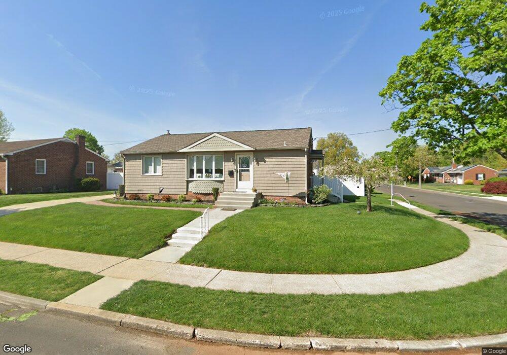
51 Storrie Ave Gibbstown, NJ 08027
Greenwich Township NeighborhoodEstimated Value: $248,253 - $312,000
--
Bed
--
Bath
1,120
Sq Ft
$261/Sq Ft
Est. Value
About This Home
This home is located at 51 Storrie Ave, Gibbstown, NJ 08027 and is currently estimated at $291,813, approximately $260 per square foot. 51 Storrie Ave is a home located in Gloucester County with nearby schools including Nehaunsey Middle School and Guardian Angels Regional School.
Ownership History
Date
Name
Owned For
Owner Type
Purchase Details
Closed on
Apr 25, 2022
Sold by
Alessi Matthew E
Bought by
Alessi Angela
Current Estimated Value
Purchase Details
Closed on
Jul 31, 1998
Sold by
Ciconte Anthony R and Ciconte June D
Bought by
Alessi Matthew E and Alessi Angela
Home Financials for this Owner
Home Financials are based on the most recent Mortgage that was taken out on this home.
Original Mortgage
$80,700
Interest Rate
6.92%
Create a Home Valuation Report for This Property
The Home Valuation Report is an in-depth analysis detailing your home's value as well as a comparison with similar homes in the area
Home Values in the Area
Average Home Value in this Area
Purchase History
| Date | Buyer | Sale Price | Title Company |
|---|---|---|---|
| Alessi Angela | -- | Baron Christian V | |
| Alessi Matthew E | $101,000 | Victorian Title Agency Inc |
Source: Public Records
Mortgage History
| Date | Status | Borrower | Loan Amount |
|---|---|---|---|
| Previous Owner | Alessi Matthew E | $80,700 |
Source: Public Records
Tax History Compared to Growth
Tax History
| Year | Tax Paid | Tax Assessment Tax Assessment Total Assessment is a certain percentage of the fair market value that is determined by local assessors to be the total taxable value of land and additions on the property. | Land | Improvement |
|---|---|---|---|---|
| 2025 | $5,147 | $149,500 | $33,600 | $115,900 |
| 2024 | $4,877 | $149,500 | $33,600 | $115,900 |
| 2023 | $4,877 | $149,500 | $33,600 | $115,900 |
| 2022 | $4,880 | $149,500 | $33,600 | $115,900 |
| 2021 | $4,829 | $149,500 | $33,600 | $115,900 |
| 2020 | $4,896 | $149,500 | $33,600 | $115,900 |
| 2019 | $4,899 | $149,500 | $33,600 | $115,900 |
| 2018 | $4,760 | $149,500 | $33,600 | $115,900 |
| 2017 | $4,645 | $149,500 | $33,600 | $115,900 |
| 2016 | $4,594 | $149,500 | $33,600 | $115,900 |
| 2015 | $4,446 | $149,500 | $33,600 | $115,900 |
| 2014 | $4,255 | $149,500 | $33,600 | $115,900 |
Source: Public Records
Map
Nearby Homes
- 836 E Broad St
- 330 Croce Ave
- 219 Vanneman Blvd
- 344 W Washington St
- 335 W Buck St
- 100 Giammarino Ave
- 0 S Democrat Rd Unit NJGL2065008
- L18 20 W Broad St
- 431 Washington St
- 342 Democrat Rd
- 157 S Poplar St
- 255 Elizabeth Ave
- 1043 Penn Line Rd
- 269 W Broad St
- 433 Jefferson St
- 0 Swedesboro Ave Unit NJGL2061592
- 227 W Buck St
- 140 142 W Jefferson St
- 53-55 Roosevelt St
- 122 W Washington St
- 43 Storrie Ave
- 38 Cooper Ave
- 26 Storrie Ave
- 329 N Ulmer Ave
- 299 N Ulmer Ave
- 28 Cooper Ave
- 31 Storrie Ave
- 44 Storrie Ave
- 0 N Ulmer Ave Unit 1006357080
- 0 N Ulmer Ave Unit 5356705
- 333 N Ulmer Ave
- 6 Cooper Ave
- 23 Storrie Ave
- 59 Mason Ave
- 31 Cooper Ave
- 22 Storrie Ave
- 279 N Ulmer Ave
- 23 Cooper Ave
- 45 Mason Ave
- 337 N Ulmer Ave