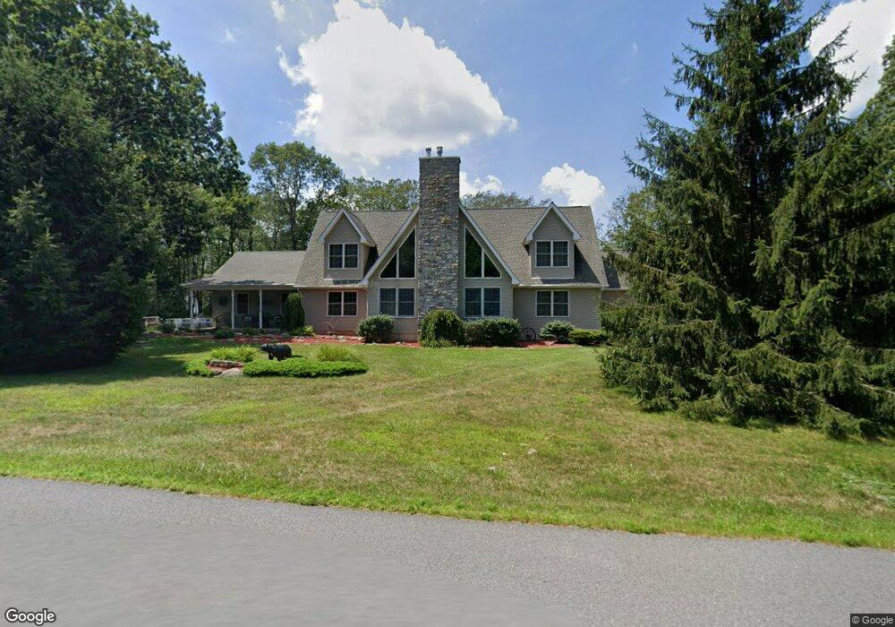
51 Wargo Rd Jim Thorpe, PA 18229
Estimated Value: $394,000 - $594,000
3
Beds
3
Baths
2,940
Sq Ft
$175/Sq Ft
Est. Value
About This Home
This home is located at 51 Wargo Rd, Jim Thorpe, PA 18229 and is currently estimated at $515,729, approximately $175 per square foot. 51 Wargo Rd is a home located in Carbon County with nearby schools including Jim Thorpe Area High School.
Ownership History
Date
Name
Owned For
Owner Type
Purchase Details
Closed on
Oct 15, 2005
Sold by
Pettit William G and Pettit Charlene
Bought by
Pettit William G and Pettit Charlene
Current Estimated Value
Create a Home Valuation Report for This Property
The Home Valuation Report is an in-depth analysis detailing your home's value as well as a comparison with similar homes in the area
Home Values in the Area
Average Home Value in this Area
Purchase History
| Date | Buyer | Sale Price | Title Company |
|---|---|---|---|
| Pettit William G | -- | None Available |
Source: Public Records
Tax History Compared to Growth
Tax History
| Year | Tax Paid | Tax Assessment Tax Assessment Total Assessment is a certain percentage of the fair market value that is determined by local assessors to be the total taxable value of land and additions on the property. | Land | Improvement |
|---|---|---|---|---|
| 2025 | $6,989 | $113,600 | $5,000 | $108,600 |
| 2024 | $6,648 | $113,600 | $5,000 | $108,600 |
| 2023 | $6,563 | $113,600 | $5,000 | $108,600 |
| 2022 | $6,563 | $113,600 | $5,000 | $108,600 |
| 2021 | $6,563 | $113,600 | $5,000 | $108,600 |
| 2020 | $6,563 | $113,600 | $5,000 | $108,600 |
| 2019 | $6,335 | $113,600 | $5,000 | $108,600 |
| 2018 | $6,335 | $113,600 | $5,000 | $108,600 |
| 2017 | $6,335 | $113,600 | $5,000 | $108,600 |
| 2016 | -- | $113,600 | $5,000 | $108,600 |
| 2015 | -- | $113,600 | $5,000 | $108,600 |
| 2014 | -- | $113,600 | $5,000 | $108,600 |
Source: Public Records
Map
Nearby Homes
- 180 Mountain View
- 135 Rosewood Dr
- 0 Rd
- 0 Bear & Behrens Rd Unit 764100
- 219 Mountain View
- 36 Piney Woods Dr
- 0 Lot 20alas Piney Woods Dr
- A141 Rosewood Dr
- 23 Maple Dr
- Lot# 367 & 368 Sparrow Ln
- 148 Broad Mountain View Dr
- 29 Hollyberry Ln
- 44 White Oak Dr
- 24 Indian Trail Rd
- A278 Sunrise Dr
- A280 Sunrise Dr
- A279 Sunrise Dr
- Lot 20ALAS Piney Woods Dr
- A384 Sunset Dr
- A385 Sunset Dr
- 53 Wargo Rd
- 47 Wargo Rd
- 4 Wargo Rd
- 40 Shadblue Ln
- 59 Wargo Rd
- 28 Shadblue Ln
- 22 Shadblue Ln
- 7 Wargo Dr
- 67 Wargo Rd
- D20 Shad Blue Ln
- B13 Shad Blue Ln
- 0 Shadblue Ln Unit 6713521
- 0 Shadblue Ln Unit 457429
- 54 Shadblue Ln
- 7 Shadblue Ln
- 41 Shadblue Ln Unit 41
- 75 Wargo Rd
- 11 Audrey Ln
- 12 Audrey Ln
- 63 Shadblue Ln