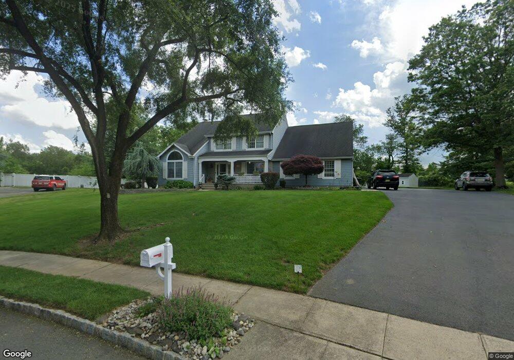
51 Wexford Dr Monmouth Junction, NJ 08852
Estimated Value: $889,000 - $1,287,000
4
Beds
3
Baths
2,744
Sq Ft
$375/Sq Ft
Est. Value
About This Home
This home is located at 51 Wexford Dr, Monmouth Junction, NJ 08852 and is currently estimated at $1,028,598, approximately $374 per square foot. 51 Wexford Dr is a home located in Middlesex County with nearby schools including Monmouth Junction Elementary School, Crossroads North Middle School, and South Brunswick High School.
Ownership History
Date
Name
Owned For
Owner Type
Purchase Details
Closed on
May 20, 2016
Sold by
Clickner Dale T
Bought by
Tottempudi Suresh and Tottempudi Haritha
Current Estimated Value
Home Financials for this Owner
Home Financials are based on the most recent Mortgage that was taken out on this home.
Original Mortgage
$584,100
Outstanding Balance
$464,984
Interest Rate
3.66%
Mortgage Type
New Conventional
Estimated Equity
$563,614
Purchase Details
Closed on
Oct 7, 1998
Sold by
Paone Martin
Bought by
Clickner Dale and Clickner Christina
Home Financials for this Owner
Home Financials are based on the most recent Mortgage that was taken out on this home.
Original Mortgage
$225,000
Interest Rate
6.92%
Create a Home Valuation Report for This Property
The Home Valuation Report is an in-depth analysis detailing your home's value as well as a comparison with similar homes in the area
Home Values in the Area
Average Home Value in this Area
Purchase History
| Date | Buyer | Sale Price | Title Company |
|---|---|---|---|
| Tottempudi Suresh | -- | Fidelity National Title Insu | |
| Clickner Dale | $305,000 | -- |
Source: Public Records
Mortgage History
| Date | Status | Borrower | Loan Amount |
|---|---|---|---|
| Open | Tottempudi Suresh | $584,100 | |
| Previous Owner | Clickner Dale | $225,000 |
Source: Public Records
Tax History Compared to Growth
Tax History
| Year | Tax Paid | Tax Assessment Tax Assessment Total Assessment is a certain percentage of the fair market value that is determined by local assessors to be the total taxable value of land and additions on the property. | Land | Improvement |
|---|---|---|---|---|
| 2025 | $15,531 | $287,500 | $105,000 | $182,500 |
| 2024 | $14,973 | $287,500 | $105,000 | $182,500 |
| 2023 | $14,973 | $287,500 | $105,000 | $182,500 |
| 2022 | $14,527 | $287,500 | $105,000 | $182,500 |
| 2021 | $11,181 | $287,500 | $105,000 | $182,500 |
| 2020 | $14,617 | $287,500 | $105,000 | $182,500 |
| 2019 | $14,749 | $287,500 | $105,000 | $182,500 |
| 2018 | $14,266 | $287,500 | $105,000 | $182,500 |
| 2017 | $14,246 | $287,500 | $105,000 | $182,500 |
| 2016 | $14,096 | $287,500 | $105,000 | $182,500 |
| 2015 | $13,665 | $287,500 | $105,000 | $182,500 |
| 2014 | $15,361 | $328,500 | $105,000 | $223,500 |
Source: Public Records
Map
Nearby Homes
- 790 Ridge Rd
- 6 Monet Ct
- 2502 Pheasant Run
- 836 Ridge Rd
- 4 Bernadette Cir
- 3 Gramercy Rd
- 74 Kelly Way
- 6 Donner Ct
- 4 Donner Ct
- 49 Krebs Rd
- 6 Condor Ct
- 1402 Schindler Dr N
- 5903 Schindler Dr S
- 149 Parker Rd
- 4704 Schindler Dr S
- 5201 Schindler Dr S Unit 5201
- 11 Taylor Rd
- 45 Old New Rd
- 203 Shields Ct
- 260 Friendship Rd