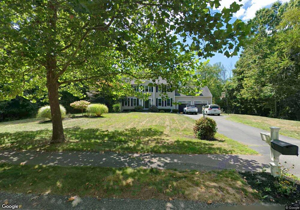
51 Willow Tree Ln Middleboro, MA 02346
Estimated Value: $707,639 - $832,000
4
Beds
3
Baths
2,188
Sq Ft
$356/Sq Ft
Est. Value
About This Home
This home is located at 51 Willow Tree Ln, Middleboro, MA 02346 and is currently estimated at $778,910, approximately $355 per square foot. 51 Willow Tree Ln is a home located in Plymouth County with nearby schools including Mary K. Goode Elementary School.
Ownership History
Date
Name
Owned For
Owner Type
Purchase Details
Closed on
Oct 31, 2008
Sold by
Phillips Joyce and Purtzenski Joyce
Bought by
Kelly Justin C and Kelly Dalissa R
Current Estimated Value
Home Financials for this Owner
Home Financials are based on the most recent Mortgage that was taken out on this home.
Original Mortgage
$370,500
Outstanding Balance
$238,147
Interest Rate
5.83%
Mortgage Type
Purchase Money Mortgage
Estimated Equity
$540,763
Purchase Details
Closed on
Jun 24, 2005
Sold by
Foley Charles R and Foley Julie A
Bought by
Purtzenski Joyce and Phillips Peter
Create a Home Valuation Report for This Property
The Home Valuation Report is an in-depth analysis detailing your home's value as well as a comparison with similar homes in the area
Home Values in the Area
Average Home Value in this Area
Purchase History
| Date | Buyer | Sale Price | Title Company |
|---|---|---|---|
| Kelly Justin C | $390,000 | -- | |
| Purtzenski Joyce | $485,000 | -- |
Source: Public Records
Mortgage History
| Date | Status | Borrower | Loan Amount |
|---|---|---|---|
| Open | Purtzenski Joyce | $370,500 | |
| Previous Owner | Purtzenski Joyce | $398,200 |
Source: Public Records
Tax History
| Year | Tax Paid | Tax Assessment Tax Assessment Total Assessment is a certain percentage of the fair market value that is determined by local assessors to be the total taxable value of land and additions on the property. | Land | Improvement |
|---|---|---|---|---|
| 2025 | $7,955 | $593,200 | $182,100 | $411,100 |
| 2024 | $7,966 | $588,300 | $173,700 | $414,600 |
| 2023 | $7,312 | $513,500 | $173,700 | $339,800 |
| 2022 | $6,778 | $440,700 | $151,000 | $289,700 |
| 2021 | $6,781 | $416,800 | $138,800 | $278,000 |
| 2020 | $6,479 | $408,000 | $138,800 | $269,200 |
| 2019 | $6,316 | $408,000 | $138,800 | $269,200 |
| 2018 | $5,817 | $372,900 | $126,300 | $246,600 |
| 2017 | $5,379 | $341,100 | $121,500 | $219,600 |
| 2016 | $5,279 | $331,600 | $114,900 | $216,700 |
| 2015 | $5,059 | $320,600 | $114,900 | $205,700 |
Source: Public Records
Map
Nearby Homes
- 804 Crystal Way Unit 804CRY
- 3509 Fox Run Unit 3509FOX
- 2701 Simmons Rd Unit 2701SIM
- 3402 Island Dr
- 4303 Oak Point Dr Unit 4303OAK
- 1808 Oak Point Dr Unit 1808OAK
- 402 Blueberry Cir
- 0 Murdock St Unit 73473837
- Lot 000 Summer St
- 10 Old Thompson St
- 246 Everett St
- 620 Plymouth St
- 227 E Main St
- 121 North St
- 132 Everett St
- 1 Bloomfield Ave
- 80 Forest St
- 26 Old Summit St
- 68 Walnut St
- 308 Wood St
Your Personal Tour Guide
Ask me questions while you tour the home.