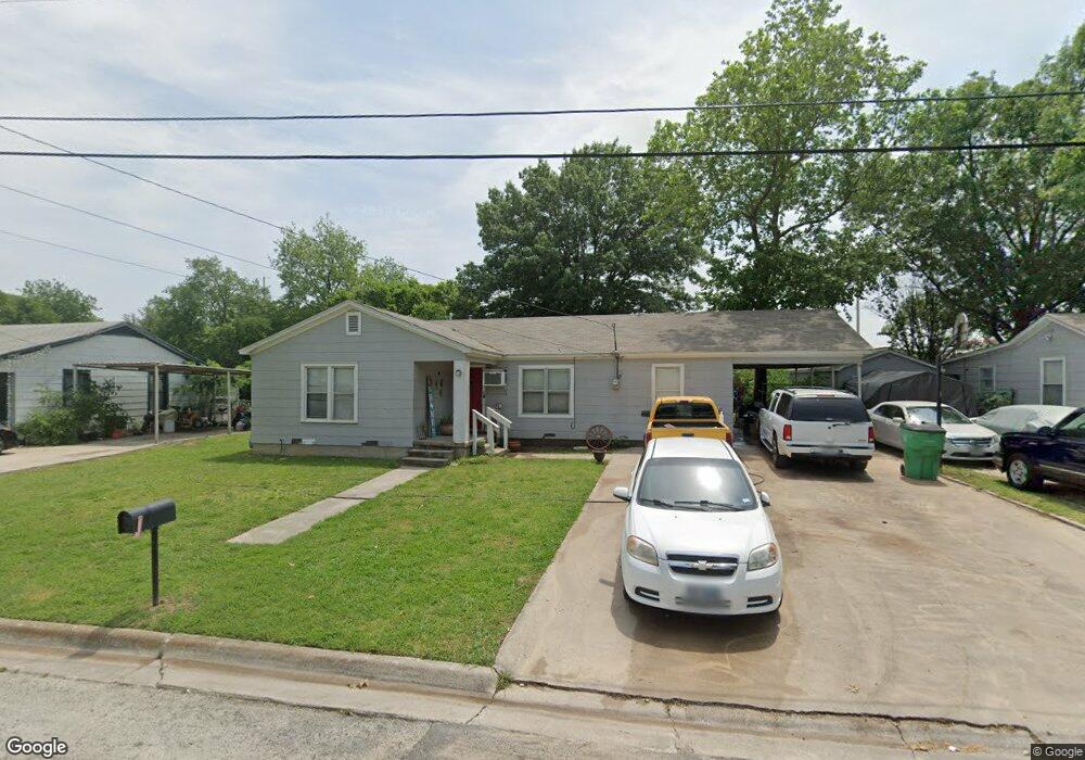
510 Berend St Gainesville, TX 76240
Estimated Value: $161,000 - $195,000
3
Beds
1
Bath
1,216
Sq Ft
$141/Sq Ft
Est. Value
About This Home
This home is located at 510 Berend St, Gainesville, TX 76240 and is currently estimated at $171,718, approximately $141 per square foot. 510 Berend St is a home located in Cooke County with nearby schools including Edison Elementary School, W.E. Chalmers Elementary School, and Gainesville Intermediate School.
Ownership History
Date
Name
Owned For
Owner Type
Purchase Details
Closed on
Jun 28, 2017
Sold by
Ott Daniel L and Ott Wendy L
Bought by
Danwen Properties Llc
Current Estimated Value
Purchase Details
Closed on
Jul 27, 2007
Sold by
Rowley Ethrl N
Bought by
Jones Donna A
Home Financials for this Owner
Home Financials are based on the most recent Mortgage that was taken out on this home.
Original Mortgage
$35,000
Interest Rate
6.71%
Mortgage Type
New Conventional
Create a Home Valuation Report for This Property
The Home Valuation Report is an in-depth analysis detailing your home's value as well as a comparison with similar homes in the area
Home Values in the Area
Average Home Value in this Area
Purchase History
| Date | Buyer | Sale Price | Title Company |
|---|---|---|---|
| Danwen Properties Llc | -- | None Available | |
| Jones Donna A | -- | -- |
Source: Public Records
Mortgage History
| Date | Status | Borrower | Loan Amount |
|---|---|---|---|
| Previous Owner | Jones Donna A | $35,000 |
Source: Public Records
Tax History Compared to Growth
Tax History
| Year | Tax Paid | Tax Assessment Tax Assessment Total Assessment is a certain percentage of the fair market value that is determined by local assessors to be the total taxable value of land and additions on the property. | Land | Improvement |
|---|---|---|---|---|
| 2025 | $2,406 | $126,984 | $35,966 | $91,018 |
| 2024 | $2,406 | $126,984 | $35,966 | $91,018 |
| 2023 | $2,485 | $126,671 | $35,966 | $90,705 |
| 2022 | $2,605 | $119,643 | $29,988 | $89,655 |
| 2021 | $2,477 | $96,192 | $25,480 | $70,712 |
| 2020 | $2,377 | $89,490 | $25,480 | $64,010 |
| 2019 | $2,017 | $73,790 | $25,480 | $48,310 |
| 2018 | $1,541 | $56,464 | $12,740 | $43,724 |
| 2017 | $1,477 | $54,345 | $12,740 | $41,605 |
| 2015 | $1,347 | $53,509 | $12,740 | $40,769 |
| 2014 | $1,347 | $50,607 | $12,740 | $37,867 |
Source: Public Records
Map
Nearby Homes
- 1704 Throckmorton St
- 1903 N Weaver St
- 1807 Buck St
- 000 U S Highway 82
- TBD E Highway 82
- 1901 Buck St
- 1214 Witherspoon St
- 901 W Star St
- 1203 Mill St
- 1124 Throckmorton St
- 810 Mill St
- 1213 Mill St
- 1120 N Commerce St
- 2662 N Weaver St
- 0 N Weaver St
- 818 N Commerce St
- 620 Throckmorton St
- 618 Moran St
- 535 Hancock St
- 113 E Cummings St
- 506 Berend St
- 516 Berend St
- 606 Berend St
- 1801 Throckmorton St
- 1802 Throckmorton St
- 1612 Throckmorton St
- 610 Berend St
- 1804 Throckmorton St
- 1802 N Culberson St
- 1805 Throckmorton St
- 1606 Throckmorton St
- 1703 N Weaver St
- 1611 N Weaver St
- 1806 Throckmorton St
- 1804 N Culberson St
- 614 Berend St
- 1607 N Weaver St
- 1807 Throckmorton St
- 1803 N Weaver St
- 320 N Weaver St