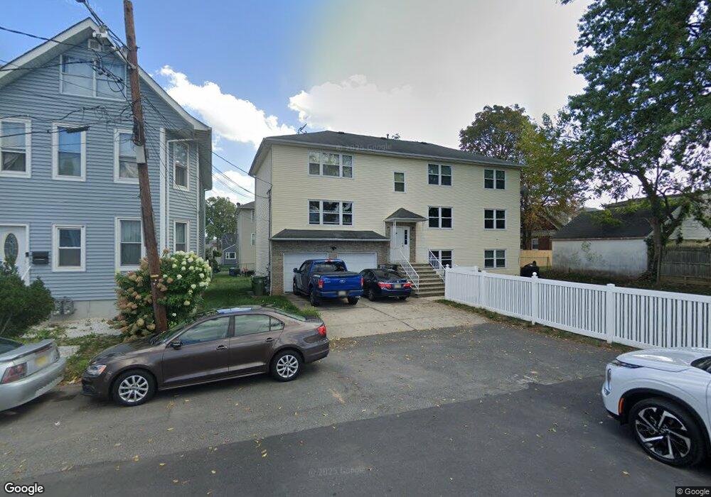
510 Briant Place Linden, NJ 07036
Estimated Value: $581,369 - $779,000
--
Bed
--
Bath
1,568
Sq Ft
$449/Sq Ft
Est. Value
About This Home
This home is located at 510 Briant Place, Linden, NJ 07036 and is currently estimated at $703,592, approximately $448 per square foot. 510 Briant Place is a home located in Union County with nearby schools including Number 1, Joseph E. Soehl Middle School, and Linden High School.
Ownership History
Date
Name
Owned For
Owner Type
Purchase Details
Closed on
Jan 9, 2004
Sold by
Tucker Mose
Bought by
Mannix Joseph and Mannix Jemima
Current Estimated Value
Home Financials for this Owner
Home Financials are based on the most recent Mortgage that was taken out on this home.
Original Mortgage
$333,900
Outstanding Balance
$157,018
Interest Rate
5.98%
Estimated Equity
$546,574
Purchase Details
Closed on
Mar 27, 1998
Sold by
Lettini Domenico P and Lettini Fausta
Bought by
Tucker Mose H and Tucker Rudy
Home Financials for this Owner
Home Financials are based on the most recent Mortgage that was taken out on this home.
Original Mortgage
$213,498
Interest Rate
6.96%
Mortgage Type
FHA
Purchase Details
Closed on
Jan 13, 1997
Sold by
Lettini Domenico P and Lettini Fausta
Bought by
Lettini Domenico P and Lettini Fausta
Create a Home Valuation Report for This Property
The Home Valuation Report is an in-depth analysis detailing your home's value as well as a comparison with similar homes in the area
Home Values in the Area
Average Home Value in this Area
Purchase History
| Date | Buyer | Sale Price | Title Company |
|---|---|---|---|
| Mannix Joseph | $371,000 | -- | |
| Tucker Mose H | $220,000 | Chicago Title Insurance Co | |
| Lettini Domenico P | -- | -- |
Source: Public Records
Mortgage History
| Date | Status | Borrower | Loan Amount |
|---|---|---|---|
| Open | Mannix Joseph | $333,900 | |
| Previous Owner | Tucker Mose H | $213,498 |
Source: Public Records
Tax History Compared to Growth
Tax History
| Year | Tax Paid | Tax Assessment Tax Assessment Total Assessment is a certain percentage of the fair market value that is determined by local assessors to be the total taxable value of land and additions on the property. | Land | Improvement |
|---|---|---|---|---|
| 2025 | $13,368 | $190,100 | $52,200 | $137,900 |
| 2024 | $13,075 | $190,100 | $52,200 | $137,900 |
| 2023 | $13,075 | $190,100 | $52,200 | $137,900 |
| 2022 | $13,144 | $190,100 | $52,200 | $137,900 |
| 2021 | $13,210 | $190,100 | $52,200 | $137,900 |
| 2020 | $13,140 | $190,100 | $52,200 | $137,900 |
| 2019 | $13,096 | $190,100 | $52,200 | $137,900 |
| 2018 | $13,092 | $190,100 | $52,200 | $137,900 |
| 2017 | $12,809 | $190,100 | $52,200 | $137,900 |
| 2016 | $12,406 | $190,100 | $52,200 | $137,900 |
| 2015 | $11,933 | $190,100 | $52,200 | $137,900 |
| 2014 | $11,701 | $190,100 | $52,200 | $137,900 |
Source: Public Records
Map
Nearby Homes
- 414 3rd Ave
- 901 Clark St
- 812 Washington Ave
- 115 Clark St
- 633 Maple Ave
- 559 Uncas Ave
- 721 E Curtis St
- 806 Roselle St
- 1220 Lincoln St
- 2209 N Wood Ave
- 574 Sherman Ave
- 813 N Wood Ave
- 514 E Elm St
- 1809 N Wood Ave Unit D1
- 1204 Warren St
- 1202 Warren St
- 1129 Spruce St
- 382 Douglas Rd
- 721 N Wood Ave
- 725 N Wood Ave
- 518 Briant Place
- 505 Pierce Ave
- 1126 Clark St
- 1120 Clark St
- 519 Pierce Ave
- 1128 Clark St
- 1114 Clark St
- 1134 Clark St
- 1509 Roselle St
- 1507 Roselle St
- 521 Briant Place
- 1110 Clark St
- 1521 Roselle St
- 1521 Roselle St Unit 1
- 1106 Clark St
- 516 Pierce Ave
- 512 Pierce Ave
- 522 Pierce Ave
- 1529 Roselle St
- 1102 Clark St